Fresh Intel from the Trail: ADT Hikers Share What's Working (and What's Not) 🥾
Planning an ADT section is one thing. Actually walking it? That's where you learn what the maps don't tell you—like which water sources are flowing, where the Trail Angels hang out, and exactly how brutal that "overgrown" section really is.

This week brought updates from ADT hikers scattered across three states, and our ongoing research in another.

Indiana: Where Cave Tours Meet Trail Angel Magic ⛰️
O'Bannon Woods State Park (Segments 5 & 6)
Rhiis and Sara have been doing the detective work we all appreciate. They've mapped out several new dispersed camping spots in O'Bannon Woods State Park and confirmed that seasonal streams are flowing strong in early June. More importantly, they've also took a shot at hunting for the infamous Hog Barn Shelter—a structure so elusive it's become the trail equivalent of Bigfoot.
"It's hard to locate since it's off the main Adventure Trail and not well-marked," they report. But here's the good news: we've got fresh coordinates that might finally crack this mystery. The next hikers through can test our theory and hopefully end this shelter hunt once and for all.
O'Bannon Woods swears it is there!
Discovery Alert: Don't miss the Big Wyandotte Cave Tours while you're in the area. We're talking about over 9 miles of underground passages with massive rooms and formations that'll make you forget about your aching feet for a while. The cave has quite the resume too—Native American history, War of 1812 saltpeter mining, and geological features.
Segment 4 Trail Angel News
Speaking of good people doing good things, we've shared the contact information to Mark, Diane and Gary —our newest Trail Angels just outside Derby, Indiana. According to Rhiis, Mark and his family own rental properties along the Ohio River and he's "a really nice guy." And Gary and Diana –"Really lovely people, took us out on the river in their boat" and have hosted ADT hikers in the past.
Sometimes the best trail magic comes from unexpected places.
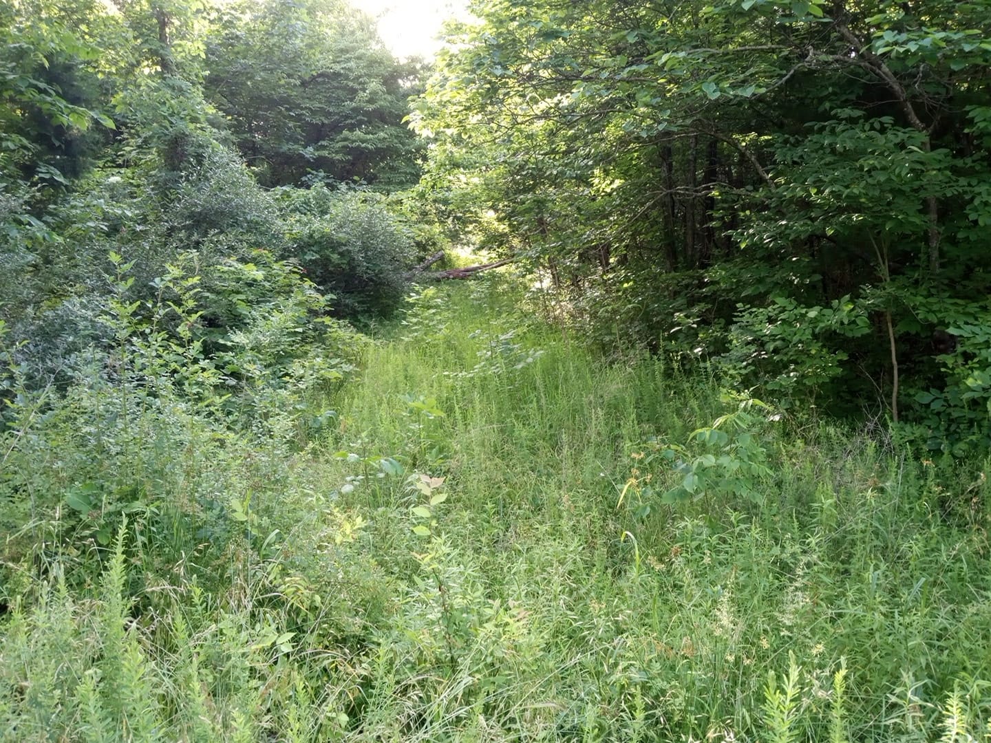
Reality Check: That utility right-of-way just north of Tipsaw Lake Campground? It's still rough. Really rough. Both Rhiis and Sara, as well as previous hiker Steve Gefell, confirm that this section is overgrown and tick-heavy. Steve's count after one passage: 15 ticks. GPS navigation is essential here, and plan for a thorough tick check afterward. But Rhiis did admit –
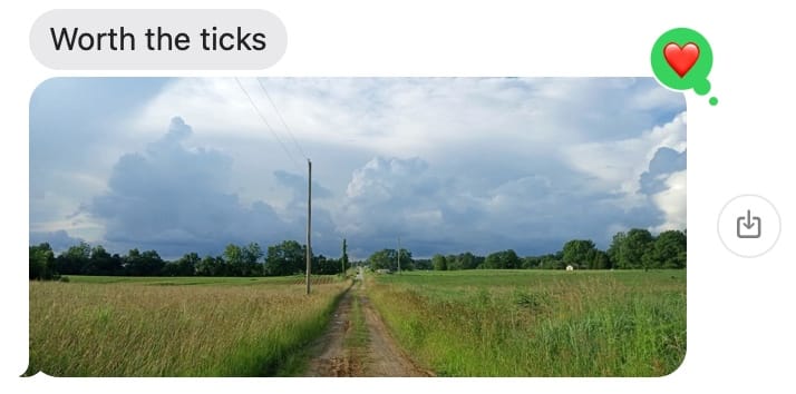
– to get to the next section of the Section.
Missouri: Small-Town Schedules and Trail Angel Churches 🌲
RayRey's Missouri Intel (Segments 2-4)
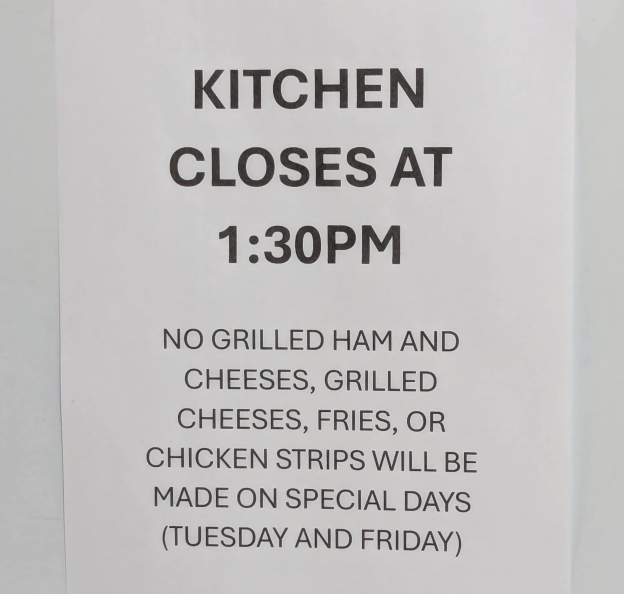
Eastbound cyclist RayRey Reynosa has been our eyes and ears across Missouri, and his updates remind us why local knowledge matters. In Chilhowee, the Corner Store serves lunch specials on Tuesdays and Fridays, but sticks to the regular menu other days—and only between 11 am and 1:30 pm. Small-town America operates on its own schedule, and it's beautiful! 🥪
The good news continues: free camping and honor system snacks are still available in Segment 4, and Rocheport's restaurant hours have been updated.
Kansas: Trail Angels and Prairie Comfort ☀️
Segment 2 Updates

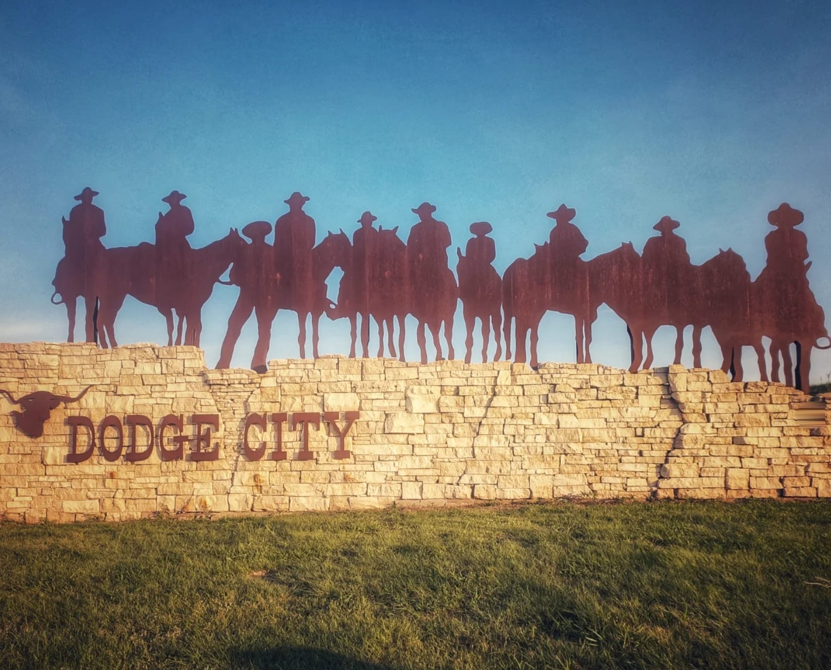
In Dodge City, Steve Gefell hit a major mental milestone.
"Queen of the Cowtowns, lies on the 100th meridian, and is the unofficial start of 'the west,'" he reports. "I'm not yet halfway through this journey in terms of miles, but when you look at a map this city would be about half way between the oceans so mentally this is a big checkpoint."
He took time to visit the statues of Wyatt Earp, Bat Masterson, Matt Dillon, and Doc Holliday, plus native son Dennis Hooper's "La Salsa Man" (above) —a repurposed burger joint muffler man where the sombrero is made from the top bun. Sometimes trail education comes in unexpected forms.
Steve also confirms the Trail Angel church in Pierceville is still welcoming hikers, and he discovered a covered picnic table in Garden City—the kind of simple comfort that feels like luxury when you've been walking all day in the Kansas sun! ☀️ 🥵
Southern Route Alert
Suzan Brydon, who's tackling the ADT's Southern Route, tipped us off to a section of the Flint Hills Nature Trail is closed for resurfacing and bridge repair. We've added a detour to our GPS data and are tracking the project until it reopens.
Colorado: Urban Trail Evolution 🏔️
Denver's Growing Trail Scene (North Segment 1)

Even established trail sections keep evolving. A new development called Denargo Market is taking shape along the Platte River Trail in Denver's RiNo district. The highlight? A climbable art sculpture called "Rhingo the Rhino" that was just unveiled. Sometimes the trail surprises you with unexpected art breaks.
📊 This Week's Summary
46 New Waypoints Added to Hiking America Database:
Hat-Tip - Rhiis & Sara, Steve Gefell, Suzan Brydon, Ray Reynosa
- Indiana-South: 29 waypoints (campsites, water, services, new trail angel)
- Kansas: 9 waypoints (services, discoveries, camping)
- Missouri: 8 waypoints (services, camping, restaurant hour updates)
- Colorado-South: 7 waypoints (services, camping)
- Colorado-North: 1 waypoint (discovery)
Categories covered: Campsites, water sources, restrooms, cafes, hazards, hidden gems, trail angels, and local contacts 📍
What This Means for Your Planning
Here's what I love about these updates: they're honest. No sugar-coating the tick-infested bushwhacking or the limited restaurant hours. This is the real trail intelligence that helps you plan smarter, not just dream bigger.
When fellow hikers take time to share what they've learned—from working water sources to welcoming Trail Angels—they're building the knowledge base that makes the ADT more accessible for everyone who follows.
The Bottom Line: Real hikers sharing real intel—that's how this massive trail becomes manageable, one honest update at a time. Because the best navigation tool is current, accurate information from people who've actually walked the miles.
Hike Your Hike - John.
ADT in the News