
First Snow on the ADT: Hiking in Shorts Through Nevada Snow and Other Trail Updates

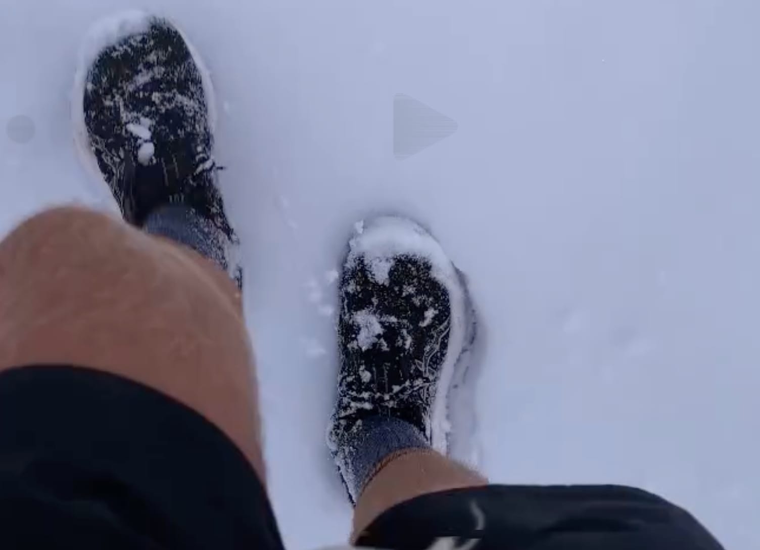
Picture this: you're hiking through Nevada in October, snow falling around you, drifts reaching 12 inches deep in places—and you're wearing shorts and trail runners. That's precisely where Steve Gefell found himself this week as the first significant snow of the season arrived on the American Discovery Trail.
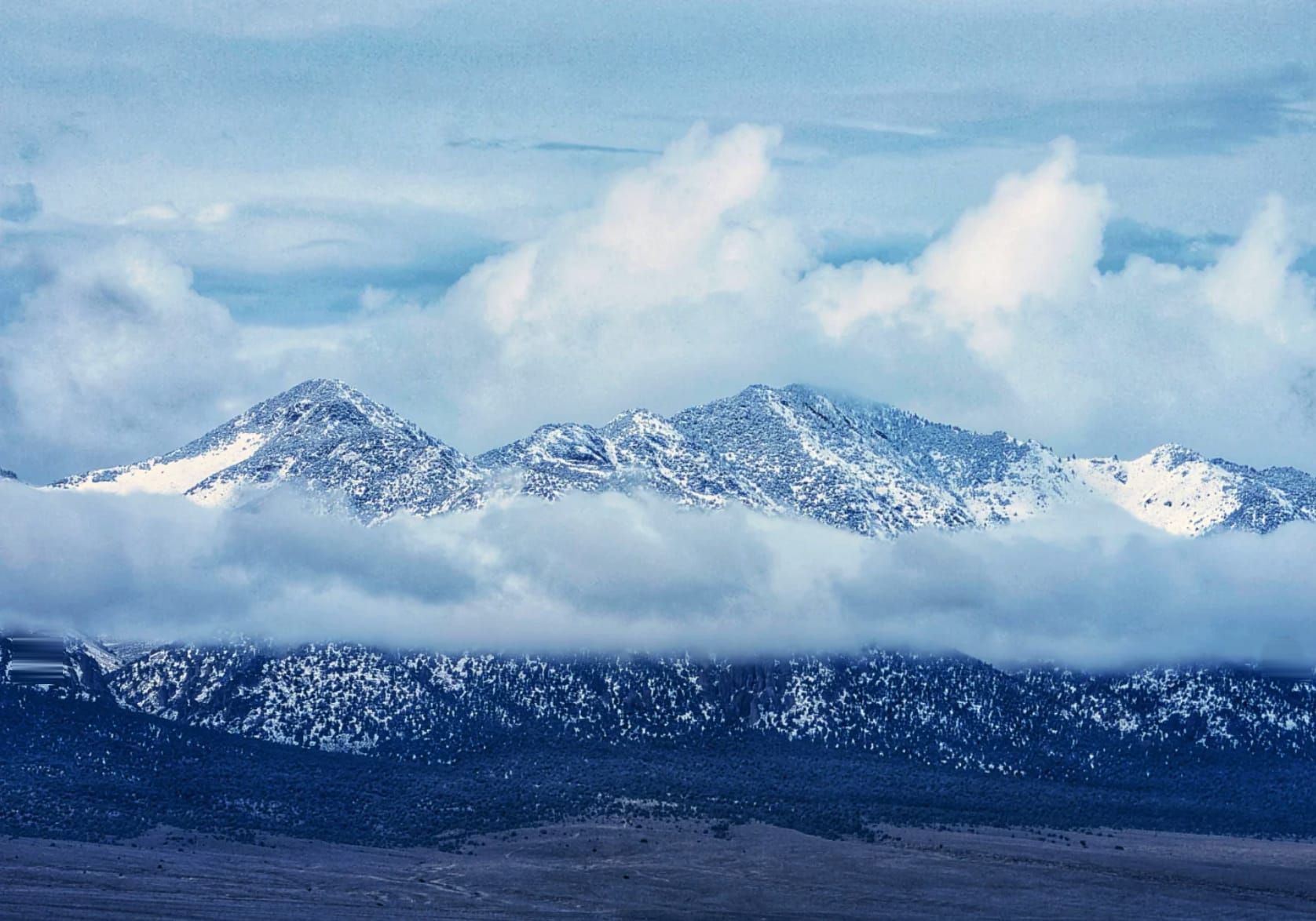
Winter is making its presence known across the trail right now—and it's arriving earlier than usual. Snow typically doesn't hit Nevada's high country until around Halloween, but this year it's showing up two to three weeks ahead of schedule. While Steve navigated fresh snow in central Nevada's Toiyabe Range, forecasters are calling for up to 10 inches in the Sierra Nevada near Lake Tahoe early this week. Meanwhile, further east, other hikers are racing to complete sections before the season comes to a close.
Currently, we have four hikers navigating the ADT in distinctly different ways as winter approaches. Their experiences—and the decisions they're making—offer valuable insights for anyone planning their own ADT journey. Here's what's actually happening on trail right now, including some significant behind-the-scenes work we've been doing to make your navigation even better.

Steve's Nevada Snow: When Preparation Meets Reality
Steve Gefell is currently about halfway across Nevada, still pushing toward his goal of finishing his ADT thru-hike this year. After flip-flopping from Moab, Utah, to Limantour Beach, California, back in August to escape unsustainable desert heat, he's been hiking eastbound and making solid progress.
This week, Nevada reminded him—and all of us—that October in the high desert can surprise you. The early arrival of snow compressed his weather window more than expected.
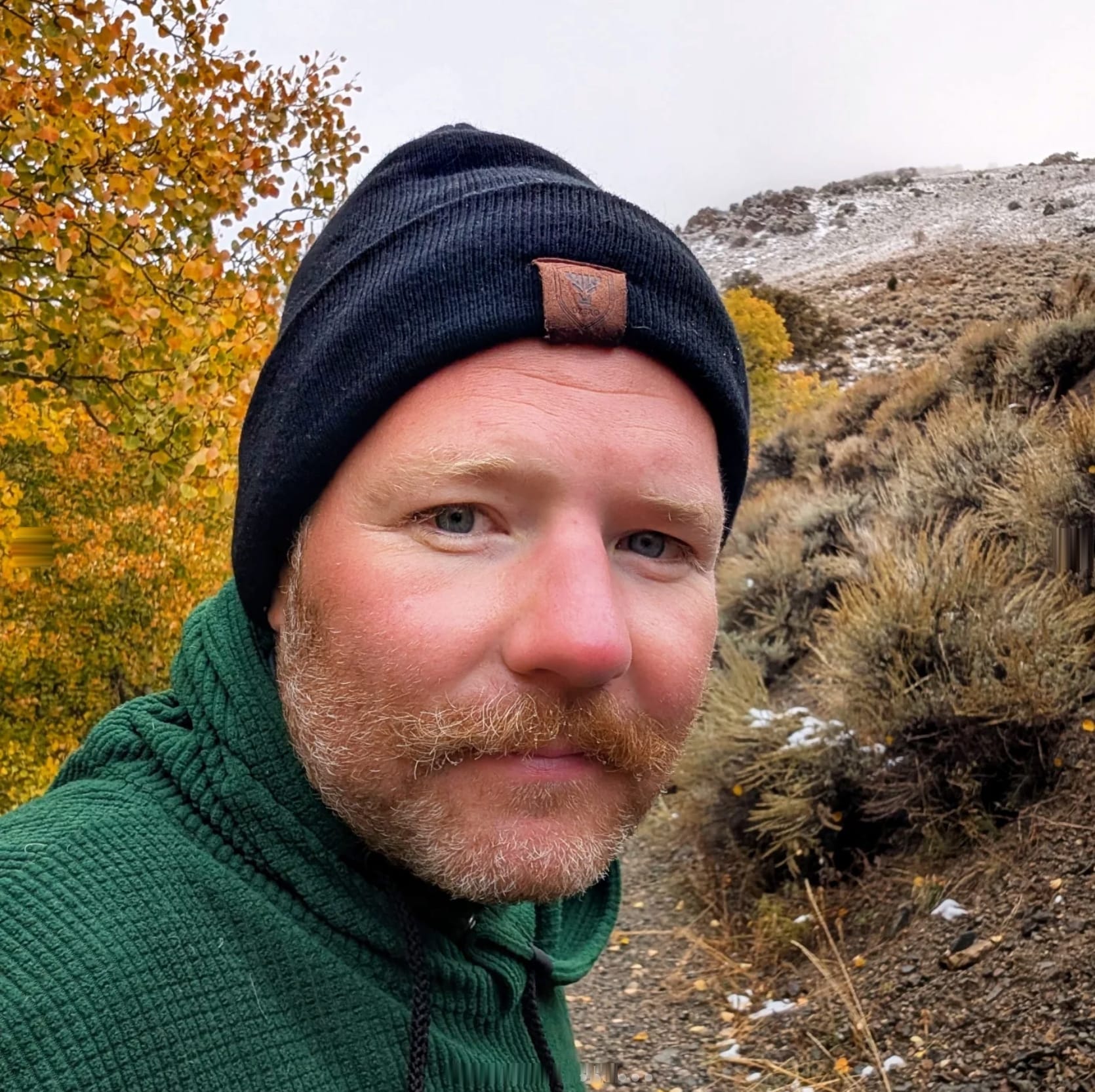
Stephen 'Saunterin Steve' Gefell
🩴 Westbound <-> Eastbound - Southern Route
Began: February 23, 2025
Support Links: ImHikingAmerica, Instagram, YouTube
Here's how Steve described his experience on Instagram:
"Well, never mind about Arc Dome trail. That trail is not maintained, and if the Reese River was flooding the other day (per folks in Gabbs) there was no doubt it would be hellish after it rained all night again. Mike Crowley (ADT Class of '21 & '24) might be an animal, but I'm made a little softer. Within a mile the snow started falling. Nevada is the driest state, but it didn't seem that way this week. I left my rain pants at home like a fool feeling they would just be extra weight. Now I was soaked and cold."
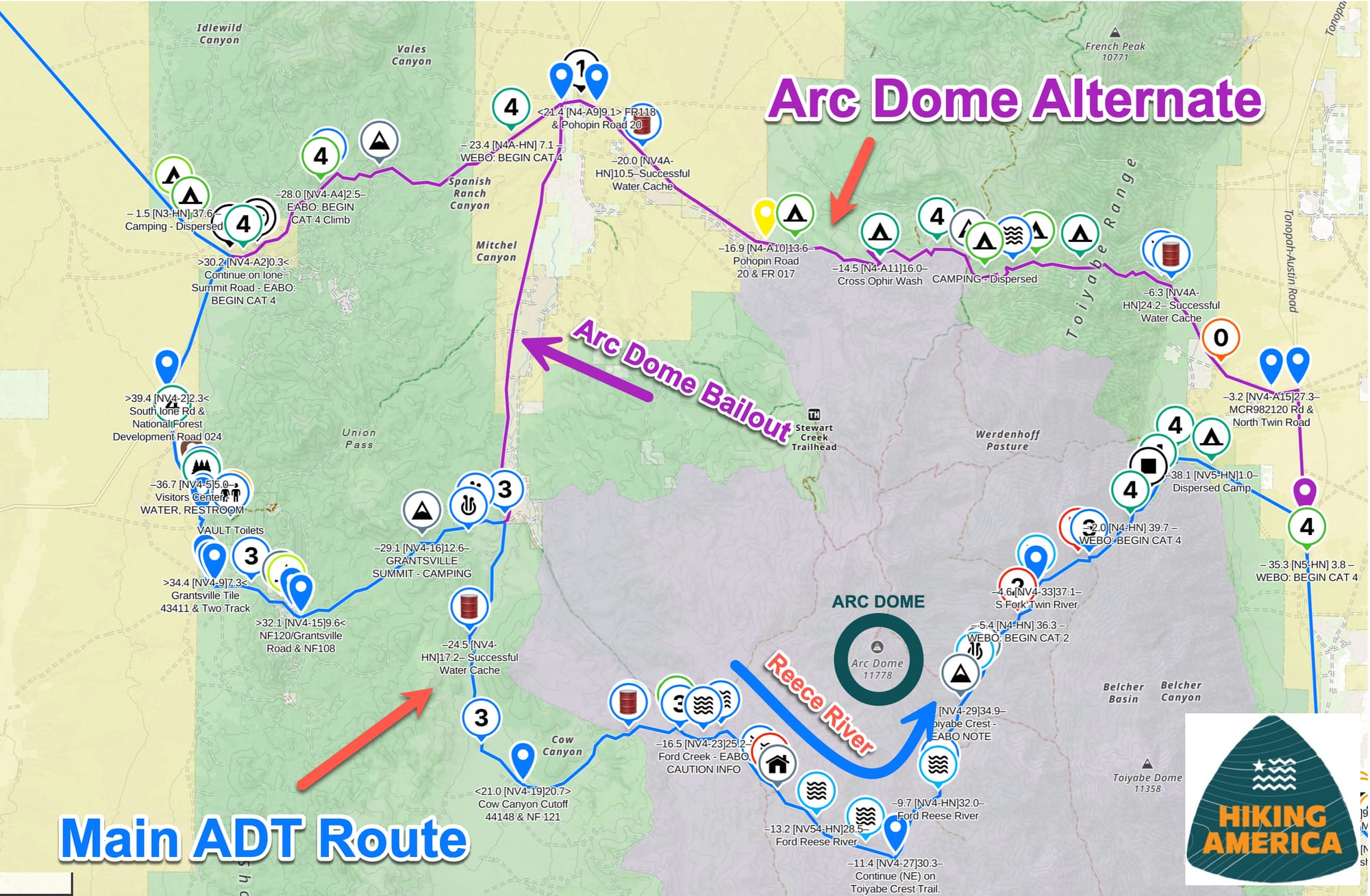
Steve made the smart call to adjust his route, using a bailout to cut through the Reese River Reservation and to the Arc Dome Alternate rather than attempting the unmaintained Arc Dome Trail in deteriorating conditions. The conditions intensified as he gained elevation over the Toiyabe Range. Snow drifts reached 12 inches deep, which he was postholing through in shorts and sneakers.
But here's where experience and adaptability matter: at the top of the pass, freezing and worried about the forecast calling for more freezing rain, Steve found an unmarked, abandoned miner's shelter—unlocked and mostly intact.

"It had some holes, but was mostly dry. My left hand was super swollen and my feet felt like dirt filled garbage bags, but after an hour under my quilt I was done shivering and basically back to normal."
That's the ADT in a nutshell: challenging conditions, smart decision-making, a bit of luck, and the resilience to keep moving forward. Steve's still out there, still making progress, and the stunning views of the Shoshone Mountains made it all worthwhile.
Understanding Nevada's Mountain Ranges
Here's something important for future ADT planners to understand: Nevada isn't one continuous mountain range. The ADT crosses multiple distinct ranges as it traverses the state, each with its own weather patterns and timing.
Steve is currently in the Toiyabe Range in central Nevada, where he's already experiencing snow. But further west, the Sierra Nevada near Lake Tahoe is expecting a more significant storm system Monday through Wednesday, with up to 10 inches of snow forecast.
This distinction matters. If you're planning an ADT hike and thinking about "Nevada weather" as one thing, you're missing the nuance. The Sierra Nevada (which the ADT crosses near Lake Tahoe) is a major barrier range that captures moisture from Pacific storm systems. The ranges further east—like the Toiyabe, the Shoshone, and others Steve is navigating—experience different weather patterns and often less dramatic accumulation.
This kind of geographic literacy doesn't come from guidebooks. It comes from watching real hikers navigate real conditions and understanding how the landscape actually works.
Different Strategies for the Same Challenge
While Steve pushes through Nevada, the other three hikers currently on the trail are taking different approaches to the changing season.
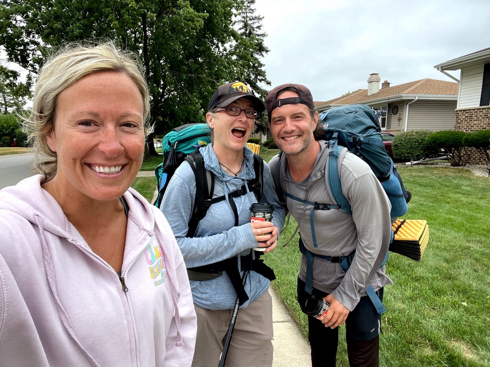
Rhiis & Sara
Westbound - Northern & Southern Route
Began: February 21, 2025
Support Links: ImHikingAmerica, TrailJournals, YouTube, Venmo
Rhiis and Sara are working their way through Nebraska right now, making steady westbound progress. Their plan is to complete Nebraska before pausing their thru-hike to spend the winter months with family in Southern California. Come spring, they'll return to the trail and continue their journey. This "seasonal pause" approach is increasingly common on the ADT, where winter conditions in the Midwest and Rockies can make hiking both uncomfortable and logistically challenging.
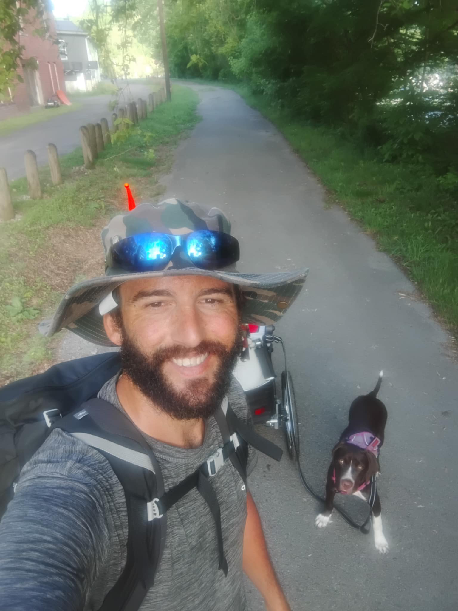
Greg James and Ember made their decision earlier. After reaching just shy of Kansas City, he pulled up stakes and is planning to live out the winter in that area. He's found work to fund the next phase of his journey, turning his thru-hike into a longer adventure that adapts to both seasons and practical realities.
There's no "right" answer here. Steve's pushing through because his flip-flop strategy put him in position to potentially finish before winter fully sets in—though the early snow arrival is testing that plan. Rhiis and Sara are pausing strategically to avoid the worst of winter weather. Greg is taking an extended break that serves both his financial needs and his timeline.
All three approaches are valid. All three reflect smart decision-making based on individual circumstances, goals, and conditions. This is what successful ADT navigation looks like—not rigid adherence to a plan, but thoughtful adaptation as circumstances change.
Behind the Scenes: 358 New Waypoints
While hikers navigate the physical trail, we've been busy behind the scenes making sure our navigation data stays current and comprehensive. Over the past two weeks, we've added 358 new crowdsourced waypoints for services (trail closure, detour, lodging, resupply, water, camping areas, restaurants, discoveries) across five states:
- 34 waypoints in Nevada
- 1 waypoint in Colorado
- 51 waypoints in Iowa
- 20 waypoints in Missouri
- 253 waypoints in Nebraska
This kind of ongoing maintenance is precisely why our GPS data and turn-by-turn guides remain the most reliable navigation resource for the ADT. The trail doesn't stand still—businesses open and close, water sources change, camping options evolve—and neither do we.
If you're a Hiking America member, these waypoints are already integrated into your Gaia GPS data, and our printable Turn-By-Turn Directions and maps are available for your planning. If you're still piecing together information from scattered sources, this is exactly the kind of current intelligence you're missing.
What This Means for Your Planning
Whether you're planning to start your ADT thru-hike next year or you're years away from your departure date, the experiences of Steve, Rhiis & Sara, and Greg and all the other members of the ADT Class of 2025 offer important lessons:
- Weather windows can shift year to year. This year's early snow arrival is a reminder that "typical" timing is just a guideline. Build buffer into your schedule and stay flexible as conditions develop.
- Timing windows matter, but they're not absolute. Steve is successfully navigating Nevada in October despite early snow—something that requires experience, proper gear (despite leaving those rain pants at home 🤦♂️), and the judgment to adapt his route when conditions demand it.
- Flexibility is a skill worth developing. All three of our current hikers have adjusted their original plans in response to real conditions. That's not failure—that's intelligent hiking.
- Real-time information changes everything. Knowing which Nevada mountain range is getting hit with weather, having 358 current service waypoints rather than information from years ago—these details directly impact your success and safety on the trail.
The ADT never stops teaching. Every hiker who takes on this trail adds to our collective understanding of what works, what doesn't, and how to navigate the endless variables that come with walking across an entire continent.
Steve's snow-in-shorts adventure in Nevada, the incoming Sierra storm, the early arrival of winter conditions, and the different strategies our hikers are using to handle seasonal transitions—all of this represents the real, lived experience of the ADT. Not the glossy, inspirational version, but the muddy, cold, beautiful, challenging, and ultimately achievable version.
This is why we maintain current waypoints, track real hiker experiences, and provide ongoing updates throughout the hiking season. Your ADT journey deserves better than outdated information and guesswork.
Want to stay connected with real-time ADT updates like these? Join our Facebook Group where we share current trail conditions, hiker progress, route updates, and the kind of intelligence that makes your planning more grounded and your hiking more confident.
These aren't just numbers and waypoints—they're the lived experiences of people walking the trail right now, and the collective wisdom of a community that wants to see you succeed.
The trail is always changing. Let's figure it out together. 🥾⛰️
Hike Your Hike - John.
News from the ADT
Suzan Brydon - ADT Class of '25

– Iowa
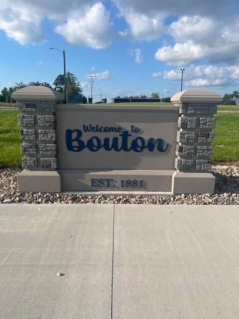
– Missouri

– Washington, D.C.
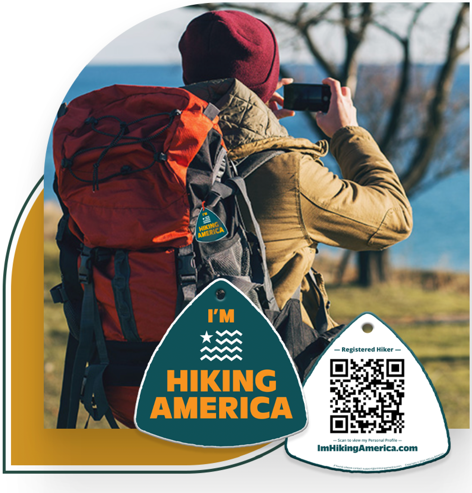
Identity for Every Adventure
Ensure your Safety and Recognition on Every Hike!
Get your Custom QR Code Tag! Only $19 for a Limited Time!
Always Free to Hiking America Members.

