
First-Ever Known Thru-Hike of the Great American Rail-Trail: Bernie Krausse to Make History
Double Triple-Crowner Bernie Krausse — with 57,000 career miles — is about to make history with the first-ever known thru-hike of the Great American Rail-Trail. Hiking America has spent months mapping the gap routes to make this 3,700+ mile coast-to-coast journey hikeable right now.


In less than a month, one of America's most accomplished long-distance hikers will stand at the U.S. Capitol Reflection Pool in Washington, D.C., take a deep breath, and begin walking west.
He won't stop until he reaches Washington State — more than 3,700 miles away.
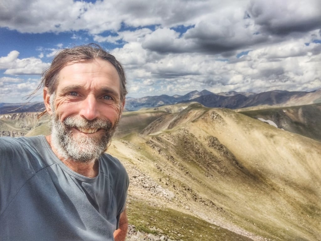
His name is Bernie Krausse, and what he's about to do has never been known to have been done before.
Who Is Bernie Krausse?
Bernie Krausse is the definition of a long-distance hiking legend — and that may be the understatement of the year.
He has completed the Triple Crown of Hiking — the Appalachian Trail, the Pacific Crest Trail, and the Continental Divide Trail — not once, but twice. That alone would be enough to cement his place in the long-distance hiking hall of fame.
But Bernie didn't stop there.
He went on to complete the entire American Discovery Trail — the 6,800-mile cross-country route stretching between Cape Henlopen, Delaware, and Point Reyes, California — a feat that only a tiny handful of hikers have ever accomplished.
Over his remarkable hiking career, Bernie has accumulated an astounding 57,000 miles on the trail. When he completes the Great American Rail-Trail, he will cross the 60,000-mile milestone — a number so extraordinary it's almost impossible to comprehend.
When Bernie Krausse takes on a trail, it gets done. And now he's setting his sights on the biggest challenge yet.
What Is the Great American Rail-Trail?
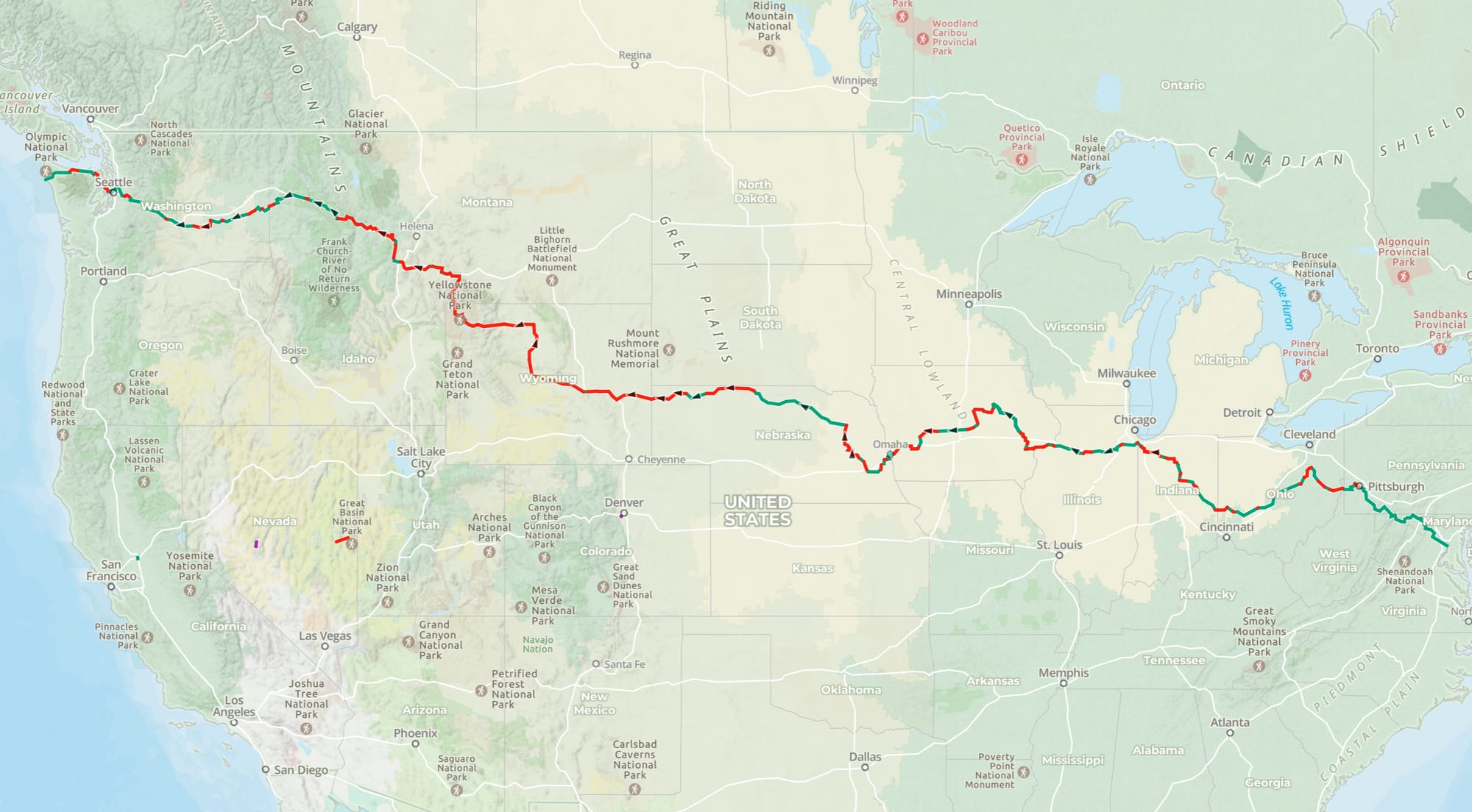
The Great American Rail-Trail is the most ambitious trail project in American history — a planned 3,700+ mile route connecting Washington, D.C. to the Pacific Coast of Washington State through 13 states.
Spearheaded by the Rails to Trails Conservancy, the Great American follows a network of converted rail corridors, greenways, and multiuse paths through some of the most iconic American landscapes in the country. Think the C&O Canal Towpath, the Great Allegheny Passage, and the breathtaking Palouse to Cascades State Park Trail in Washington State.
The trail is currently 56% complete — with approximately 2,100 miles of existing trail connected by roughly 1,670 miles of gaps still under development across the route.
Building those final gap sections will take years, possibly decades.
We decided not to wait.
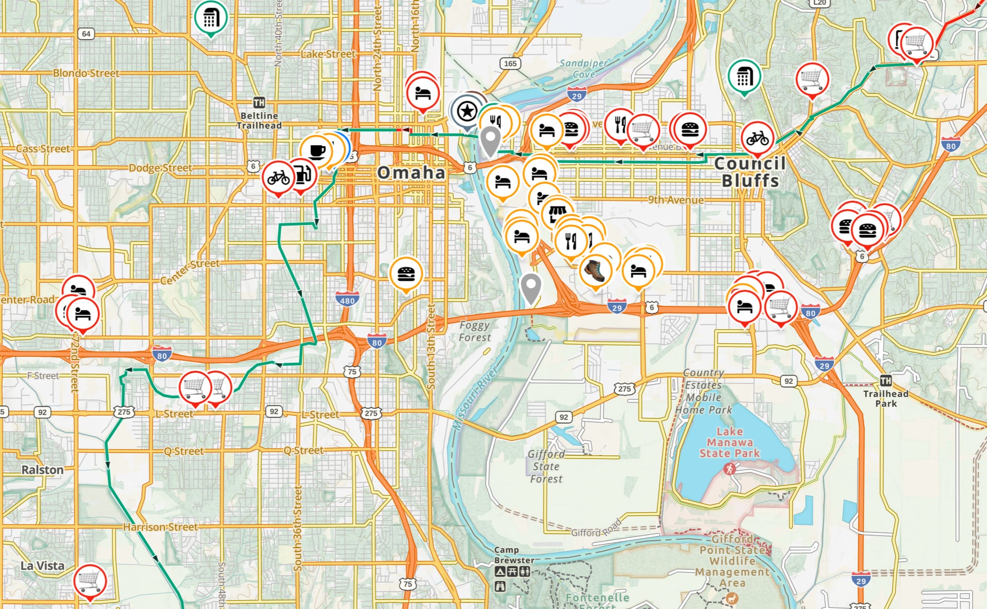
How Hiking America Made the Whole Route Walkable — Right Now
Here at HikingAmerica.com, we've spent months working directly with Bernie to solve the gap problem.
Using existing hiking trails, forest paths, and carefully researched alternative corridors, our team has built complete GPS tracks for every gap section along the Great American route — connecting each existing trail segment into one continuous, unbroken journey across the country.
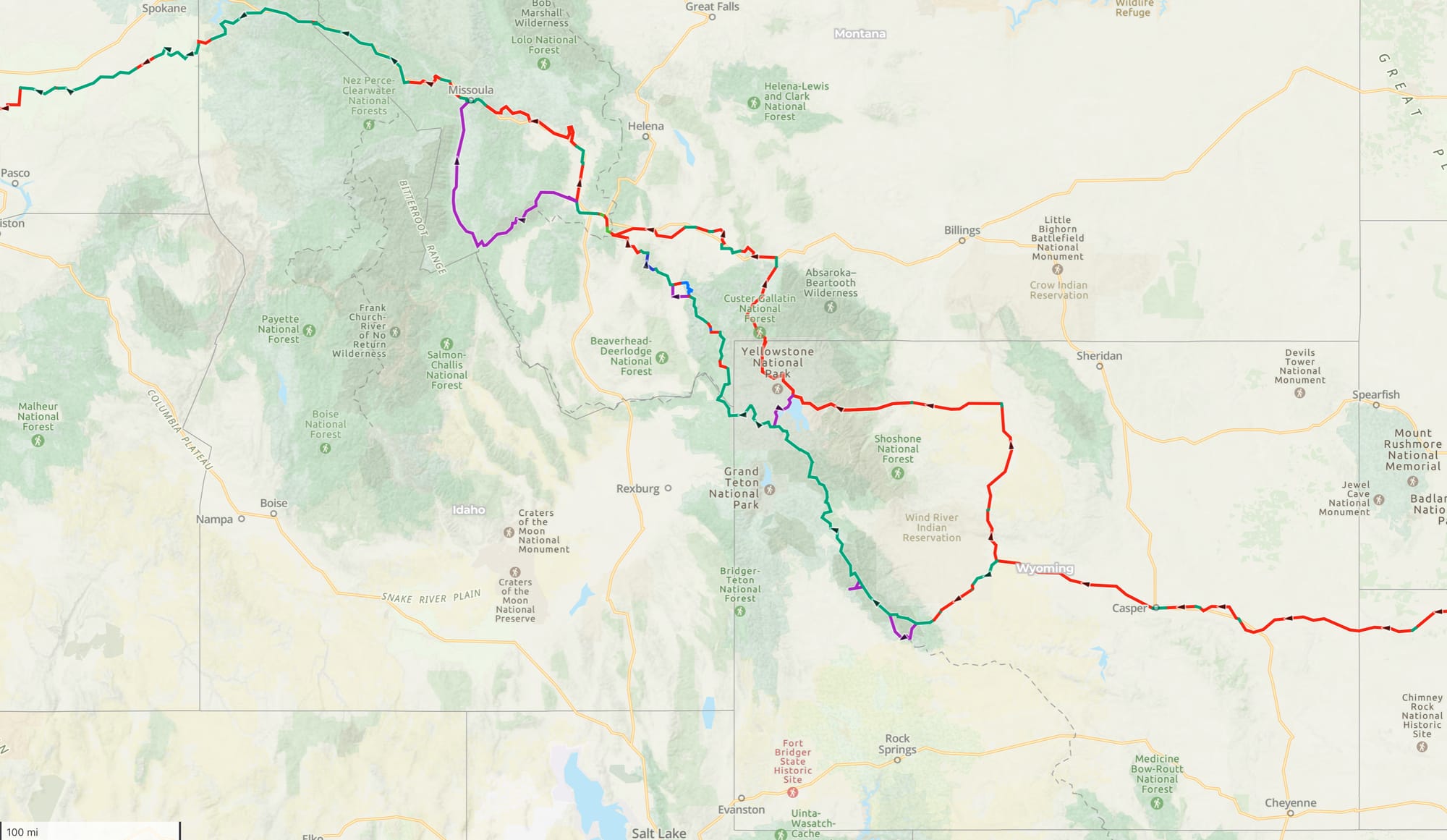
In Wyoming, the state with the greatest percentage of gaps, we've created a Hiker Alternate that runs from Shoshoni, Wyoming, through Yellowstone National Park to Butte, Montana, via a series of trails including the Continental Divide Trail.
The result is a fully navigable, 3,700+ mile route that is hikeable today — without waiting for Rails to Trails Conservancy's construction timeline to reach completion.
Every gap has a route. Every route has a GPS track...right now. And Bernie Krausse is about to put every single mile of it to the test.

The Route: From the Capitol to the Coast
At end of March or early April, Bernie's journey begins at the Capitol Reflection Pool in Washington, D.C. — around as iconic and symbolic a starting point as you could imagine — and heads west through:
- 🏛️ Washington, D.C. & Maryland — The C&O Canal Towpath and Great Allegheny Passage
- ⛏️ Pennsylvania & West Virginia — Through Pittsburgh and into the Appalachians
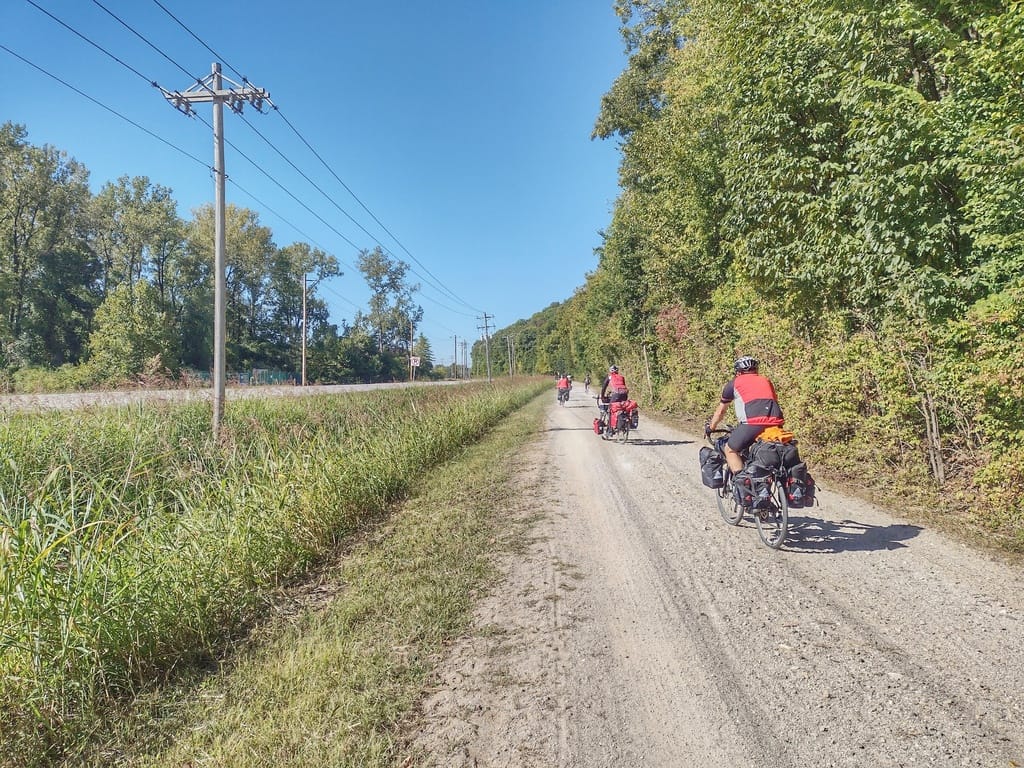
- 🌾 Ohio, Indiana & Illinois — The heart of America's rail-trail network
- 🌽 Iowa & Nebraska — Wide open skies and some of the longest rail-trails in the country
- 🏔️ Wyoming & Montana — The most remote and rugged sections of the entire journey
- 🌲 Idaho & Washington State — The stunning final push to the Pacific
When Bernie reaches the Pacific Coast of Washington State, he won't just have completed a remarkable personal achievement. He will have proven to the hiking world that this route is real, it is ready, and it is waiting for you.
Watch Bernie's Route Video
Bernie has put together a short video that walks through the route and shares his vision for this historic hike.
Get the Route
🏛️ Official Great American Rail-Trail Route Maps
Want to explore the official Great American Corridor as mapped by the Rails to Trails Conservancy? Their interactive route maps show the existing completed trail sections across all 13 states.
Note: The official RTC maps reflect the existing completed trail sections. The gap routes that connect those trails into one continuous, hikeable journey were researched and mapped by Hiking America.
📍🗺️ Hiking America's GPX Tracks to the Great American
Compatible with Gaia GPS, Google Earth, Garmin, and most major GPS tools.
Whether you're planning ahead from your living room or loading tracks into your device before hitting the trail, these files are yours for the taking. No catch!
And Coming Soon –
⛺️💧🍜 Hiking America's Services Layer to The Great American
Serious hikers know that a route is only the beginning. Hiking America subscribers will have access to our full Great American Services Layer on Gaia GPS — resupply points, camping areas, water sources, hiker notes, and everything else you need to plan your own cross-country journey, all organized and ready to go in Gaia GPS.
Already a Hiking America subscriber? The Great American layer will be included in your existing subscription — no additional charge. 🙌
New to Hiking America?
Access to Hiking America's Great American layer plus our complete American Discovery Trail data collection all for one small monthly fee - cancel anytime.
Follow Every Step of Bernie's Journey
This is going to be one of the most closely followed long-distance hikes of 2026, and HikingAmerica.com will be your home base for every mile of it.
Here's what's coming:
📖 The Hiking America Guide to the Great American — resupply, camping, water sources, and everything you need to plan your own cross-country journey
📍 Regular updates from Bernie on the trail — hiker notes, photos, and dispatches from the road
🥾 A community of Great American hikers — because Bernie won't be the last
This Is Bigger Than One Hike
Bernie's journey isn't just a personal accomplishment. It's a proof of concept.
The Great American Rail-Trail represents one of the most powerful visions for the future of outdoor recreation in America — a safe, scenic, connected pathway that every American can use. When Bernie completes this route, he sends a message to every hiker, every planner, every trail advocate, and every community along the way:
The trail is here. Come walk it.
We're honored to be part of making that possible.
Stay Connected
Don't miss a single step of Bernie's historic journey.
- 🔔 Bookmark HikingAmerica.com for GPS tracks, trail guides, and updates
- 📱 Follow us on Facebook or join our Facebook Group
- 📺 Subscribe to the Hiking America YouTube Channel for video updates
- 📧 Sign up for our newsletter updates
HikingAmerica.com is a resource for maps, GPS data, and trail guides for hiking the American Discovery Trail and the Great American Rail-Trail. Our Gaia GPS data collections cover thousands of miles of long-distance hiking routes across America.