
258 New Waypoints: A Look Inside How We Keep Your ADT Navigation Current
258 new waypoints added to Hiking America's ADT data—General Delivery post offices, Amazon Lockers, and hiker-friendly contacts. Each is verified and formatted to stand out when needed—a behind-the-scenes look at how we keep your navigation current.

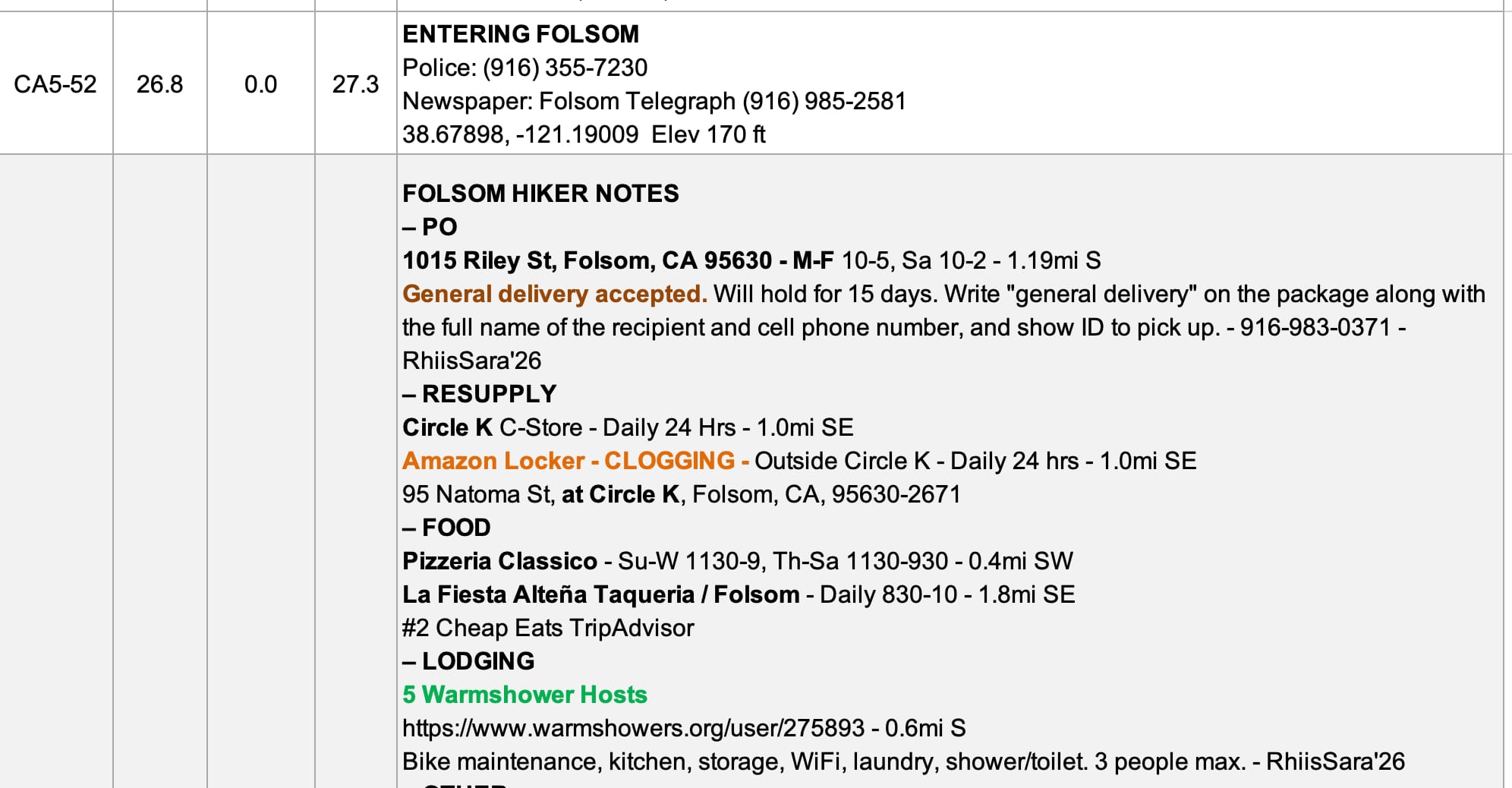
Just in the past two weeks, we've added 258 new waypoints to the Hiking America GPS data and turn-by-turn guides. That might sound like just a number, but behind each one is a piece of intelligence that could make the difference between a smooth resupply and a frustrating detour.
This is the part of running Hiking America that doesn't always get talked about—the constant, ongoing work of keeping navigation data current and useful. So I wanted to pull back the curtain a bit and show you what goes into these updates and why they matter for your ADT planning.
Why Resupply Waypoints Matter More Than You'd Think
When people talk about long-distance hiking challenges, they usually focus on the physical demands or the mental game. But ask anyone who's actually walked across the country, and they'll tell you: resupply logistics can make or break your experience.
The ADT isn't like the Pacific Crest Trail or the Appalachian Trail, where resupply points are well established and widely documented. You're crossing through small towns that don't see many thru-hikers, navigating post office policies that vary by location, and trying to figure out which businesses will actually hold packages for passing hikers.
That's where these 258 new waypoints come in.
What We Just Added
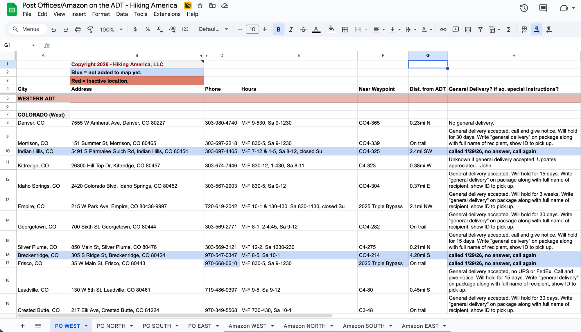
The latest updates focus on three critical categories:
General Delivery Post Offices
With the incredible volunteer, off-season support of ADT Thru-Hikers Rhiis and Sara, we've mapped and verified post offices along the ADT that accept General Delivery packages—the tried-and-true method for long-distance resupply. But here's what took time: not every post office handles General Delivery the same way. Some require advance notice. Some won't hold packages longer than a few days. Some have specific protocols you need to know about before you ship.
Each waypoint now includes notes on local policies that we've verified, either through direct contact or reports from recent hikers.
Amazon Locker and Counter Locations
This is relatively new territory for long-distance hiking, but Amazon Lockers and Counter locations are becoming increasingly useful for ADT resupply—especially in areas where post office hours don't align well with hiking schedules. We've added locations near the trail where you can have packages delivered and picked up on your timeline.
Hiker-Friendly Contacts
Some of the most valuable waypoints aren't official businesses at all. These are individuals and small operations across the country who've opened their doors to ADT hikers and bikers—people willing to hold packages, offer advice, or provide support when you need it. These connections often come from direct reports from hikers, and I'm grateful to everyone who has shared this intelligence.
Making It Easy to Find What You Need
Adding waypoints is one thing. Making them actually useful in the field is another.
When you're hiking through Kansas in 95-degree heat or trying to sort out your next resupply in a coffee shop somewhere in California, you don't want to squint at your phone trying to figure out which little pin means what. You need information that jumps out immediately.
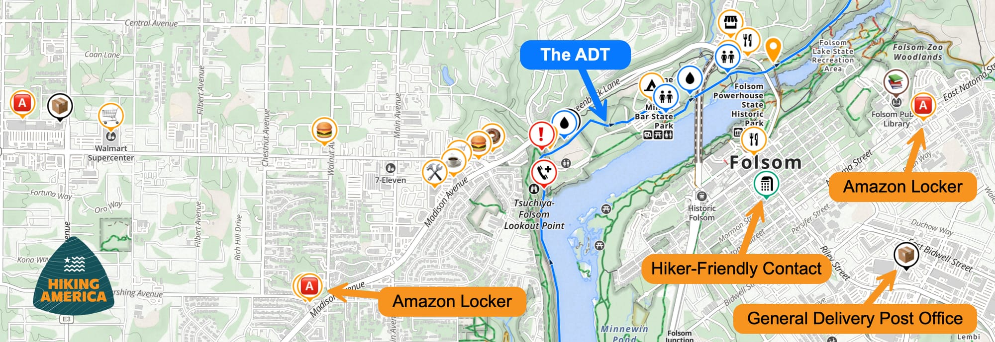
In Gaia GPS:
General Delivery post offices now appear with a distinctive brown package icon instead of the standard black pin. Amazon Lockers and Counters are indicated with an Amazon orange "A". When you're scrolling through your route and viewing potential resupply points, they will stand out clearly from other waypoint types.
In Turn-by-Turn Guides:
We've formatted these waypoints in the turn-by-turn guides with bolded brown text for General Delivery Post Offices, and bolded orange for Amazon Locker locations. Whether you're reading on your phone or have printed sections for reference, you can quickly scan a page and identify your resupply options without sifting through dense text.
This might seem like a small visual detail, but when you're tired and just need to know where your next resupply is, these little design choices make the information actually accessible.

Why I Do This Work
I've been thinking lately about what drives this work—updating waypoints at odd hours, cross-referencing hiker reports, testing new ways to display information.
Here's what I keep coming back to: Hiking America exists to provide hikers with the tools, maps, and guidance they need to confidently explore America's long-distance trails—especially the American Discovery Trail—and another to be announced soon! 🤯
The work isn't just about creating data once and calling it done. It's about maintaining that data, refining it, and ensuring it serves you when you need it. ⛰️
The ADT changes. Post offices update their policies. Businesses come and go. Trail conditions shift. Hiker-friendly contacts retire or move. If the navigation data doesn't evolve with those changes, it stops being useful.
So that's the mission—to demystify the logistics, keep the information current, and make coast-to-coast hiking accessible to anyone with the dream and determination to walk across America.
Community News: The ADT 250 Relay
Speaking of the ADT community, the American Discovery Trail Society is planning the upcoming American Discovery Trail 250 Relay—a special event coinciding with the 250th anniversary of the founding of America.
This is a unique opportunity to be part of ADT history and connect with fellow trail enthusiasts. If you've been looking for a way to experience a section of the trail or contribute to something bigger than your individual hike, this relay might be exactly what you're looking for.
You can find more information and the interest form here: https://discoverytrail.org/america-250-relay
What This Means for Your Planning
If you're already a Hiking America subscriber, these updates are live in your Gaia GPS data and Turn-by-Turn guides right now. You don't need to do anything—the waypoints are there, formatted and ready to use.
If you're still in the planning stages and haven't committed to the ADT yet, this is exactly the kind of ongoing intelligence that makes complex logistics manageable. Resupply planning doesn't have to be the overwhelming part of your preparation. When you have current, verified data on where to send packages and who can help along the way, you can focus your energy on the parts of planning that actually deserve it—like getting excited about the journey ahead. 🥾
The trail is waiting, and now you've got 258 more reasons to feel confident about your resupply strategy.
Want access to continuously updated ADT navigation data? Check out our complete GPS resources and planning tools designed specifically for America's most ambitious trail.

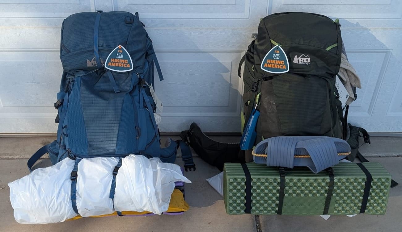
I'm Hiking America Credential Badge
Recognized by trail angels, hostels, and fellow hikers nationwide!
Get your Custom Hiking America Hiker Tag!
Only $19 for a Limited Time!
Always Free to Hiking America Members.