
Week One on the Great American Rail-Trail: Bernie Krausse Reports from the C&O Canal
Bernie Krausse is one week into his Great American Rail-Trail thru-hike — and already sending back the kind of trail intelligence you can't get from a guidebook. Here's what he found between D.C. and Cumberland. 🥾

Photos by Bernie Krausse
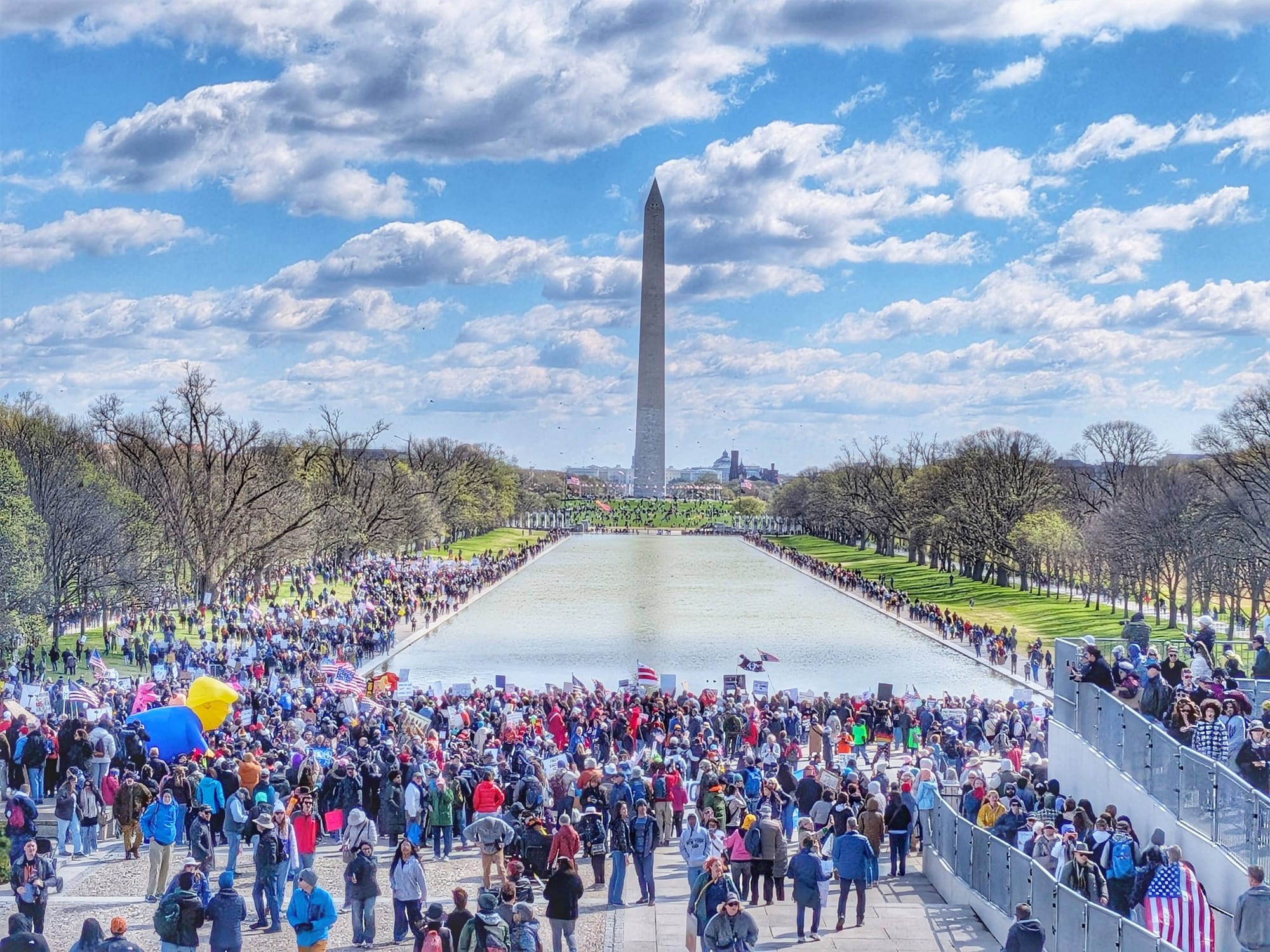
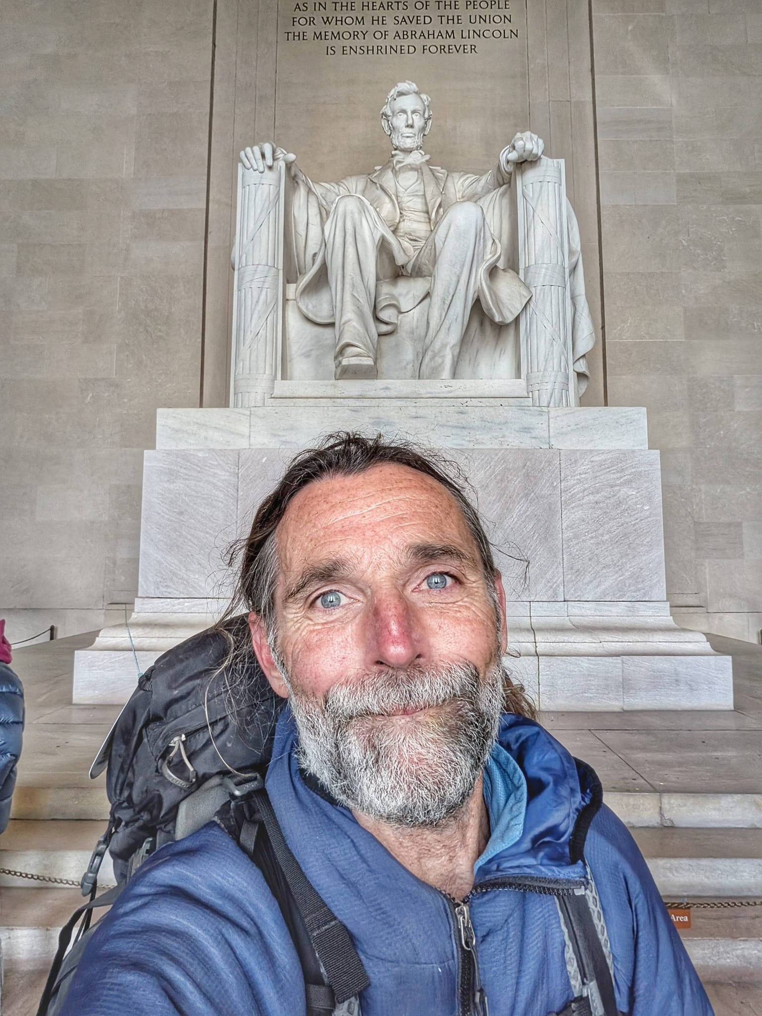
On March 28, 2026, Bernie Krausse stepped away from the Capitol Reflecting Pool in Washington, D.C. and pointed himself west. His destination: Washington State, roughly 3,800 miles away on the other end of the Great American Rail-Trail.
Bernie Krausse
Great American Rail-Trail - Westbound
Started: March 28, 2026
Support Links: ImHikingAmerica, Facebook, Venmo, PayPal Donate
Bernie isn't new to this. He's a Double-Triple Crown hiker — meaning he's completed the Appalachian Trail, Pacific Crest Trail, and Continental Divide Trail twice each. He hiked the American Discovery Trail in 2022. When he finishes the Great American Rail-Trail, he'll have logged more than 60,000 career miles on foot. So when he sends back field notes, we pay attention.
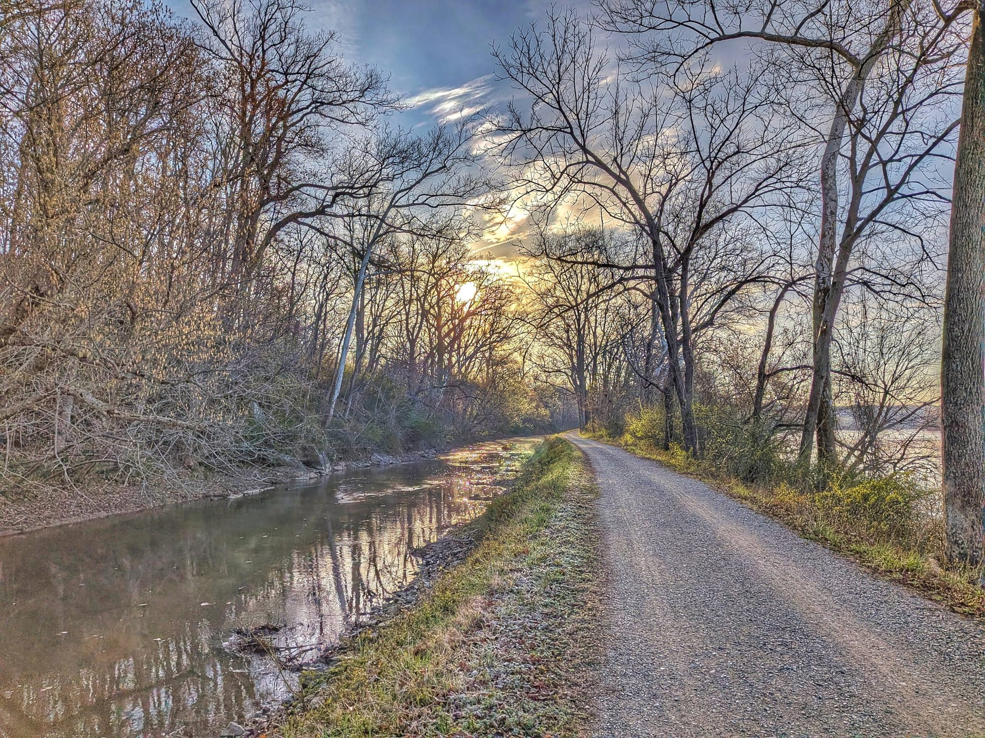
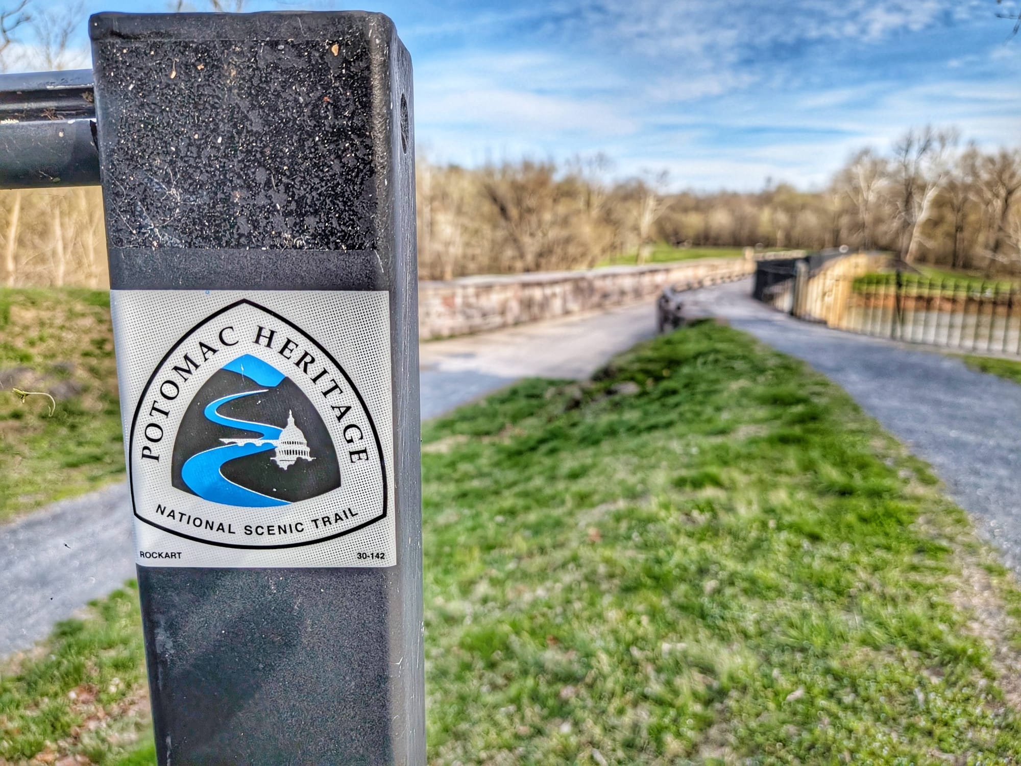
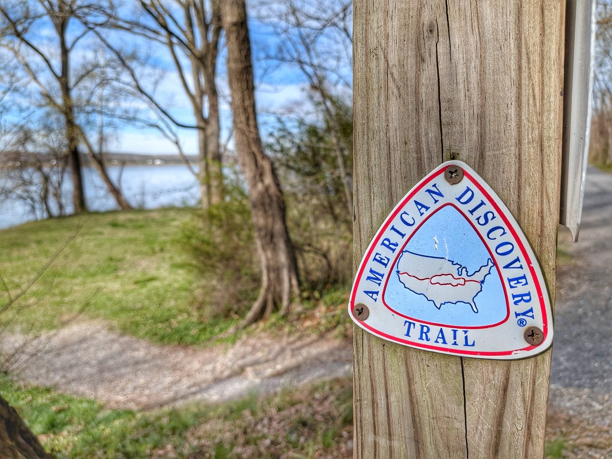
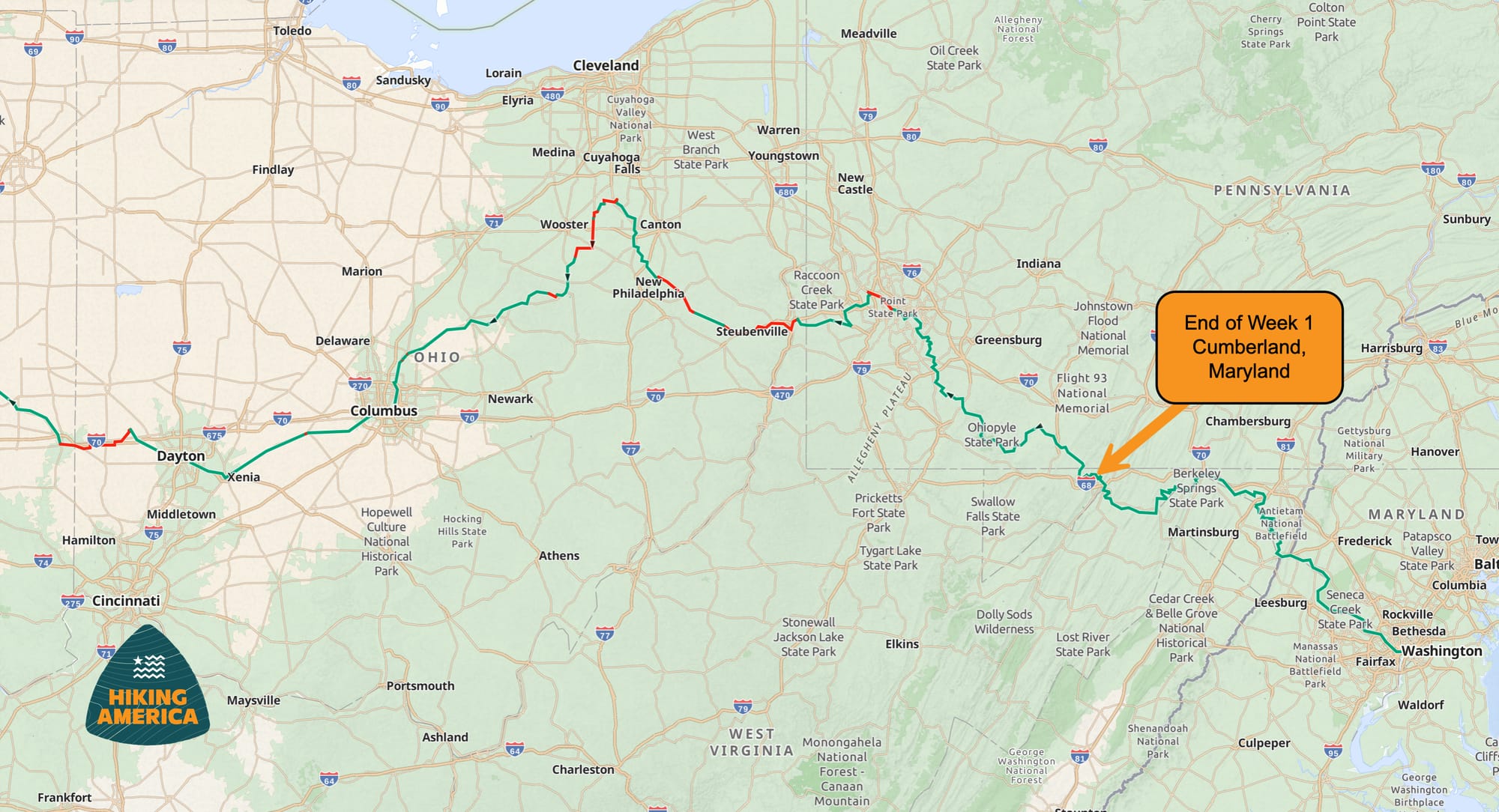
This first week took Bernie along the Chesapeake and Ohio Canal towpath — the same corridor shared by the Potomac Heritage National Scenic Trail and, of course, the American Discovery Trail. It's a fitting opening chapter: flat terrain, rich history, and a slow immersion into the rhythm of long-distance walking.
Here's what we learned from his first six days.
The Route: D.C. to Cumberland via the C&O Canal
Bernie averaged roughly 27 miles per day across his first week, covering the towpath from the Capitol through Great Falls, past Harpers Ferry, through Hancock and Paw Paw, and pushing toward Cumberland, Maryland - where the C & O ends and the Great Allegheny Passage begins. The terrain is straightforward — flat, crushed-limestone canal towpath — but the logistics of water, cell service, and resupply told a more nuanced story.
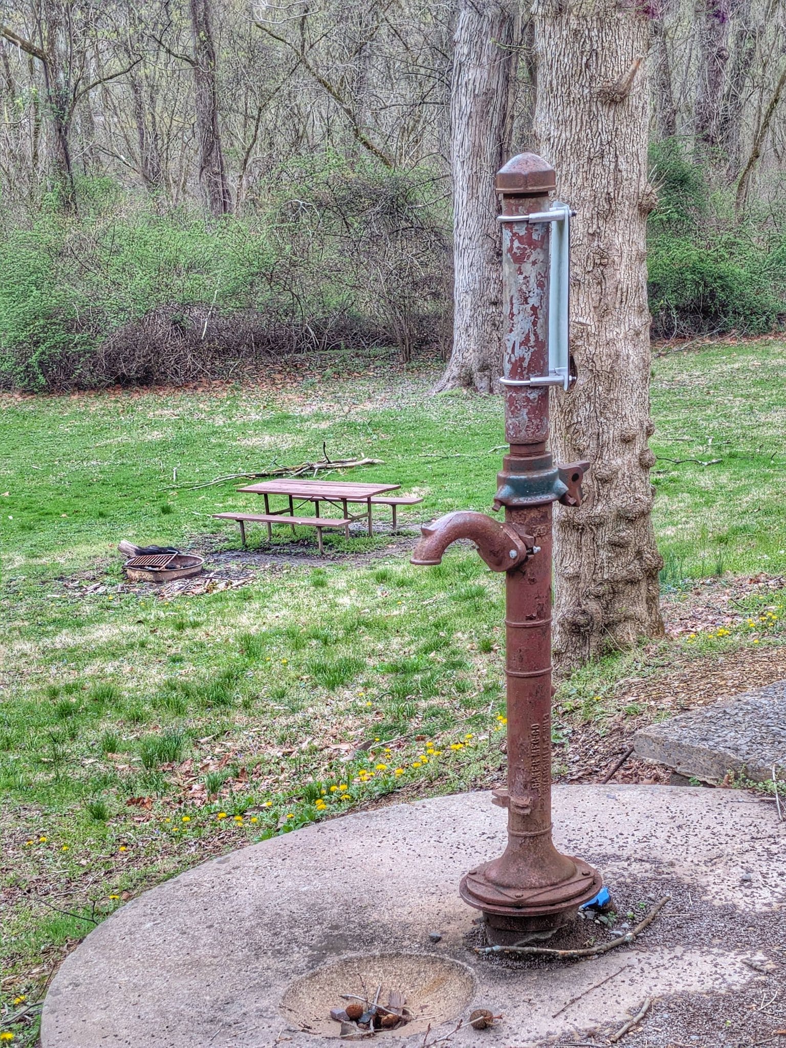
Water Access: Plan Ahead
One of the first things Bernie flagged is that water pump handles along the C&O Canal have been removed by the Park Service and won't be turned back on until mid-April. That's a significant detail for any early-spring hikers.
Bernie filtered water from creeks feeding into the Potomac (NOTE: NOT from the Potomac) and topped off at the few open businesses along the way. We're documenting exactly which sources were available at this time of year and updating our waypoint data accordingly. This is the kind of real-time intelligence that makes field verification so valuable — a static guidebook might still list those fountains as available.
Cell Service: Expect Gaps
Verizon coverage drops off significantly west of Harper's Ferry and remains unreliable through the Paw Paw region. Bernie found that the convenience store in Paw Paw no longer offers free WiFi, so he walked to the local library to charge devices and get online.
If you're planning to hike this section, download your GPS data and maps before you lose signal. Gaia GPS works in Airplane Mode after you've loaded your data — a small preparation step that makes a real difference when you're navigating without cell service for extended stretches.
Resupply: Hancock Is Your First Real Stop
Bernie resupplied for the first time in Hancock, Maryland — about 75 miles from D.C. Along the way, White's Ferry (around mile 35) has a deli and small convenience store where he charged batteries and got tap water from the kitchen. A Burger King near Hancock also served as a charging stop.
These are the kind of trail-corridor details we build into our Great American Rail-Trail and American Discovery Trail waypoints — not every restaurant in the region, but the specific services a hiker can actually access from the route.
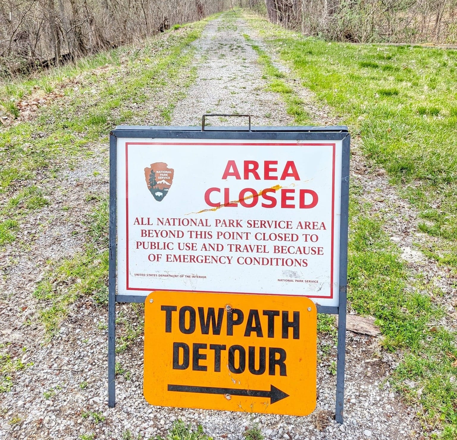
Trail Conditions and Detours
Bernie encountered a detour off the canal path onto the Western Maryland Rail-Trail for one to two miles due to a collapsing bridge. Two downed trees also partially blocked the towpath. These conditions change season to season, and having hikers on the ground each year reporting them in real time lets us keep our GPS data current.

The Paw Paw Tunnel — a 3,118-foot canal tunnel built in the 1850s — was passable and became the highlight of Bernie's week. He walked through it without a headlamp, using the brick-lined wall as a guide. For hikers who'd prefer to see where they're stepping, bring a light — there are puddles inside.
Trail Intersections Worth Noting
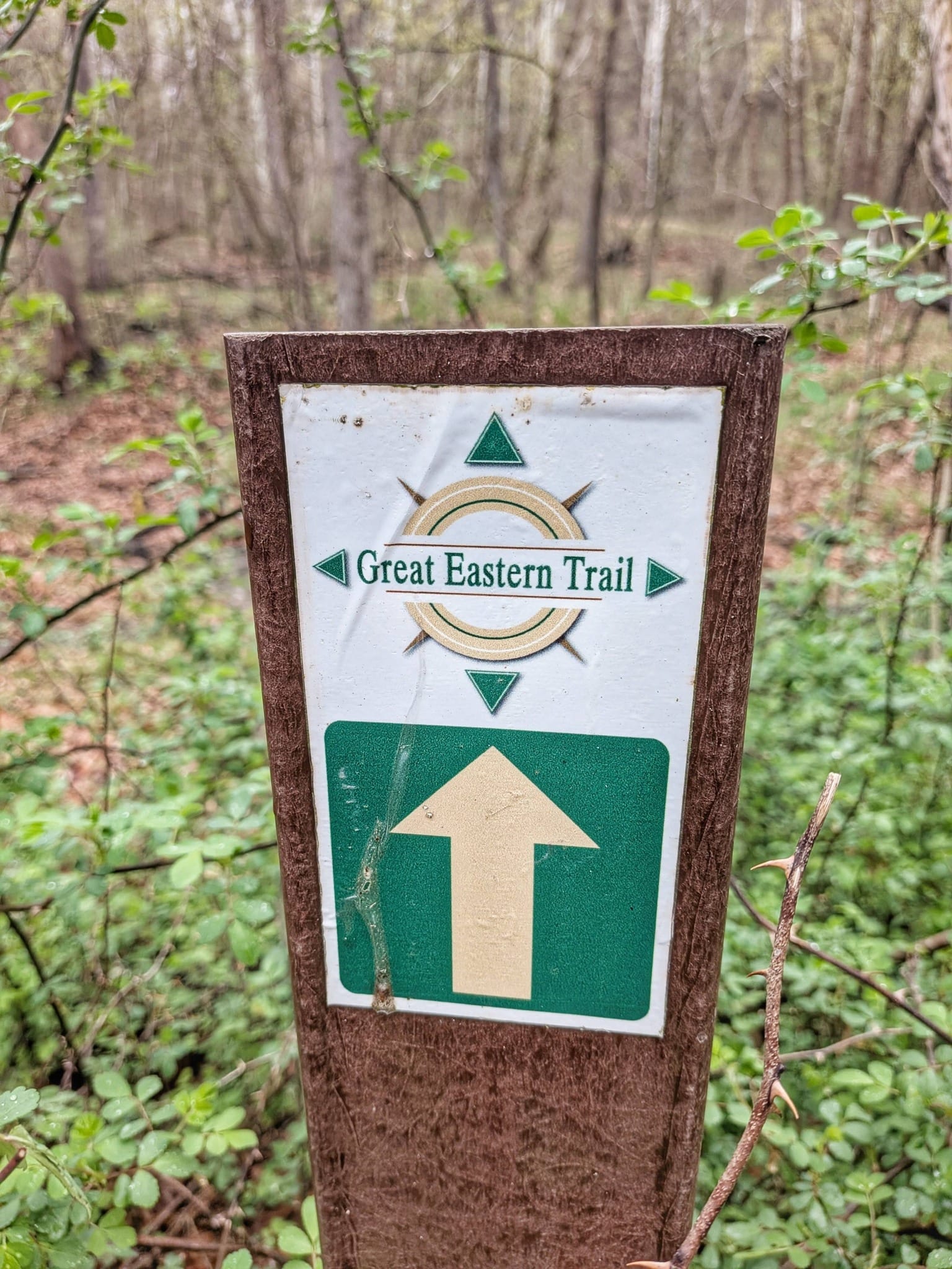
This corridor is layered with long-distance trail history. During his first week, Bernie crossed or paralleled several major routes: the Potomac Heritage National Scenic Trail (which he's now adding to his national scenic trail collection), the American Discovery Trail (which crosses the Potomac into West Virginia near Paw Paw), the Appalachian Trail at Harper's Ferry, the Tuscarora Trail near Hancock, and the Great Eastern Trail.
For hikers dreaming about what comes after their first big trail, this stretch is a reminder of just how interconnected America's long-distance trail network really is.

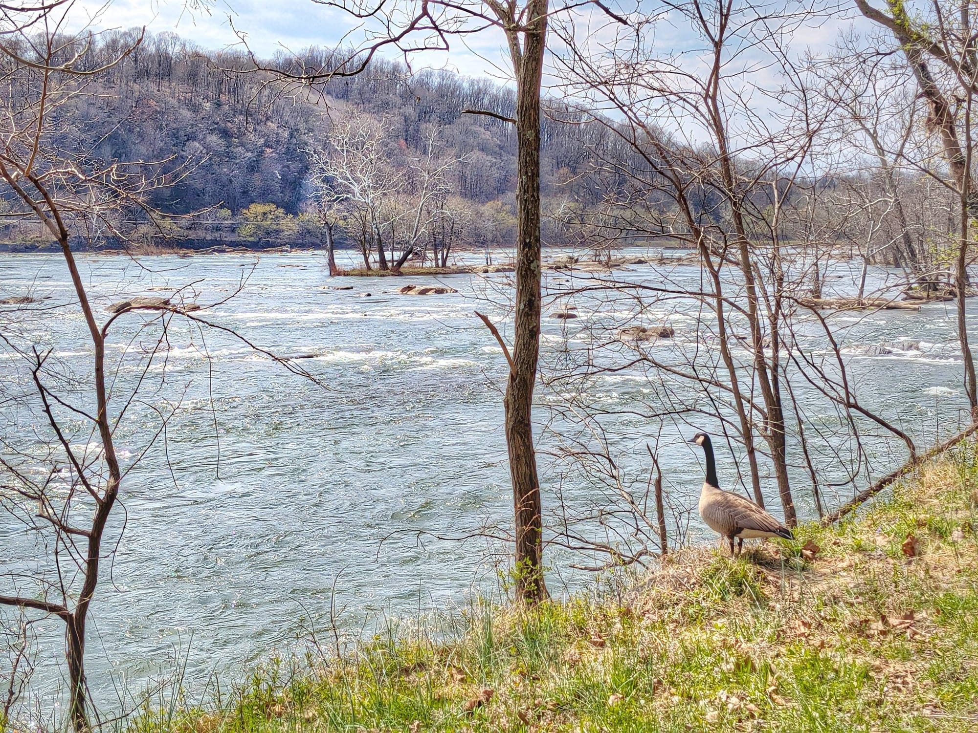

Wildlife and the Early Spring Corridor
Bernie's dispatches painted a vivid picture of the canal ecosystem coming alive in early spring: bald eagles, great blue herons, ospreys, kingfishers, hooded mergansers, and pileated woodpeckers. Pond turtles — hundreds of them — sunbathed along the canal or dove in as he approached. Eastern ratsnakes, snapping turtles, newts, and even a baby snake no bigger than a large inchworm made appearances.
For anyone hiking this section in late March or early April, the wildlife alone is worth the timing.
What This Means for Our Data
Bernie's hike isn't just a personal journey — it's the first real field test of Hiking America's Great American Rail-Trail GPS data. Every day he's on the trail, we're verifying waypoints, noting what's changed, and refining the information that future hikers will depend on.
This week confirmed several things we'd built into our data and flagged a few things we need to update. The water fountain situation, the Paw Paw WiFi change, and the bridge detour are all getting folded into our waypoints now, while the information is fresh and useful.
We'll be publishing weekly dispatches from Bernie throughout his Great American Rail-Trail thru-hike. If you're planning your own journey on this route — or just want to follow along as 3,800 miles of trail data gets verified one step at a time — this is the place to be.
Already a Hiking America Subscriber?
The Great American services layer is included in your existing subscription — no additional charge. As we build out the data during Bernie's verification hike, it'll automatically appear in your Gaia GPS alongside your American Discovery Trail waypoints.
New to Hiking America?
A Hiking America subscription gives you access to our complete navigation data for both the American Discovery Trail and the Great American Rail-Trail — GPS tracks, service waypoints, turn-by-turn guides, and real-time trail updates. All for one subscription.
$7/month or $70/year — cancel anytime.
Or start with our free Great American GPS tracks and see what Hiking America is all about.
Hike Your Hike - John.
