
Great Eastern Trail in Tennessee: the Cumberland Trail
Hiking America's Great Eastern line is drawn across Tennessee, from Lookout Mountain and the Walnut Street Bridge along the Cumberland Trail to Cumberland Gap.


Tennessee is on the map. Our Great Eastern line runs from Lookout Mountain above Chattanooga to Cumberland Gap, where Tennessee, Kentucky and Virginia meet, and it's drawn, checked and loaded into Gaia GPS.
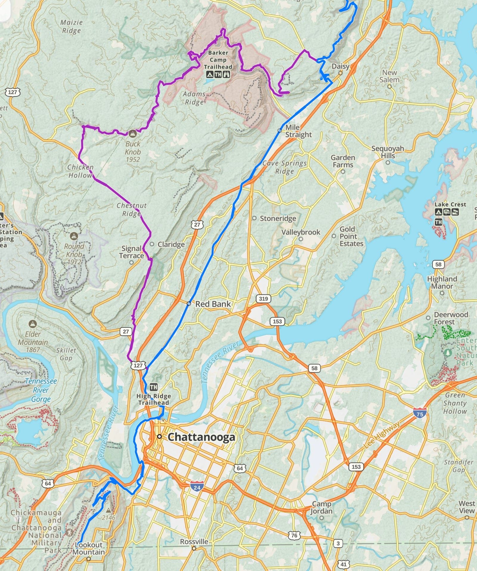
Chattanooga
The line comes down off Lookout Mountain through St. Elmo, follows the Tennessee Riverwalk and crosses the river on the Walnut Street Bridge. A road walk then heads north through Red Bank and Hixson to Soddy-Daisy and the Cumberland Trail.
If you'd rather trade road for trail, the North Chickamauga Alternate leaves the main line in Chattanooga and picks up the Cumberland Trail sooner. It's more trail and more miles, mapped as its own alternate track.
The Cumberland Trail
From Soddy-Daisy the line follows the Cumberland Trail along the edge of the Cumberland Plateau, past Dayton, Spring City, Crab Orchard and Frozen Head State Park, to Caryville and LaFollette. The state park is still building parts of the trail, so road walks link the open sections.
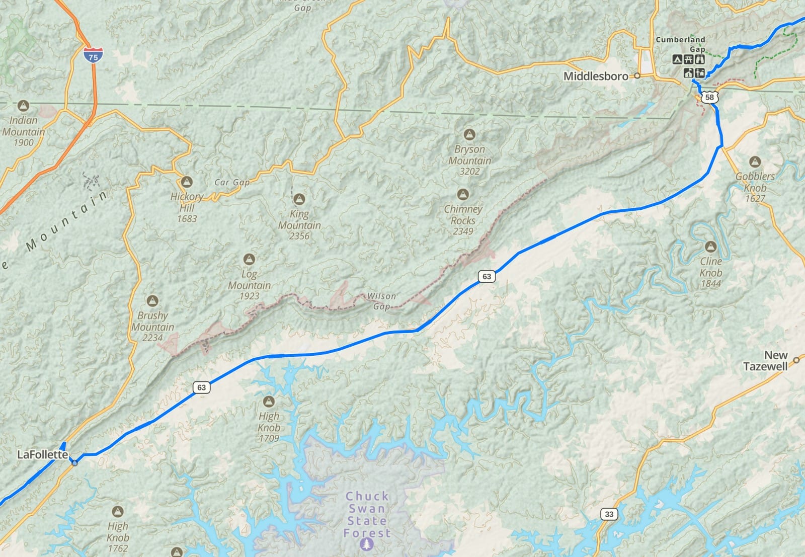
LaFollette to Cumberland Gap
North of LaFollette the line follows SR 63 through Harrogate, then finishes on trail in Cumberland Gap National Historical Park. The Cumberland Trail State Park told us McClouds Trail and Wilson Gap are private now and closed to the public, so the road walk is the way through. If that changes, we'll move the line.
Like Alabama and Georgia, every turn is drawn on OpenStreetMap and checked in Gaia before its pin goes in. When all nine states are done, Tim Hupp, president of the Great Eastern Trail Association, looks the line over, and then the track goes out free to anyone. Follow the build state by state on the Great Eastern Trail page.
Want the free Great Eastern track the day it's ready? Sign up free and we'll send it.
Before you go, read the latest notices on the Great Eastern Trail page, and check with the Cumberland Trail State Park and the weather forecast.
Hike Your Hike - John. 🥾
Hiking America is an independent navigation resource and is not part of the Great Eastern Trail Association. Learn about GETA at greateasterntrail.net.