
Two GAP tunnels close Nov. 25, Harpers Ferry's footbridge stays closed this fall, and floods close highways around Bluff, Utah
The Borden and Big Savage tunnels on the Great Allegheny Passage both close November 25, with no detour posted for either. In southeast Utah, flooding since November 1 has closed highways around Bluff and Montezuma Creek.

This is Hiking America’s weekly roundup of news affecting the routes we map and the trails we provide information for.
Maryland and D.C.
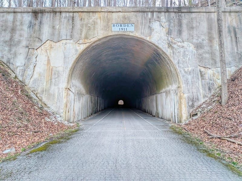
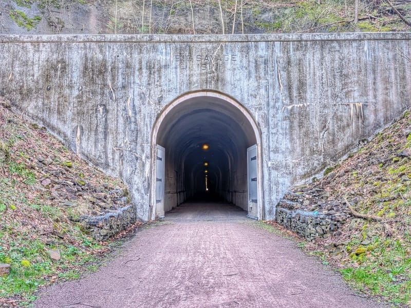
The Borden Tunnel at mile 17.9 of the Great Allegheny Passage closes November 25 and is scheduled to reopen April 1, 2027, with work continuing through April 30. The same day, Somerset County closes the Big Savage Tunnel, about four trail miles on at mile 22 in Pennsylvania, until late March or early April, depending on snowfall and temperature. Neither has a posted detour, no shuttle will run around Borden, and the GAP Conservancy calls the local roads near Big Savage "narrow and treacherous." The Great American Rail-Trail uses the whole GAP, so anyone passing after November 25 needs a ride around both tunnels. Until then, expect construction vehicles and possibly flaggers at Borden.
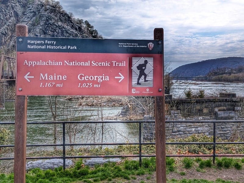
The Goodloe Byron Memorial Footbridge, the walk from the C&O Canal towpath into Harpers Ferry, has been closed since July 27, and the Appalachian Trail Conservancy's October 22 update says it is "expected to remain closed this fall." The free shuttle between the Harpers Ferry National Historical Park Visitor Center and Lock 34 is still running, with very limited space. The American Discovery Trail and the Great American stay on the towpath here, so the closure affects the trip into town.

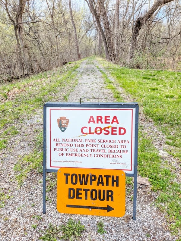
The National Park Service's C&O Canal conditions page, last updated November 3, lists four changes on the towpath the two routes share, with no end dates:
- Mile 134.3: the bridge over Polly Pond Creek is closed. The detour leaves the towpath at Lock 56 (mile 136.2) and follows the Western Maryland Rail Trail to the Lock 55 bridge (mile 134.1).
- Miles 106 to 106.8: the detour crosses the canal to Dam No. 5 Road on a temporary mulch trail and wooden stairway. The Dam No. 5 parking lot is closed.
- Mile 99.8, Williamsport: reaching the towpath from Cushwa Basin takes a steep set of stairs or the gravel rail-trail to a crossing.
- Mile 64.4: a washout half a mile below the Dargan Bend boat ramp has moved the pedestrian footbridge 100 feet upstream.
In Washington, the same page lists a local detour on the Capital Crescent Trail near the Potomac Aqueduct at mile 1.1, on the Great American's way out of the city.
Pennsylvania
The GAP remains closed between mile 87, where the Sheepskin Trail meets it, and mile 89 in Connellsville, as it has been since the October 17 landslide. The Conservancy's latest update, October 22, gives no reopening date. Book a shuttle directly; the Conservancy suggests Wilderness Voyageurs in Ohiopyle, 800-272-4141. Our 7-mile detour around the closure is in the Hiking America Gaia GPS data for the Great American. GAP alert: https://gaptrail.org/trail-alert/landslide-and-closure-between-ohiopyle-and-connellsville/
In West Mifflin, the two miles between the Whitaker Flyover (about mile 136) and the Port Perry Flyover (about mile 138) have been closed for rock scaling since July 9, with no detour and no reopening date. The daily Duquesne–Homestead shuttle ended October 31. Hire a shuttle in advance (the Conservancy names Bill's Car and Transport in Pittsburgh as the closest) or take Pittsburgh Regional Transit routes 59 or 61C. GAP alert: https://gaptrail.org/trail-alert/segment-closure-and-shuttle-between-duquesne-and-homestead/
A 0.1-mile section at mile 141 in Homestead closes on weekdays for apartment construction, with a sidewalk detour and normal travel on evenings and weekends. The Layton Bridge replacement near mile 99 brings stops of 20 minutes or less, with flaggers, over two to three years of work. Homestead alert: https://gaptrail.org/trail-alert/detour-around-apartment-construction/ · Layton alert: https://gaptrail.org/trail-alert/layton-bridge-replacement/
West Virginia
The American Discovery Trail 250 Relay, organized by the American Discovery Trail Society, crosses West Virginia over the next nine days. It walks the North Bend Rail Trail from Pennsboro to West Union on Saturday, November 7 (12.6 miles), and reaches Clarksburg on Monday, November 9 (28.0 miles, run, walk or bike). On Veterans Day, November 11, it starts at 9 a.m. at the Barbour County Historical Museum in Philippi and goes 49.5 miles to Blackwater Falls State Park; the relay's day page warns that a support vehicle is unlikely to reach the last 12 miles. Dolly Sods follows on November 12, Keyser on November 13 and Paw Paw on November 14.
Ohio
On the American Discovery Trail's northern route, Concord Fairhaven Road north of Fairhaven has been closed since August 24 for a bridge replacement over Four Mile Creek, and the county lists it reopening December 11. The closed stretch runs from Paint Creek Four Mile Road south to State Route 177. The detour goes west on Paint Creek Four Mile Road, then southeast on State Route 177, and adds about 1.2 miles; walk facing traffic on 177.
Preble County Engineer:http://prebeng.org/current_events/current%20events.html ·
 John Wesley Brett

Illinois
A boil water order has been in place since October 26 at the campground at Garden of the Gods in Shawnee National Forest, with no end date. Bring your own water or plan to boil it. Shawnee Supervisor's Office: 618-253-7114. Forest Service alert: https://www.fs.usda.gov/r09/shawnee/alerts/boil-water-order-pharaoh-campground-garden-gods · Illinois South guide: https://www.hikingamerica.com/guides-illinoiss/
Iowa
Black Hawk County Conservation closed the Cedar Valley Nature Trail between Gilbertville and Weiden Road in late October and replaced more than 20 stretches of deep cracks. The work was done by October 31, and more repairs are planned next year. Nearby in Waterloo, the Cedar Valley Lakes Trail from Vinton Street to Evansdale reopened in late October with new asphalt, after a closure since April for a sewer line repair under the Cedar River. Cedar Valley Trails Partnership: https://mailchi.mp/cf5dfc7cb7fc/trails-newsletter-april-2025-cedar-valley-trails-partnership-17247091 · Iowa guide: https://www.hikingamerica.com/guides-iowa/
Missouri
The Route 7 bridge over Big Creek and the Rock Island Trail at Pleasant Hill reopened more than a month ahead of schedule, MoDOT announced November 2. It closed February 16. The trail's intermittent closures under it have ended, so stay on the trail instead of taking the Route 58 and South Purvis Road alternate. MoDOT: https://www.modot.org/projects/missouri-route-7-bridge-replacement-over-big-creek-and-rock-island-trail-cass-county
In Lee's Summit, Jackson County's corridor page shows Phase 1 of the Greenwood Connector under construction, with completion expected at the end of 2026 and a trailhead planned at Hamblen Road. It isn't open; stay on the road walk east of SW Jefferson Street. County page: https://makeyourdayhere.com/Facilities/About-the-Rock-Island-Rail-Corridor · Missouri guide: https://www.hikingamerica.com/guides-missouri/
Colorado
The Air Force Academy announced November 2 that its section of the New Santa Fe Regional Trail, closed since March 1, is open again on foot or by bicycle, and trail users must stay on the trail. The south gate at Ice Lake is open. Bike Colorado Springs' November 4 update says the trail remains closed from South Gate Boulevard to Monument at the Academy's north edge for a Colorado Springs Utilities project, with no reopening date; earlier word was through December. American Discovery Trail hikers walking through should keep the road alternate. Status: https://www.bikecoloradosprings.org/usafa-trail-status/ · Academy: https://www.usafa.edu/visitors/getting-on-base/ · Colorado South guide: https://www.hikingamerica.com/guides-colorados/
Little Bear Campground on Grand Mesa stays closed through December 31, and the Island Lake day-use area and Trail 748 are closed through November. Forest Service alert: https://www.fs.usda.gov/r02/gmug/alerts/little-bear-campground-and-island-lake-day-use-area-roads-and-trail-closure-0
Utah
Flooding began November 1 in southern San Juan County. As of the Moab Sun News tracker's November 4 update, Highway 163 was closed west of Bluff, where the Comb Wash bridge washed out, and State Route 262 was closed at milepost 20 north of Montezuma Creek. US 191 between Moab and Monticello has been open since early November 2, and UDOT listed no closures in Grand County. None of the reports we've read names the roads the American Discovery Trail uses in the county (UT 95, Woodenshoe, Elephant Hill, the Needles park road, Lockhart Basin, Kane Springs), so their condition is unknown. If you're headed that way, call San Juan County at 435-587-3223 or the BLM Monticello Field Office first. Tracker: https://moabsunnews.com/2026/11/01/moab-region-flood-tracker-2026/ · Utah guide: https://www.hikingamerica.com/guides-utah/