Wildfire Season and the ADT: Real-Time Updates When You Need Them Most
Wildfires have disrupted ADT hikers for years - from Mary Davison's close call with the Mosquito Fire to recent detours in Utah. We're currently monitoring four active fires near the trail. Real-time intel matters when conditions change fast. 🔥⛰️


Picture this: you're one day away from entering the Sierra Nevada, months into your American Discovery Trail journey, when wildfire forces a trail closure. That's exactly what happened to Mary "Medicare Pastor" Davison in 2022 when the Mosquito Fire shut down a large section of the ADT in Tahoe National Forest.
It's a scenario that's become all too familiar for ADT hikers. Over the past few years, wildfires have consistently disrupted cross-country journeys, forcing detours and route changes that can make or break a thru-hike attempt.

When the Trail Goes Up in Smoke
The reality of modern long-distance hiking means dealing with wildfire season as a planning factor, not just a possibility. Here's what ADT hikers have faced recently:
2024: The Little Twist Fire in southwestern Utah forced Marshall Travis into an unexpected Northern detour, adding miles and complexity to an already challenging section.
2023: Mike Crowley encountered the same Little Twist Fire area, requiring careful navigation South around fire-damaged terrain and ongoing restoration work.
2022: Mary Davison came within a day of hiking directly into the massive Mosquito Fire zone in California's Sierra Nevada—a close call that could have ended her journey entirely.
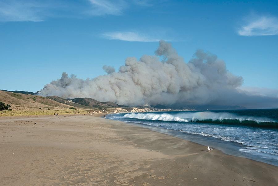
2021: The Woodward Fire created a complete barrier at the ADT's Western Terminus in California, making it impossible to reach the traditional starting point for eastbound hikers.
In every single case, we developed and published alternate routes to keep hikers safe and moving forward. Because here's what I've learned after years of supporting ADT hikers: the trail itself will throw enough challenges at you. Navigation around predictable hazards shouldn't be one of them.
Current Fire Conditions: What We're Watching
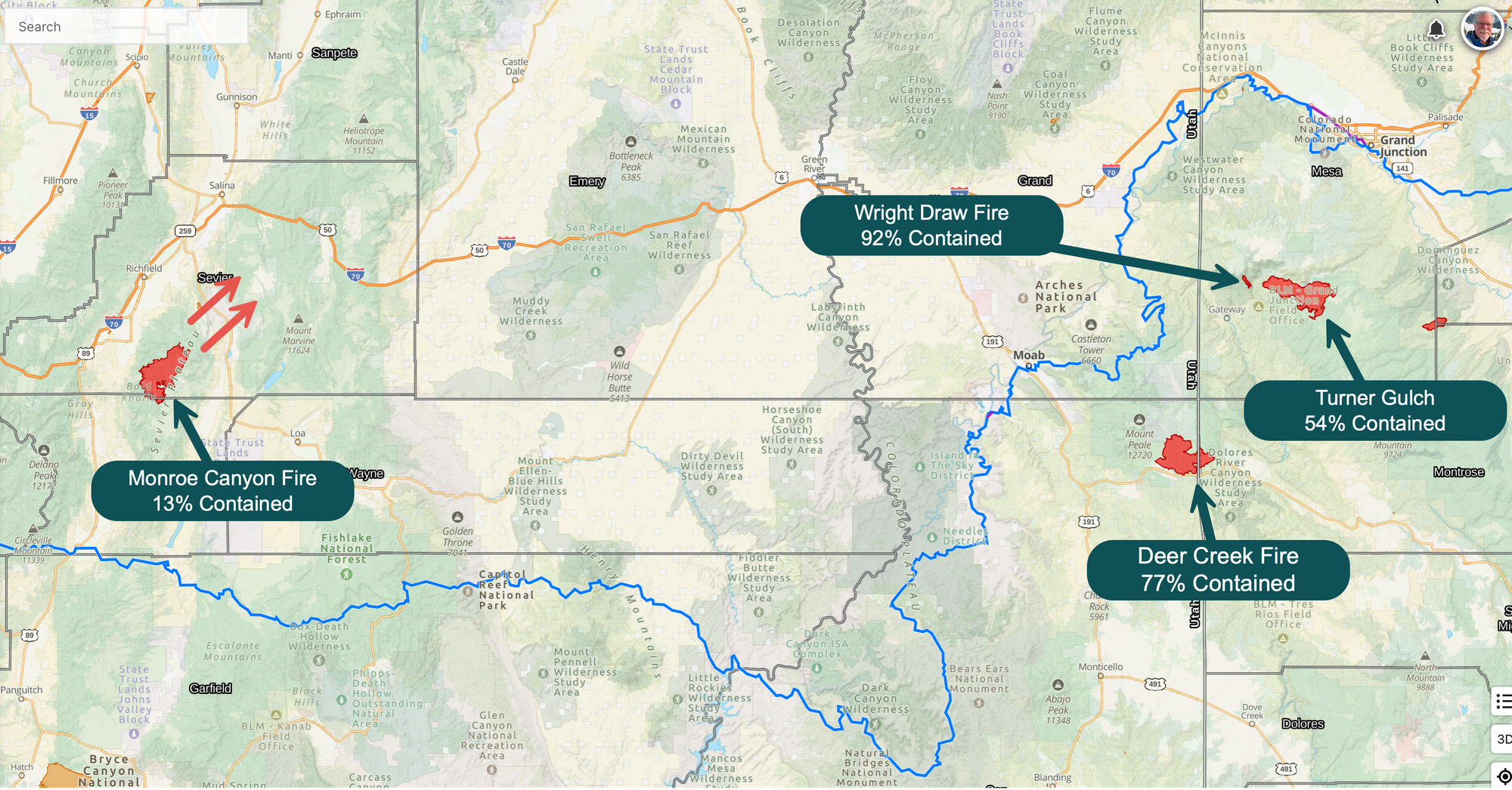
As I write this, four active wildfires are burning near ADT corridors in Utah and Colorado. While none currently require detours, we're monitoring each one closely:
Monroe Canyon Fire (Central Utah): The newest arrival, popping up just last week. Currently 13% contained but growing northeast—away from the ADT route. We're watching the wind patterns and containment progress.
Deer Creek Fire (Utah/Colorado border): 77% contained and forecasted to remain stable over the next week. This one had us concerned initially, but firefighters have made good progress.
Wright Draw Fire (Colorado, east of Moab): 92% contained. Nearly wrapped up, but we'll keep monitoring until it's fully suppressed.
Turner Gulch Fire (Colorado): The largest of the current burns at 54% contained. Expected to remain stable, but size alone keeps it on our radar.
The good news? None of these fires currently threaten the ADT route. In fact, hiker Steve Gefell left Redstone, Colorado, this past week and will soon join the Kokopelli Trail, which passes northwest of both the Wright Draw and Turner Gulch fires. He should have clear passage through that section. Should.
The reality? Conditions can change quickly during fire season - so we'll keep watching.
Real-Time Intel When It Matters Most
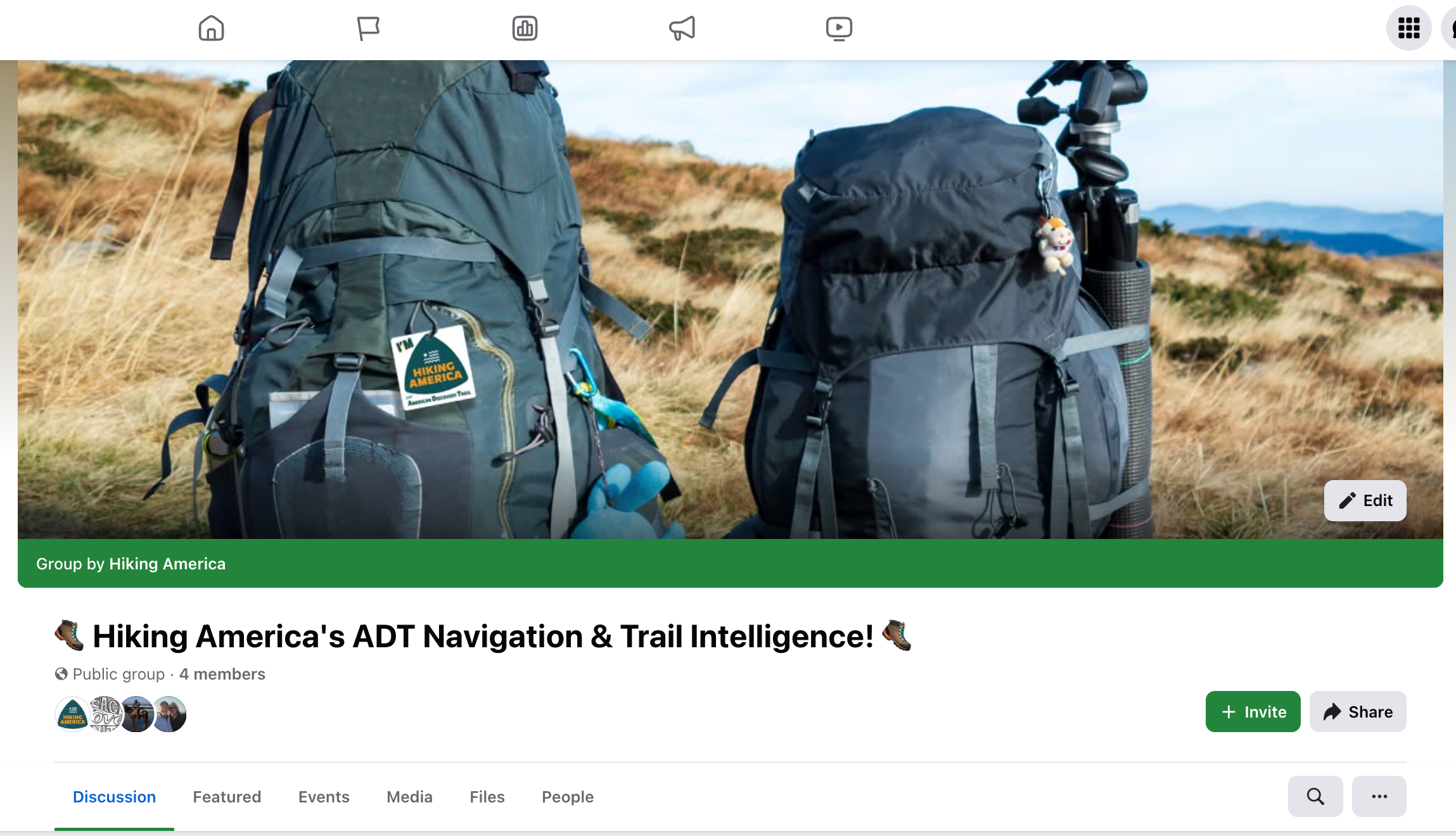
This is exactly why we're launching the Hiking America Facebook Group TODAY - as in RIGHT NOW!
When atmospheric rivers flooded the Ohio River crossing, we had alternate routes posted within hours. When wildfires create new hazards, hikers need immediate updates and verified detour options. We believe building a community around such events can only aid in a hiker's success.
Static guidebooks and outdated forum posts can't respond to changing trail conditions. But a community of former and active hikers, route researchers, Trail Angels, and local everyday people can!
In our new Facebook group, we're building a place for:
- Immediate fire and weather alerts that affect ADT sections
- Verified detour routes with GPS coordinates and turn-by-turn directions
- Real-time trail reports from hikers currently on the ground
- Community support from people who understand the unique challenges of cross-country hiking
Planning for the Unpredictable
Here's what years of tracking wildfire impacts has taught me: you can't predict where fires will start, but you can prepare for how to handle them when they do.
The most successful ADT hikers aren't the ones who never encounter problems—they're the ones who have reliable information sources and backup plans when conditions change. They're part of a community that shares real-time intelligence and proven solutions - one that talks with one another.
Whether you're planning your ADT journey or currently hiking, having access to up-to-date route information isn't only convenient—it's essential for both safety and success.
Ready to stay connected with Hiking America's most current ADT intelligence? Join the Hiking America Facebook group and let's share the real-time updates and strategies that can keep our hiker journeys on track, even when the trail itself changes course. 🔥⛰️
Stay safe out there, and remember: the trail is always changing, but with the right community and information, you can adapt and keep moving forward.
Hike Your Hike - John.