
Mosquito Wildfire Closure Update
The Mosquito Wildfire shut down a large section of the American Discovery Trail in September. The USDA FS lifted part of the closure this week!

In September, the Mosquito Wildfire shut down a large section of the American Discovery Trail from Foresthill to Palisades Tahoe, California. The U.S.D.A. Forest Service lifted part of the closure this past week, signaling some hopeful news for the ADT Class of 2023.
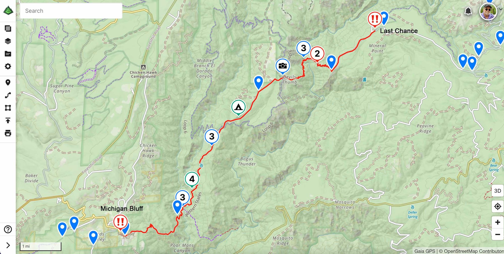
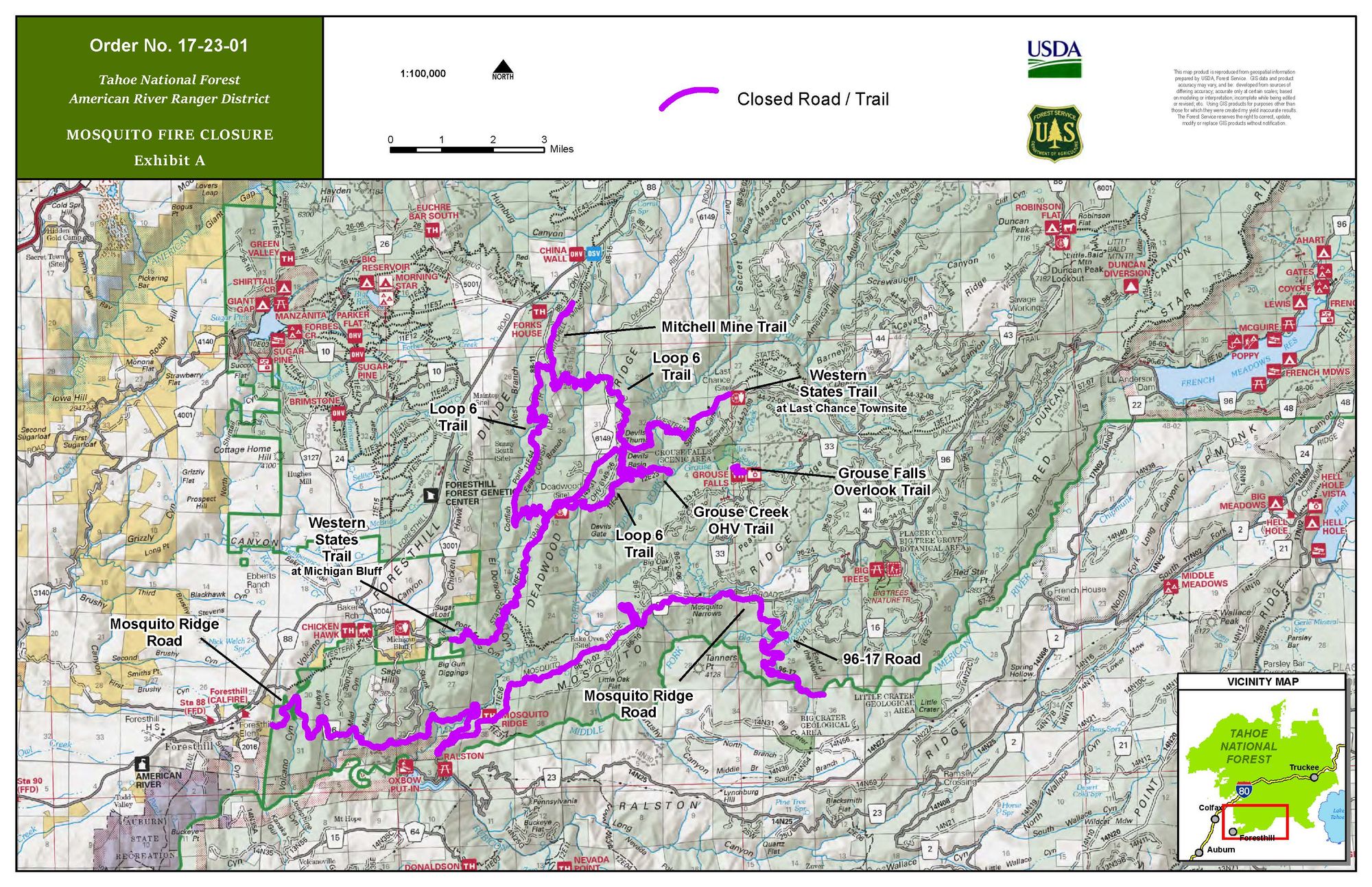
What remains shut down, following this week's updated Forest Order, is a section of the Western States Trail, which the American Discovery Trail follows in northeastern California, from Michigan Bluff, just east of Foresthill, northeast to the Last Chance townsite.
Unfortunately, the obvious alternative, Mosquito Ridge Road, is also closed due to the fire. But we will keep an eye out for any changes as the May Eastbound window opens through that area.
Rest assured, Hiking America will have the detour on all our products should the closure remain.
Just for Kicks —
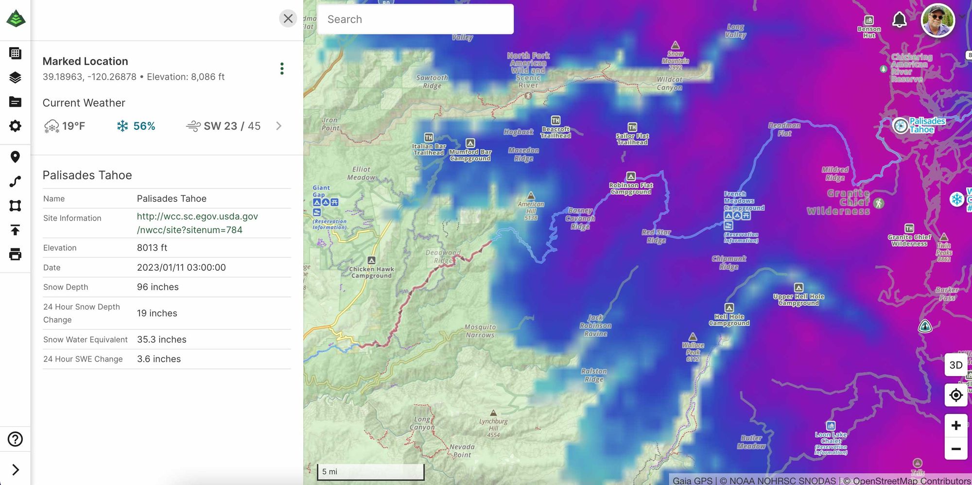
Let's zoom out a bit and bring up the Gaia GPS Snow Depth and Snow Stations layers. The closed section is that faint red track just west of the current snow line. You can see the Hiking America track continuing northeast to Palisades Tahoe in light blue. These Snow Depth maps, updated daily, are an amazing feature of Gaia GPS!
Even if that section were opened, we'd be going nowhere fast – as the snow depth at Palisades Tahoe in the upper right-hand corner - is 96 inches or 8 feet! With more FEET coming this weekend. Ooof! 👀
Hike Your Hike - John.