
Iceman in the Nevada Basin: Water, Wild Horses, and What the ADT Actually Teaches You
ADT hiker Iceman just pushed 39 miles through central Nevada in a single day — not because he wanted to, but because the water situation demanded it. Here's what his journals tell us about planning this section of the American Discovery Trail.

One of the most honest things about the American Discovery Trail is that Nevada doesn't try to be anything it isn't.
There are no crowds, no trailhead selfie spots, no curated overlooks with interpretive signs. What there is: ancient highway corridors, livestock tanks, wild horses moving across ridgelines, and the very real question of where your next reliable water source is going to be.
ADT hiker Tyler 'Iceman' Reiser spent the last week threading through central Nevada, and his journals give us as clear a picture of this stretch as anything I've seen from a hiker in real time. 🥾
Tyler 'Iceman' Reiser
Westbound - Western Route
Began: April 16, 2026 - Moab, Utah
Support Links: Trail Journals
He's 30 days into a section starting from Moab. On May 10th, he walked out of Ely on a day when the humidity sat at 7%, and the temperature swung 55 degrees from overnight low to afternoon high. By May 14th, he was rolling into Eureka, Nevada — just 4.4 miles on a short day — after a 39-mile push the day before. What happened in between is worth understanding if you're planning this stretch of the ADT.
The Water Situation Is Real
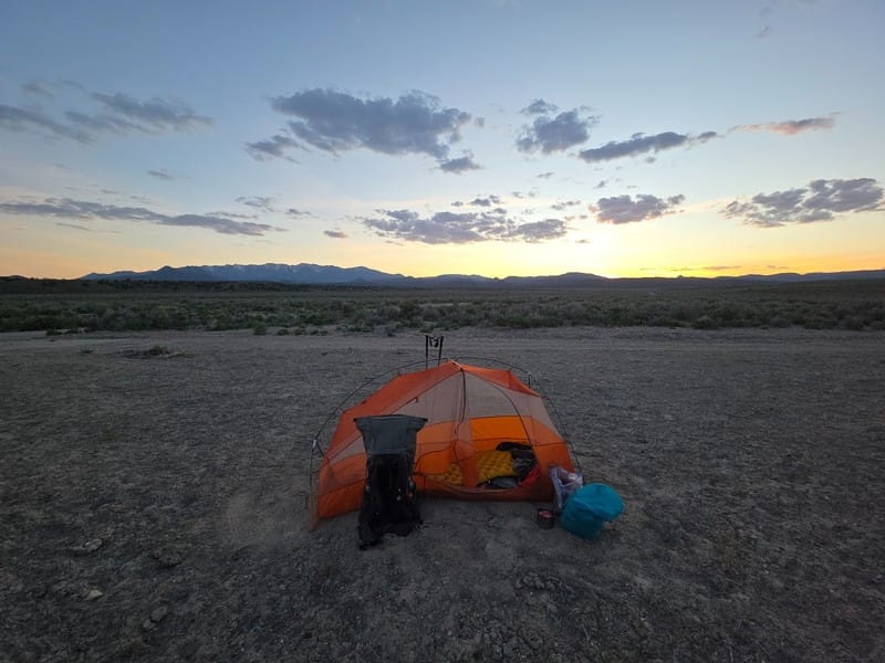
The Nevada Basin section of the ADT is not a place to wing your water strategy. Iceman's journals document something that no guidebook can fully capture: the variability. A spring that looks promising on the map might have an oily gloss on the surface and a slight trickle by the time you get there. A stock tank at a cattle operation might require climbing a ladder with a collapsible container, treating 4.5 liters with chlorine dioxide, and repeating the process twice. An unmarked trough with a working float might be surrounded by cattle stirring up a dust cloud the moment they notice you.
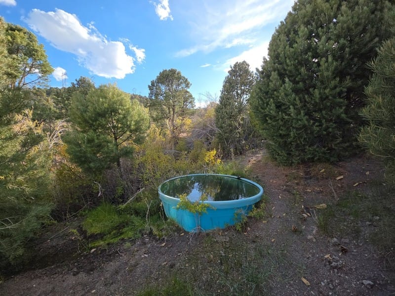
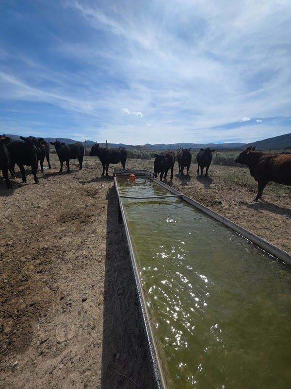
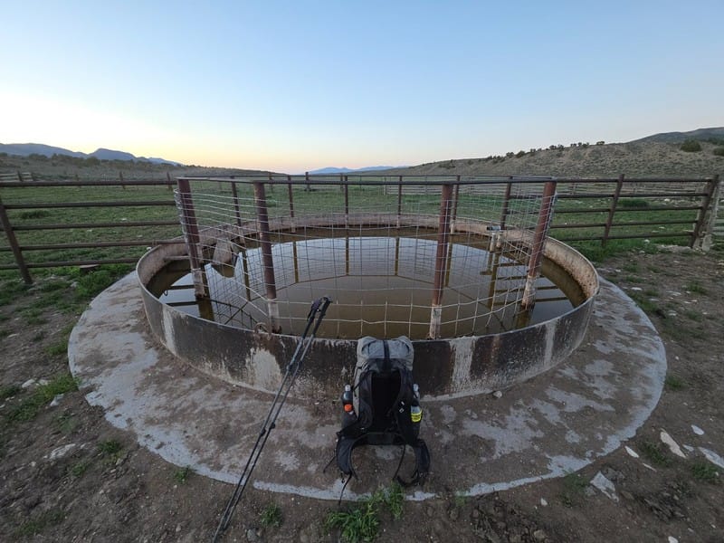
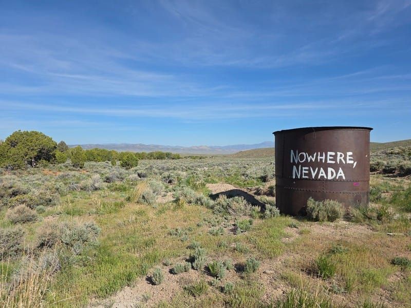
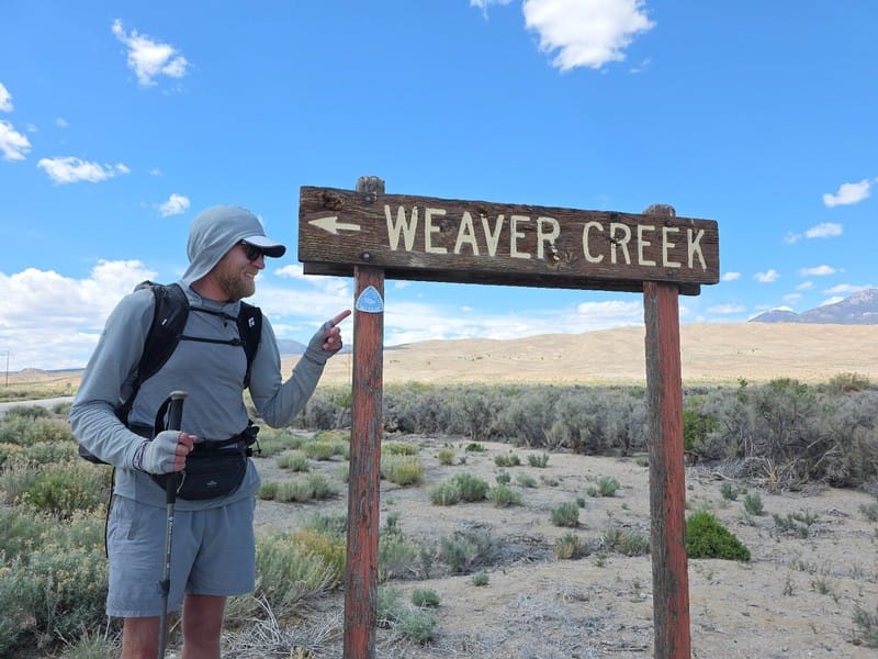
Water sources in Nevada come in all shapes and sizes. Photos: Tyler 'Iceman' Reiser
None of that is a complaint — it's just what water logistics look like in this part of the country. Tyler handled it methodically, and it shows. He was making decisions about when to top off versus when to trust the next source, carrying 4+ liters through exposed stretches, and marking dry springs so others would know. That kind of real-time documentation is exactly what makes field reports from active hikers so valuable for trip planning.
If you're heading into this section, the takeaway is straightforward: don't count on any single source, build in a buffer, and treat everything. The verified waypoints in our Gaia GPS data flag known water reliability issues in this corridor, but Iceman's on-the-ground notes are adding another layer of current intelligence to what we know.
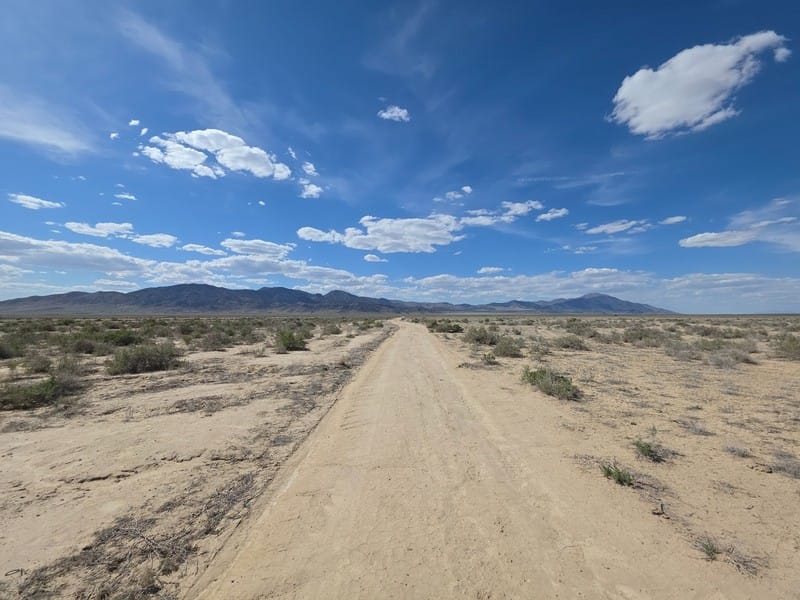
The Road Walk Reality
Central Nevada ADT involves some road walking. Iceman wrote about the psychological weight and difference between walking on the old Lincoln Highway roadbed (quiet, sandy, overgrown) and the current US 50 corridor running parallel.
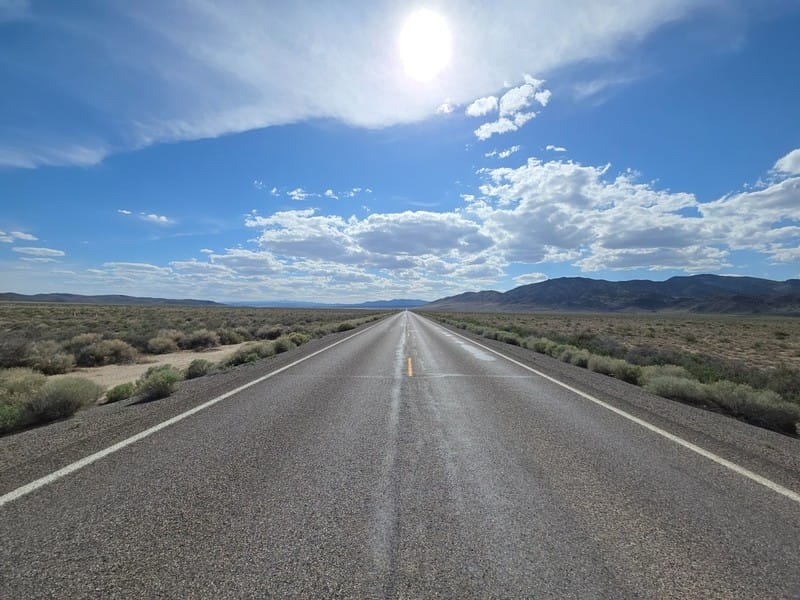
What struck me reading his journals was a moment where he sat down on an abandoned highway roadbed, looked at the three generations of road visible from one spot — the 1901 original, the 1926 predecessor, the current 70 mph superhighway — and felt something. He described it as sad, then moved on. That's the ADT in Nevada. It hands you things to think about that don't fit neatly into any category. ⛰️
Wild Horses in the Humboldt
Day 27 through Humboldt National Forest was something else entirely. Iceman saw wild horses throughout the day — in groups, moving across meadows, watching him from hillsides after spotting him and relocating to slightly higher ground. His description of the way they move as a group, the different colors, the way they seem genuinely alive in a way that's different from domesticated horses.
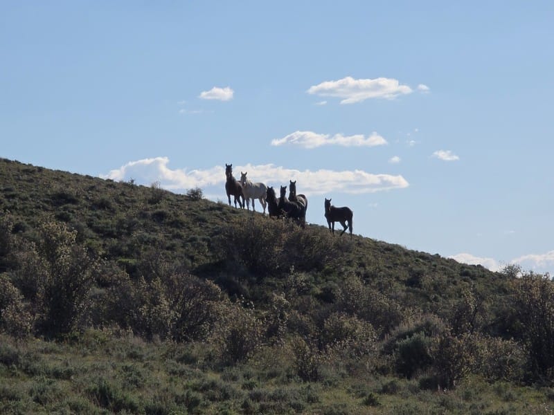
That's part of what I find valuable in following hikers like Tyler in real time. The trail isn't just logistics. The Humboldt section gives you trees, shade, springs, and wild horses. The Newark Valley section gives you exposure, wind, sagebrush, and a water tank with "Nowhere, Nevada" painted on it. Both are the ADT.
What Iceman's Push Tells Us About Pacing
He walked 39.4 miles on Day 28 — a function of a 28-mile stretch between water sources combined with exposed terrain and wind that made early camping untenable. That's not a typical day, and it's not something most hikers plan for. But it's also not uncommon in Nevada for conditions to push your mileage in ways that weren't in the plan... especially in low-snow winter years like 2025-2026.
The hiker who does best in this section isn't necessarily the fastest. It's the one who has read the water situation carefully and has given themselves enough daily flexibility to respond to what the trail actually asks for on a given day.
If you're planning the Nevada section of the ADT, Iceman's recent journals are worth reading in full. He also sent along 53 new Hiker Note waypoints that we are incorporating into our guides and Gaia GPS data for Nevada.
We'll continue sharing field updates from active hikers as they come in. 🌲
Hike Your Hike - John.
Ready to look at what the Nevada section of the ADT actually involves? Our Gaia GPS data for this corridor includes verified water source notes and waypoints built around the realities Iceman is documenting right now.


Black Diamond Memorial Day Sale
