
Hiking America - Iowa
Iowa · Northern Route
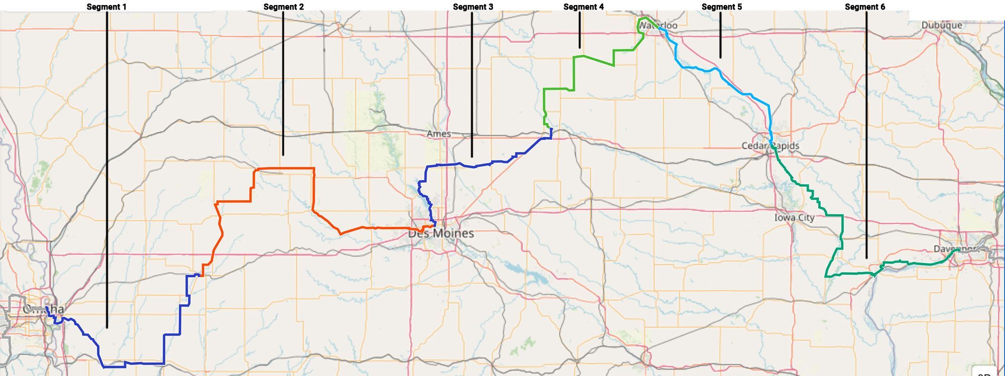
Iowa carries the American Discovery Trail's northern route about 542 miles across the full width of the state, river to river: the Missouri at Council Bluffs to the Mississippi at Davenport. It is the trail's rail-trail heartland: converted rail corridors do most of the walking, linking Loess Hills prairie, the Raccoon and Des Moines river valleys, the Cedar Valley, and a long run of small farm towns and river cities.
Six named rail-trails string the crossing together: the Wabash Trace, the Raccoon River Valley Trail, the Neal Smith and High Trestle trails, the Cedar Valley Nature Trail, and the Hoover Nature Trail. Near Cedar Falls the route touches its northernmost point on the entire ADT, and a northern alternate through Perry and Madrid trades the Des Moines metro for the blue-lit High Trestle Trail Bridge over the Des Moines River valley.
Segment Guides
The Missouri River and the Wabash Trace
The western end sits on the Missouri River at Council Bluffs, across from Omaha. The Bob Kerrey Pedestrian Bridge, an S-curved span where a hiker can stand in Iowa and Nebraska at once, carries the route over the river, and the Iowa Riverfront Trail runs it down past Lake Manawa State Park and the Western Historic Trails Center, a National Park Service site marking the Lewis and Clark, Mormon, Oregon, and California trail corridors that converged here. South of the city the route picks up the Wabash Trace Nature Trail, a 63-mile crushed-limestone rail-trail through the Loess Hills, wind-built ridges of fine glacial soil found in this depth only here and along China's Yellow River. The Trace runs a tree-tunneled grade through Mineola, Silver City, and Malvern. East of the Trace, open farm country and county roads carry the route to Atlantic, past Griswold, Lewis, and Cold Spring State Park.
The T-Bone Trail and the Raccoon River Valley Trail
Atlantic anchors the north end of the T-Bone Trail, a rail-trail to Audubon, a county-seat town known for Albert the Bull, a giant concrete Hereford built as a roadside monument. Past Coon Rapids the route joins the Raccoon River Valley Trail near Herndon. At 89 miles, the RRVT is the longest paved loop trail in the nation and a Rails-to-Trails Hall of Fame trail; the ADT rides its eastern side between Herndon and Waukee, through Yale, Redfield, and Adel. The Clive Greenbelt Trail then carries the route into the Des Moines metro along Walnut Creek.
Saylorville Lake and the Neal Smith Trail
The Neal Smith Trail runs north from the Des Moines riverfront along the east bank of Saylorville Lake, a Corps of Engineers reservoir, through Big Creek State Park and its campgrounds. Near Sheldahl the route picks up a stretch of the High Trestle Trail, then the Heart of Iowa Nature Trail, a 32-mile rail-trail through Slater, Cambridge, and Collins. The Iowa Highway 330 Trail closes the segment into Marshalltown, the Marshall County seat on the Iowa River.
The High Trestle Trail Bridge and the Northern Route
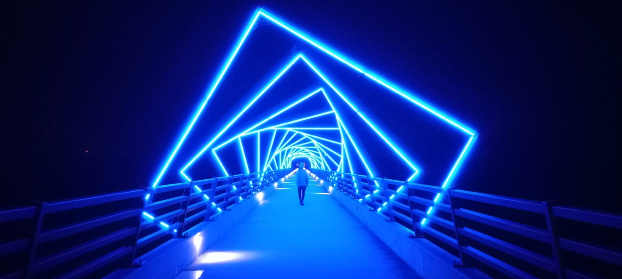
A northern alternate branches off the main route at Herndon, running the Raccoon River Valley Trail's north loop through Dawson and Perry, a rail-trail town whose restored 1913 Hotel Pattee once hosted Louis Armstrong on a 1954 tour. The High Trestle Trail runs east from Perry through Madrid to its centerpiece: the High Trestle Trail Bridge, a half-mile, 13-story crossing of the Des Moines River valley. Forty-one angled steel frames arch over the deck, lit blue at night, staged to evoke a descent through the coal-mine shafts that Italian immigrant families once worked below. The alternate rejoins the Heart of Iowa Nature Trail near Slater, trading the Des Moines metro miles for the river-valley crossing.
Cedar Falls and the Trail's Northernmost Point
Marshalltown sits on the Iowa River at the segment's western end. Eastward, a chain of short rail-trails (the Comet, Pioneer, and Cedar Prairie) crosses Albion, Beaman, and Grundy County. At Hudson and Cedar Falls, home of the University of Northern Iowa, the Cedar Valley Lakes Trail marks the northernmost point on the entire American Discovery Trail, just west of where the route crosses the Cedar River into Waterloo.
The Cedar Valley Nature Trail
The Cedar Valley Nature Trail runs 52 miles between Evansdale, on the edge of Waterloo, and Hiawatha. It was one of Iowa's first rail-to-trail conversions and is part of both the ADT and the Great American Rail-Trail. Built on the old Waterloo, Cedar Falls & Northern interurban line, it traces the Cedar River floodplain (part paved, part crushed limestone) through Gilbertville, La Porte City, Urbana, and Center Point, where a restored depot serves as a trailhead. The McFarlane Bridge carries it over the Cedar River in the wooded middle stretch, a designated Important Bird Area.
Cedar Rapids and the Hoover Nature Trail
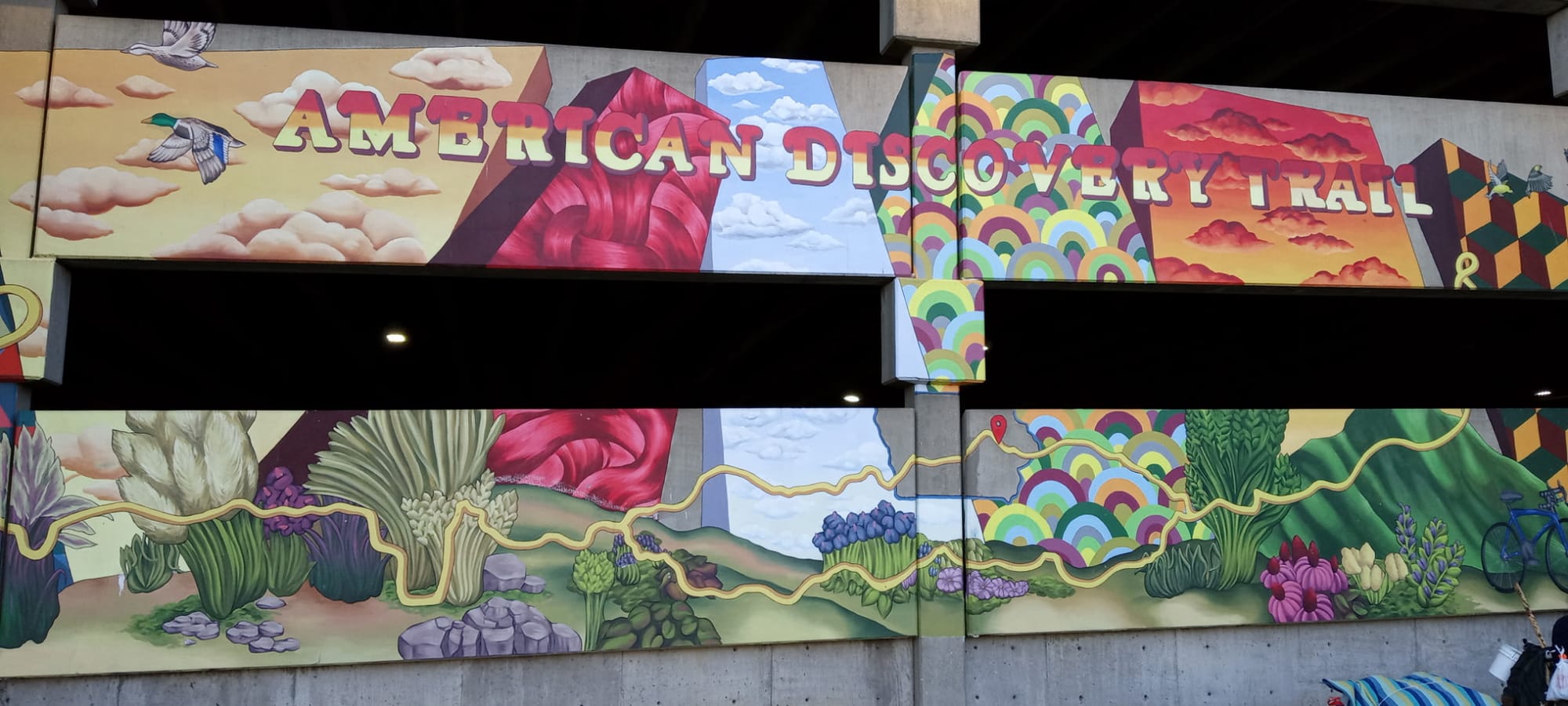
Cedar Rapids, Iowa's second-largest city, sits where the Cedar Valley Nature Trail meets the Cedar River Trail downtown. The route passes the American Discovery Trail Mural, painted in 2019 on a parking structure facing Greene Square, and the NewBo and Czech Village districts on the river's east and west banks. The Quaker Oats mill here, one of the largest cereal plants in the world, scents the whole city with cooking oats, sweetest on the days it runs Cap'n Crunch. South of the city the Hoover Nature Trail carries the route through Ely and Solon toward West Liberty and the farm country of Muscatine County.
Muscatine and the Mississippi River
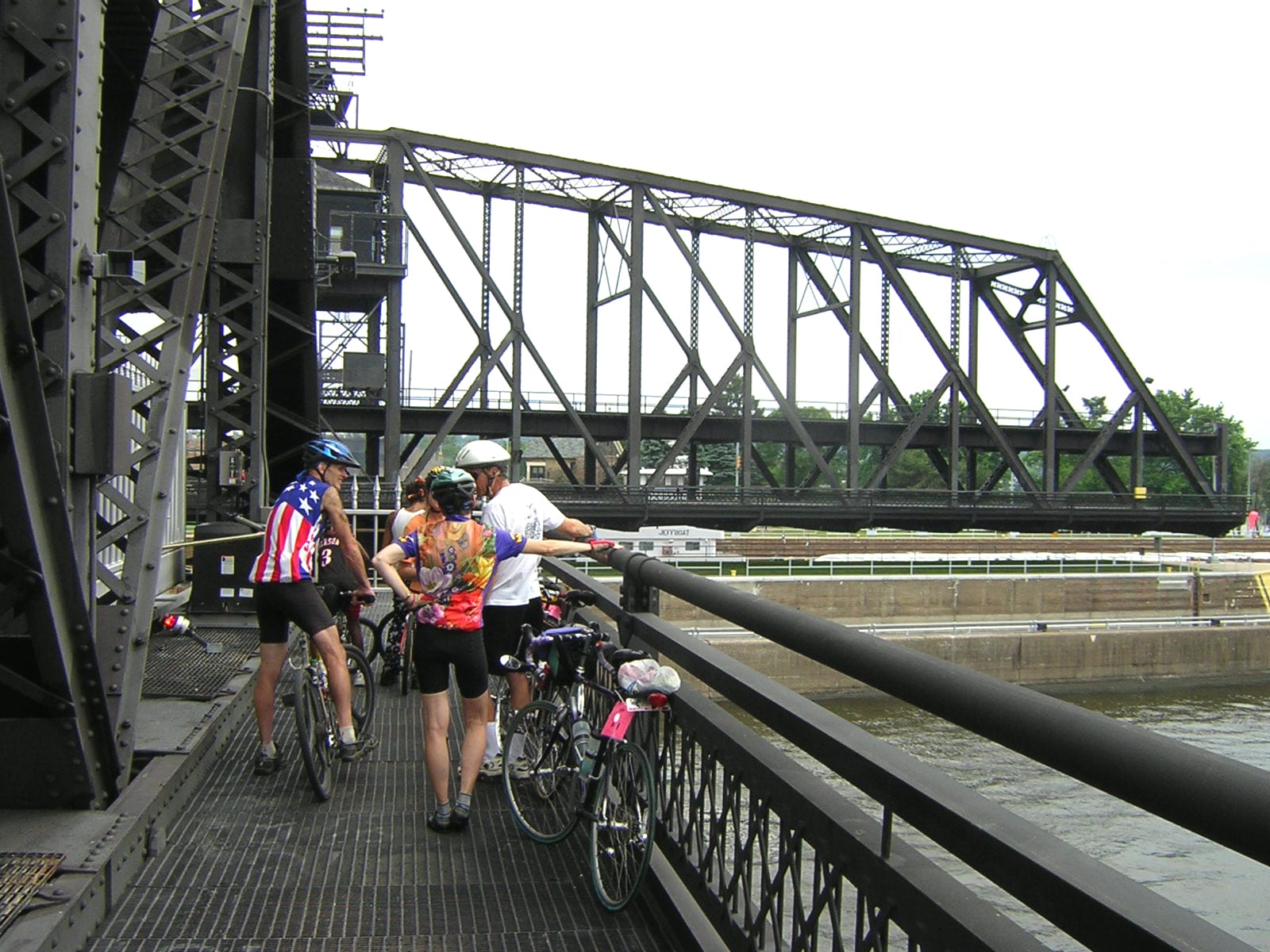
Muscatine, on a broad bend of the Mississippi, was the Pearl Button Capital of the World. Its factories cut more than a billion buttons a year from river-mussel shells at the industry's turn-of-the-century peak, roughly a third of the world's supply. The Running River Trail runs the town's waterfront past the Norbert F. Beckey Bridge. East of Muscatine, Wildcat Den State Park holds the Pine Creek Grist Mill, an 1840s water mill still standing above the creek. The route rejoins the Mississippi through Buffalo and Credit Island into Davenport, ending at the Government Bridge: a double-deck swing span at the site of the first railroad bridge ever built across the Mississippi, and the crossing into Rock Island, Illinois.
Timing and Terrain
The grade is gentle throughout: rail-trails and river-valley bike paths, rarely above two or three percent. That makes Iowa one of the easier states underfoot on the northern route. The cost is exposure: long paved and limestone miles across open farmland, thin shade outside the tree-tunnel stretches, and hot, humid summers with storm risk. Water on the trails themselves is spaced out, and the crushed-limestone sections (parts of the Wabash Trace and the Cedar Valley Nature Trail) turn soft and slow after rain. There is no high country to gate a season; spring and fall are the most comfortable, summer walkable with an early start and enough water.
Water, Resupply, and Camping
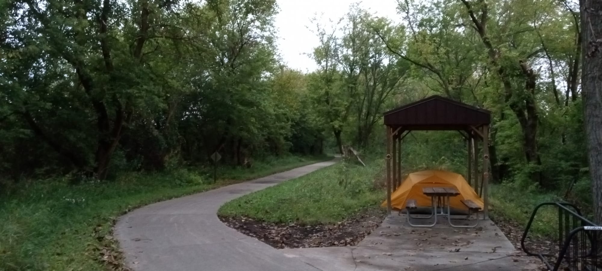
Council Bluffs, Atlantic, the Des Moines metro, Marshalltown, Waterloo–Cedar Falls, Cedar Rapids, Muscatine, and the Quad Cities are full-service, with a steady run of smaller towns and convenience stores between. Camping is the harder problem, as it is across the rail-trail Midwest: little public forest lines the corridors, so nights lean on state parks (Lake Manawa, Big Creek, Wildcat Den), county and city campgrounds, trailhead shelters, and town parks that allow tenting by permission, details that live in the segment guides. Warmshowers hosts are unusually common along the Raccoon River Valley and Cedar Valley trails.
What an Iowa Crossing Looks Like
A rail-trail state, corner to corner: two great rivers as bookends, a half-dozen converted rail lines doing the walking, and the flattest, most forgiving miles on the northern route. A blue-lit bridge thirteen stories over the Des Moines River, a city that smells of Cap'n Crunch, a river town that once buttoned half the world, and the single northernmost point on the whole coast-to-coast trail. 🌽🥾