
How to Break the American Discovery Trail Into Manageable Sections (Without Losing Your Mind)
Last week, Leif Olson completed the entire American Discovery Trail — all 6,800 miles. He joins Bernie Krausse and Brianna DeSanctis in a very small group of hikers who've walked every mile. Most ADT hikers don't do that. Here's how to think about planning the route that's right for you.


Last week, Leif Olson completed the entire American Discovery Trail — all 6,800 miles of it, from one coast to the other over a period of two years. He joins Bernie Krausse, who did the same in 2025, and Briana DeSanctis, who did so a year before that, in a very small group of hikers who have walked every mile of every route the ADT has to offer since 1990.
Most people who hike the ADT don't do that. And honestly, most people don't need to.
The ADT isn't like the Appalachian Trail or the Pacific Crest Trail, where there's one continuous ribbon of trail and a well-worn culture around completing it end-to-end. The ADT is something different entirely — a coast-to-coast route that crosses 15 states, connecting America's back roads, rural highways, small towns, river valleys, and open farmland into a single continuous journey. Large portions of it aren't trail at all in the traditional sense. You're not always deep in the wilderness; you're often Discovering America — passing through communities, walking county roads at sunrise, crossing landscapes most people only see from a car window.

That character shapes how you should think about planning it. And it starts with understanding what you're actually committing to.
Most ADT Hikers Choose One Route, Not Both
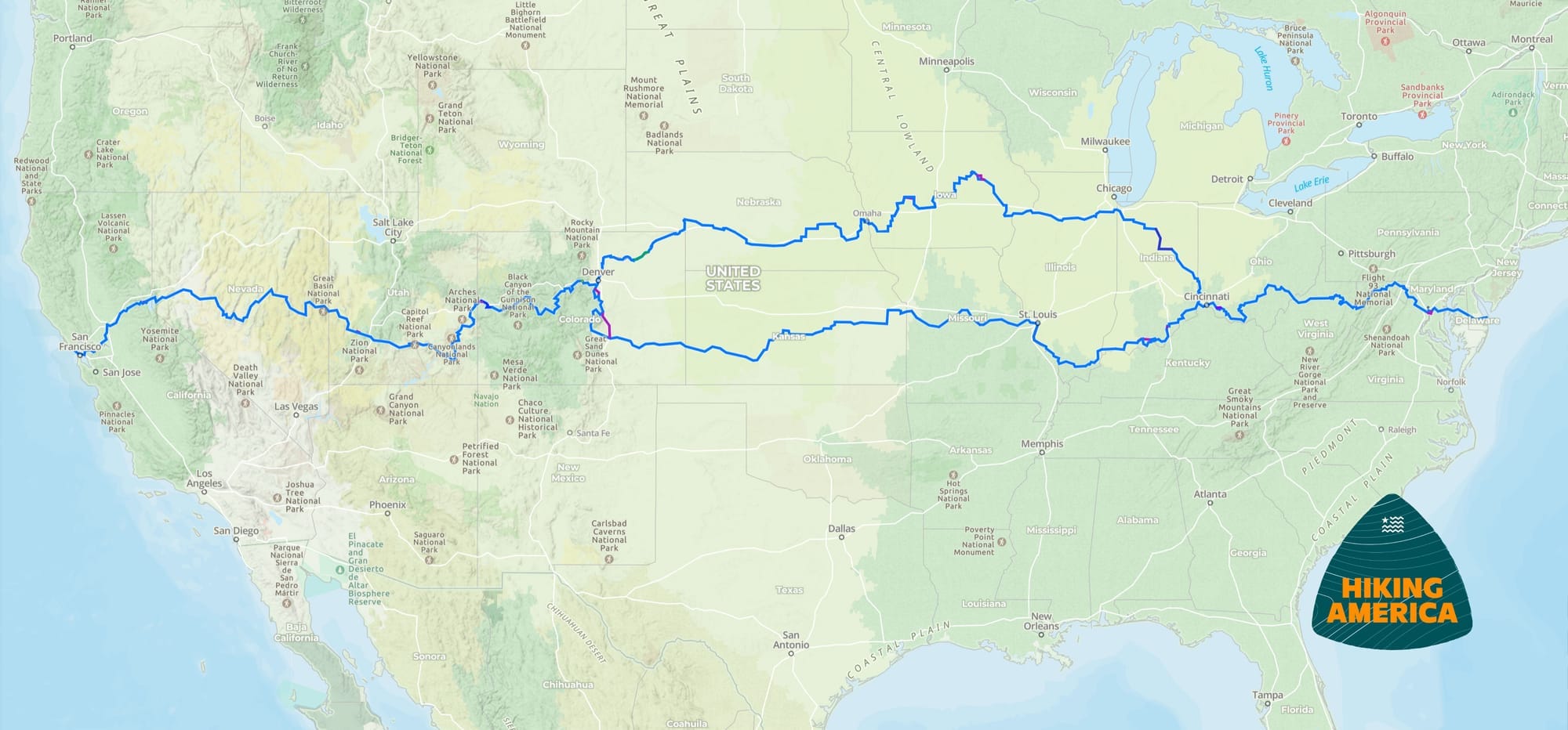
The ADT's 6,800-mile total reflects the trail's split into two distinct routes between Cincinnati and Denver — a northern route and a southern route. Most thru-hikers choose one.
The northern route runs approximately 4,900 miles. It passes just south of Chicago — through Chicago Heights — before moving across the upper Midwest.
The southern route runs just over 5,000 miles. It moves through southern Indiana, southern Illinois, and Missouri before crossing Kansas and entering southern Colorado.
Both routes connect the same two endpoints: Cape Henlopen, Delaware, in the east, and Point Reyes, California, in the west. Both are genuine coast-to-coast journeys. Choosing between them comes down to terrain preference, seasonal timing, and which stretch of middle America calls to you more.
Completing both routes — the full 6,800 miles — is something very few hikers have done. For most hikers, picking one route and committing to it fully is the right call.
Start With the Two Big Decisions
Once you've decided on a route, two more foundational questions shape everything else.
Direction: Eastbound or Westbound?
Either direction works, and the right choice depends on your timeline and the seasons you'll be hiking through. Starting westbound from Delaware in early spring means hitting the desert sections of Utah and Nevada in summer heat. Starting eastbound from California can shift that timing considerably.
The good news: Hiking America's GPS data and turn-by-turn guides are fully dual-directional. You're not locked in — and if conditions demand a mid-hike adjustment, that flexibility is built into your navigation from day one.
Northern or Southern Route?
Make this call early. It shapes a significant portion of your planning — terrain, resupply towns, water sources, and seasonal considerations all differ meaningfully between the two. Research both options, look at the logistics, and pick the one that fits your timeline and interests. Once you've chosen, you can stop thinking about the other one and focus entirely on what's ahead.
Break It Into States, Not Miles
With route and direction settled, the most natural planning framework is by state. Fifteen states give you fifteen distinct planning projects — each with its own terrain, resupply options, water considerations, and timing factors.
That reframe matters. You're not planning a 5,000-mile expedition. You're planning a series of connected state-length journeys that happen to add up to one.
Some states will demand more planning attention than others. Water strategy in Utah and Nevada is a different conversation than water strategy in Ohio. But even the complex states become workable when you're focused on just that one piece at a time.

Anchor Your Sections to Resupply Points
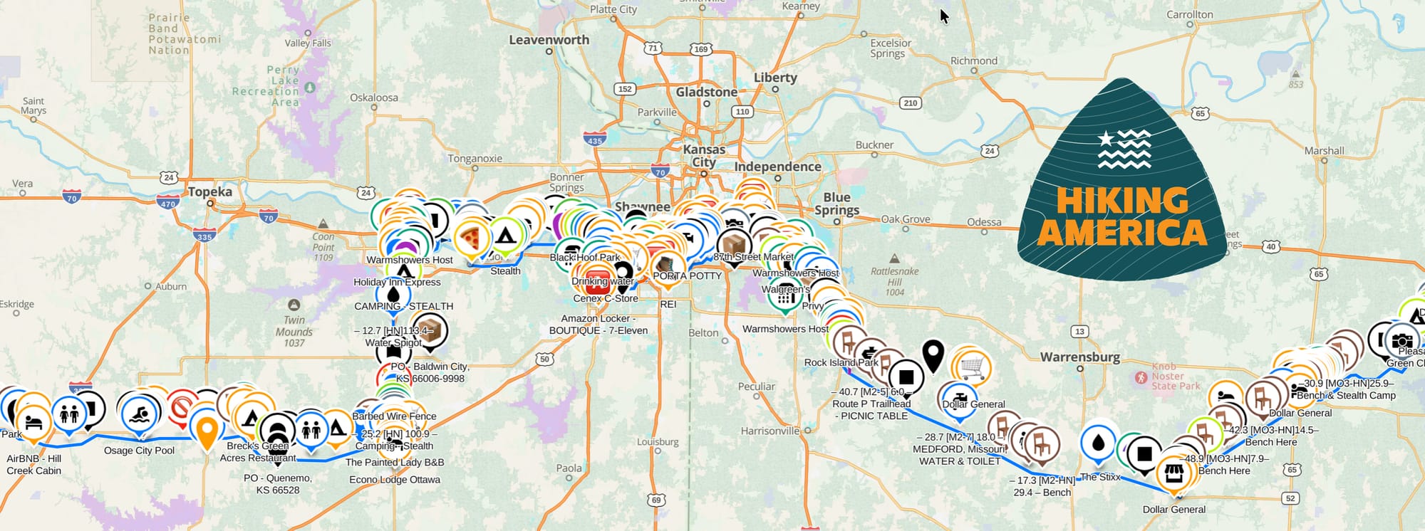
Within each state, your practical planning unit is the resupply stretch — the distance between towns where you can restock food, water, and supplies. On the ADT, that's often more accessible than people expect. Because so much of the trail follows backroads and passes through rural communities, you're frequently closer to a small town or a gas station than you would be on a wilderness trail.
That said, the stretches where services thin out deserve extra attention. Map your resupply anchors early, then build your daily planning around them. This quickly surfaces the sections where you'll need to carry more and plan more carefully — before you're standing at a trailhead realizing you didn't.
Build in Flexibility From the Start
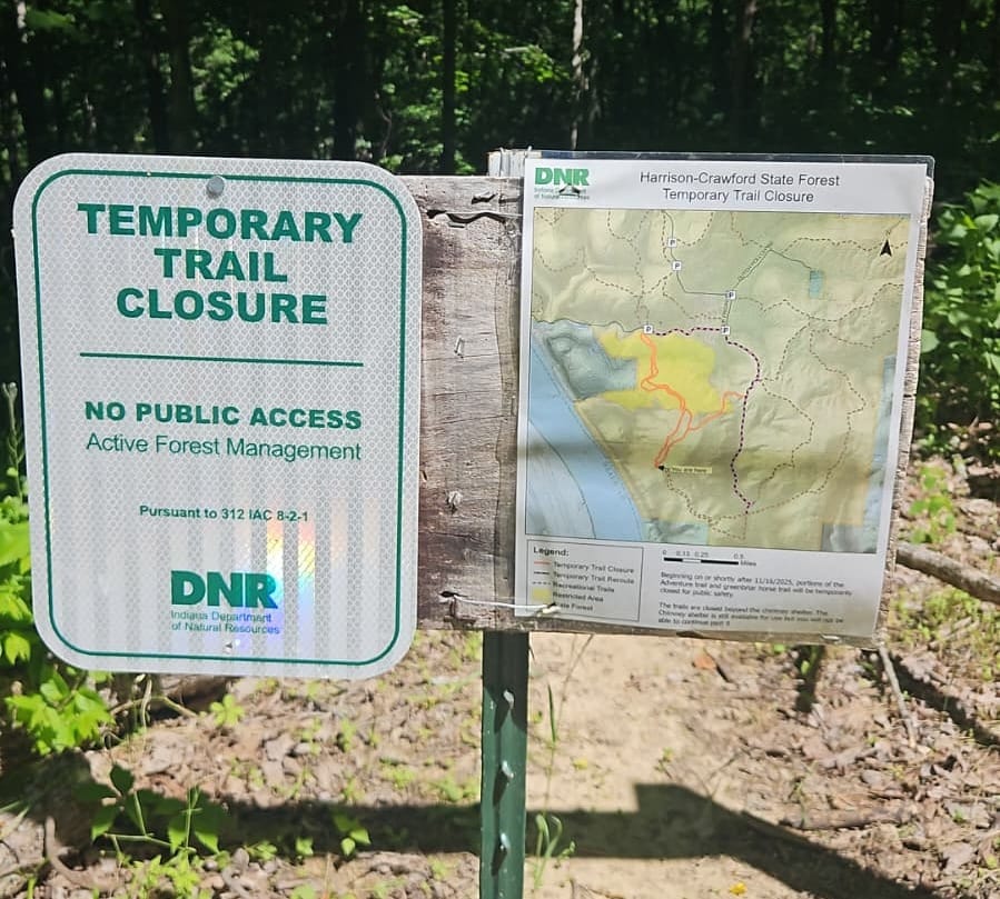
The ADT rewards flexible planners. Weather, road conditions, seasonal closures, and plain old human reality will all reshape your schedule at some point — and on a trail where you're often walking through active agricultural land, small-town America, and varied terrain, unexpected detours are part of the experience rather than exceptions to it.
A durable approach: plan in 2–3 week segments with firm anchor points and flexible daily mileage within them. Leave room for weather days, rest days, and the kind of unplanned conversations and discoveries that make the ADT what it is.
Build in the capacity to adapt. The hikers who finish aren't the ones who never deviate from the plan — they're the ones whose plan had enough give to survive contact with reality.
Use Your GPS Data as a Planning Tool, Not Just a Trail Tool
Before you ever set foot on the ADT, your navigation data is one of the most useful planning resources you have. Open it by state, walk the route section by section, review terrain and waypoint notes, and identify the stretches that need extra preparation. That kind of pre-hike familiarity pays off every day once you're moving.
Hiking America's ADT waypoint data includes 19,000+ curated waypoints — water sources, camping options, resupply points, road crossings, and terrain notes — all organized for eastbound or westbound navigation, color-coded and accessible offline. Spending time with that data before your start date, state by state, is some of the most productive planning time you can log.
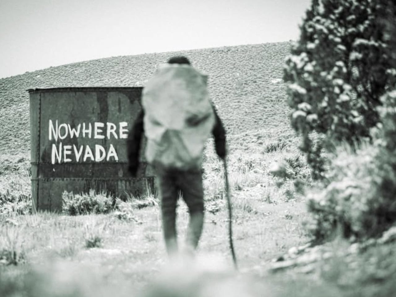


Photos courtesy: Leif Olson, Bernie Krausse, Rhiis Lopez
The Bottom Line
The ADT isn't a trail you conquer by staring at the full map until it starts making sense. It's a trail you plan one section at a time, with enough flexibility to adapt and enough solid navigation to keep moving confidently when things change.
Leif Olson just walked the whole thing. And others have too. All of them put one foot in front of the other, section by section, state by state, backroad by backroad — until they ran out of continent.
You don't have to figure out all 6,800 miles before you start. You just need the next section dialed in. 🥾
Ready to Start Planning Your Route?
A Hiking America subscription gives you access to the complete ADT waypoint library, dual-directional GPS data, and turn-by-turn guides for the full trail — organized so you can plan section by section, in whichever direction works for you.
Subscriptions start at $7/month. Get your navigation sorted and take that first step with confidence.


Hiking America Custom Profile Hang Tag
Recognized by trail angels, hostels, and fellow hikers nationwide!
Get your Custom Hiking America Hiker Tag!
Only $19 for a Limited Time!
Always Free to Hiking America Members.