
Best Time to Start the American Discovery Trail: Where Your 2027 Start Date Puts You Each Month
There's no single best day to start the American Discovery Trail. Your direction and daily miles decide when you meet Colorado's passes, the Great Basin and the Sierra.


TL;DR: The best time to start the American Discovery Trail depends on your direction and your pace. The trail crosses five stretches, and a few of them have hard seasonal windows: snow on Colorado's high passes, heat and long dry miles in the Great Basin, and the Sierra crossing. Hikers who time their start badly hit at least one of those in the wrong month. Mark your start date and your daily miles on a map, and you'll see where you'll be each month before you commit.
Before you settle on a date, check the month it puts you on Argentine Pass, 13,207 feet up in Colorado, where the snow-free season runs from about mid-July to mid-September.
The best day to start the American Discovery Trail comes down to two things: which direction you're walking, and how many miles a day you'll really cover.
Most hikers pick a date around their life, after the school year ends, after the wedding or the day after retirement, and work out the rest later. Of the 20 American Discovery Trail starts on our hiker class pages, 17 left between February and April, and the middle of the pack stepped off around March 11.
The trail crosses five stretches, each with its own season, and your start date and pace decide when you reach each one.
In this post
- How Long Does It Take to Hike the American Discovery Trail?
- The Five Stretches of the American Discovery Trail and Their Seasons
- Why Colorado's High Passes Set the Calendar for Your Whole ADT Hike
- Find Your 2027 Start Date: Mark Your Months on the ADT Map
- What to Plan This Winter for a 2027 ADT Start
- American Discovery Trail Start Date FAQ
How Long Does It Take to Hike the American Discovery Trail?
Nobody can tell you how long the American Discovery Trail takes until you can say how far you'll walk on the fourth day in a row, on pavement, carrying everything. The longest crossing I've followed up close was Briana DeSanctis's. I supported her through Nevada, and she was walking every mile of both routes, all 6,800.
Real ADT crossings have taken anywhere from about seven and a half months to more than two years. Ken and Marcia Powers walked it in 231 days in 2005, with only four zero days (FKT). Briana DeSanctis started on January 1, 2022 and finished in February 2024 (NBC Bay Area).
That's why the "6 to 8 months" you'll see quoted doesn't help much. It assumes a pace, and the pace is yours.
A one-way crossing is about 4,900 miles on the northern route or about 5,000 on the southern. Divide the northern route's 4,900 by the miles you'll actually walk in a day, then add your zero days:
- At 15 miles a day: about 327 walking days, or 11 months.
- At 20 miles a day: about 245 walking days, or 8 months.
- At 25 miles a day: about 196 walking days, or 6½ months.
The southern route adds about 220 miles, or 11 more walking days at 20 a day.
Road walks make high miles easier on some days. Heat, weather, town stops and tired feet take them back on others. I lay out our guide maps at 2 miles a page because 2 miles is about what a hiker with a 40-pound pack averages in an hour. Ten hours on your feet makes a 20-mile day, and most days give an hour or two of that to water, a store, a post office counter or a hot afternoon in the shade.
The Five Stretches of the American Discovery Trail and Their Seasons
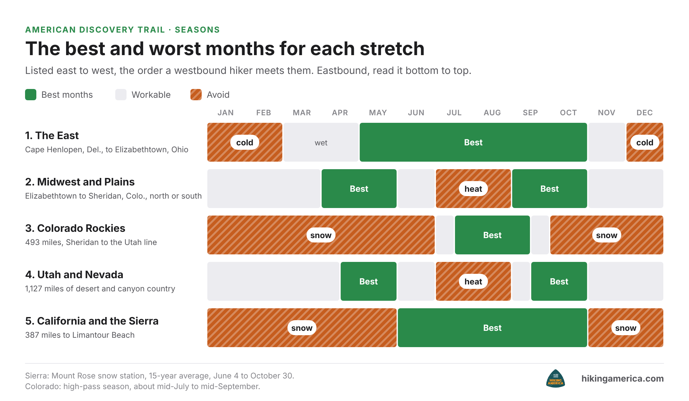
Coast to coast, the ADT crosses five stretches, and each has a season to aim for and a season to avoid. Listed east to west, the order you'd meet them walking westbound:
- The East: the Atlantic coast at Cape Henlopen, Delaware, over the Appalachians to Elizabethtown, Ohio, near Cincinnati. Wet in spring and cold in winter.
- The Midwest and Plains: Elizabethtown to Sheridan, on the south edge of Denver, where the trail runs as two routes, northern and southern. Long open roads in summer sun. One hiker on WhiteBlaze remembered "walking across Kansas under the blistering sun" (WhiteBlaze, 2013).
- The Colorado Rockies: 493 miles from Sheridan to the Utah line, with Argentine Pass at 13,207 feet, the highest point on the trail. A hiker planning a 2010 crossing named them as "difficult to cross in colorado unless in the summer" (WhiteBlaze, 2010).
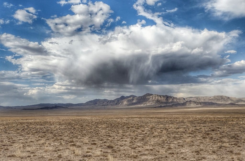
- The Great Basin and canyon country: Utah and Nevada, 1,127 miles together. Long dry miles, where hikers warn about "the shadeless heat and lack of water" (WhiteBlaze, 2013).
- The Sierra and California: 387 miles to the Pacific at Limantour Beach, in Point Reyes, with the last mountain crossing on the way. Snow early in the season, dry creeks late. Rhiis Lopez crossed on bare ground in October 2026 and went 22.2 miles without finding running water: The Sierra is still open. The creeks are dry.
If I could hand every hiker a calendar, it would put them on Colorado's passes between mid-July and mid-September, over the Sierra between early June and the end of October, and across Utah and Nevada in late spring or fall, never July or August. No one start date hits all three. You pick the one you're willing to fight.
Walking eastbound, flip the list. The same five stretches come in reverse order, and the Sierra and Great Basin come first.
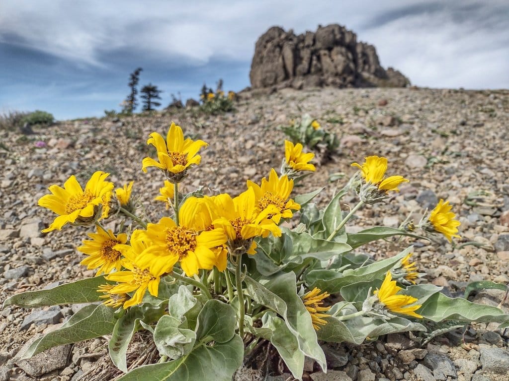
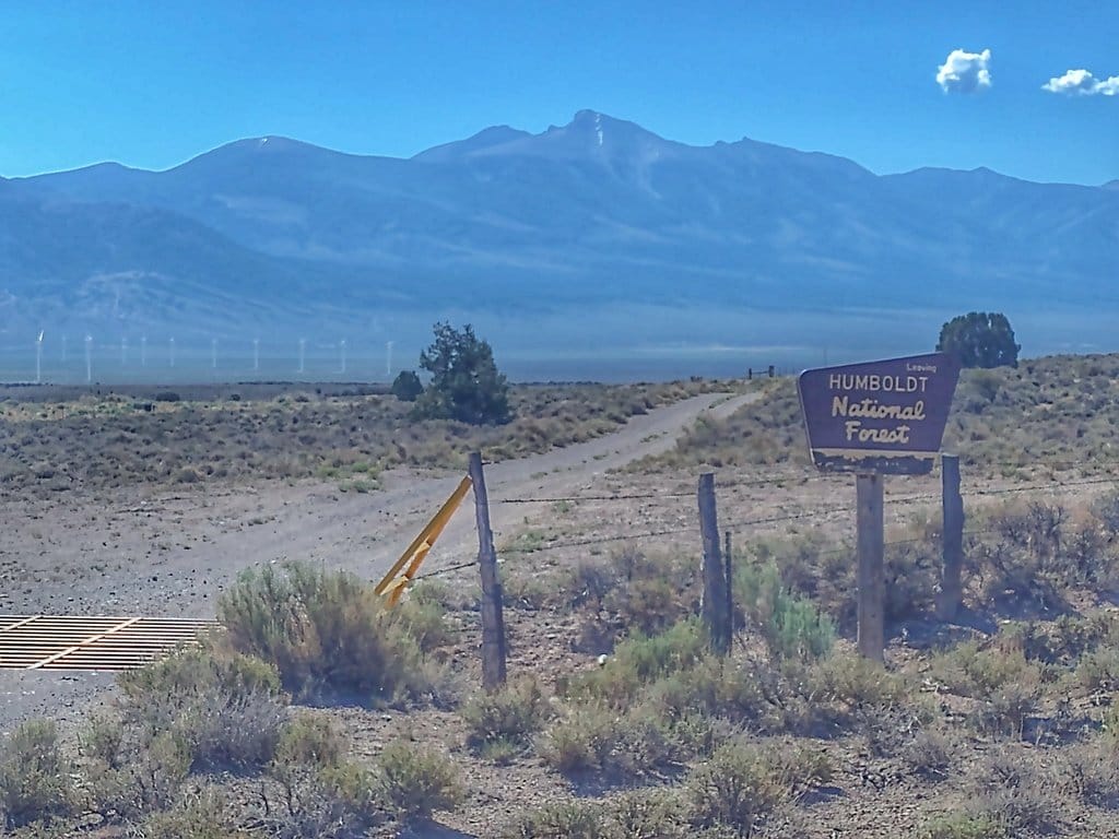
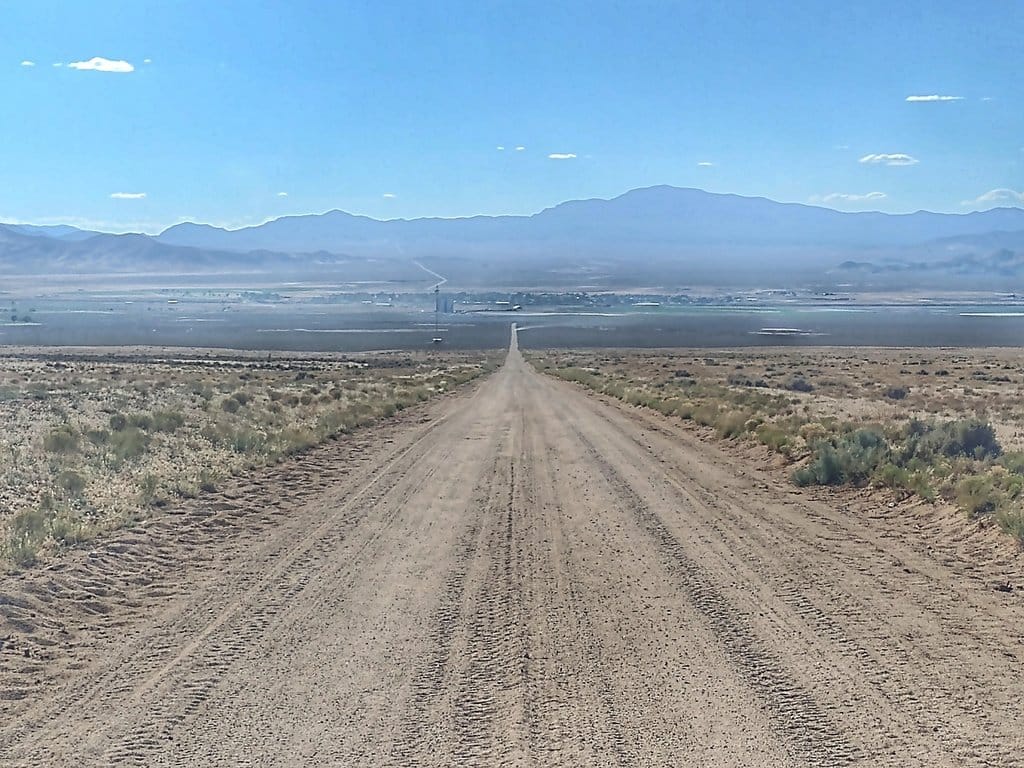
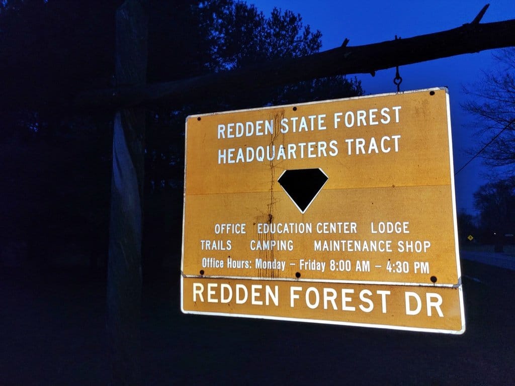
Bernie Krausse's 2022 eastbound crossing: the Sierra in early June, Nevada and Utah in late June and July, Delaware in December. Photos: Bernie Krausse
Why Colorado's High Passes Set the Calendar for Your Whole ADT Hike
Rhiis Lopez and Sara Heitman walked west across Kansas in June 2026 and reached southern Colorado in midsummer, where the heat beat them. They leapfrogged ahead to Denver, and Rhiis walked west over the high passes to Grand Junction, arriving the first week of September, inside the passes' window.

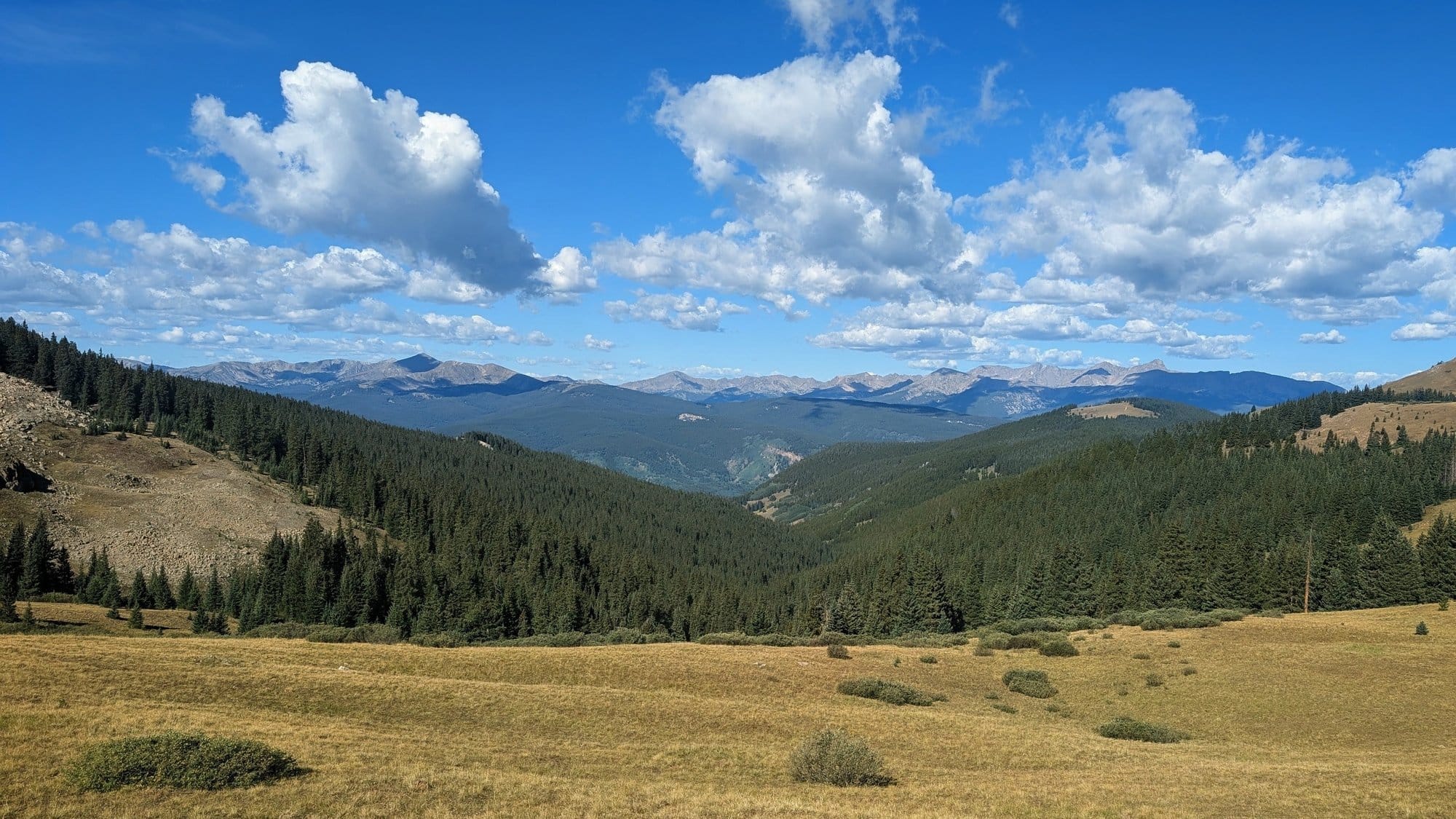
Rocky Ford on the Colorado plains in July, and Kokomo Pass at 11,977 feet in August, 2026. Photos: Rhiis Lopez
Colorado's high passes have the narrowest window on the trail, so they set the calendar for everything else. Arrive too early and you meet snow. Arrive too late and you meet it again on the way out. Every other stretch has a better and worse season, but Colorado is the one where the wrong month can stop you.
So work backward. Start with when you want to be in Colorado, count back the miles to your starting coast at your own pace, and that gives you a start date.
It also shapes direction. One hiker weighing a 2013 crossing wanted to go west to east "to absolutely make sure I get Cali, Nevada, Utah, and Colorado in... before snow" (WhiteBlaze, 2013). Start on the Pacific and the mountains come early. Start on the Atlantic and you need a pace that gets you to Colorado while the passes are open.
One hiker in an American Discovery Trail Facebook group, planning a mid-March westbound start from Delaware, asked how early he could start the Colorado portion without worrying about the weather. His answer was to winter near Gunnison, Colorado, and cross the Rockies once it's warm enough. He expects the whole crossing to take just under two years.
Picking a date that fits your schedule works when the date also fits Colorado. If it doesn't, the rest of the trip pays for it: a rushed Plains crossing, a late arrival in the Rockies, or the Great Basin in the worst of the heat.
Steve Gefell left Cape Henlopen westbound on February 23, 2025, and by August he was in Moab, where he met more than three straight weeks above 100 degrees with no shade. He jumped to Limantour Beach, California, and walked east, timed to reach the same Utah and Nevada deserts after the heat broke.
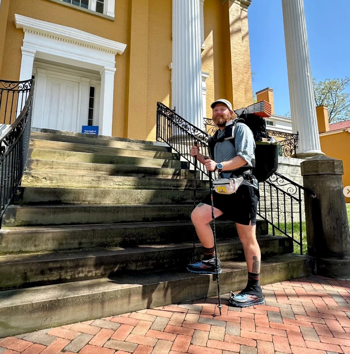
Stephen "SaunterinSteve" Gefell
Westbound - Southern Route with Flipflop at Moab, Utah
Began: February 23, 2025
Finished: November 7, 2025
Support Links: ImHikingAmerica, Instagram, YouTube
Find Your 2027 Start Date: Mark Your Months on the ADT Map
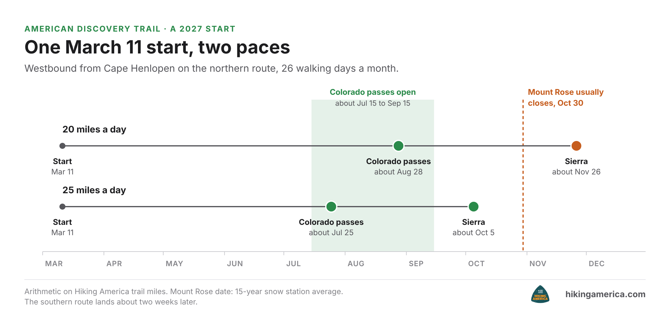
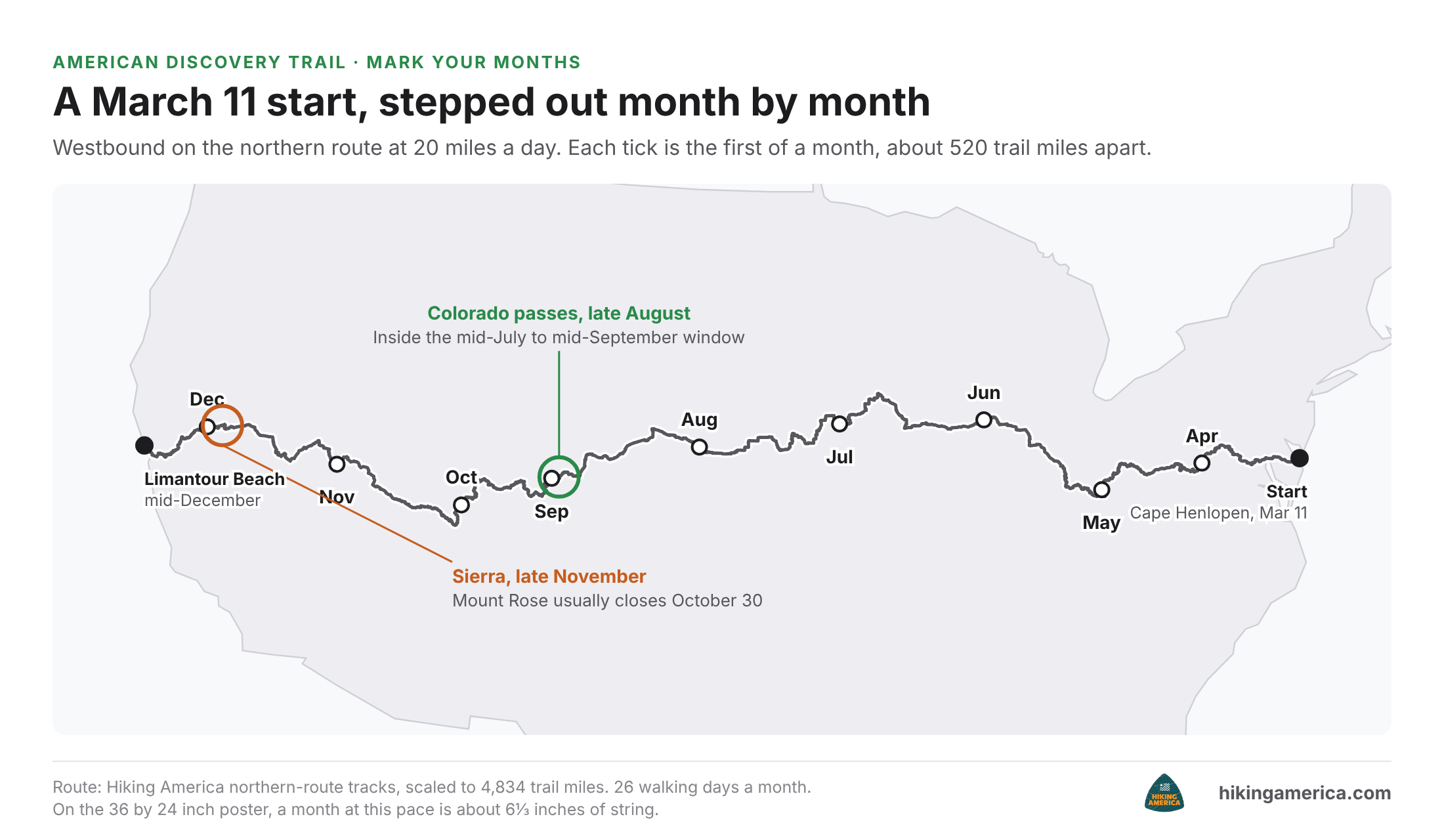
Mark Colorado before you mark a start date. Shade the high passes west of Denver for mid-July through mid-September, and measure every other month against that band. A westbound start on March 11 at 20 miles a day reaches the passes in late August, inside it. Keep stepping and the same start reaches the Sierra in late November, more than three weeks after Mount Rose, at 8,801 feet, usually closes for the season on October 30. At 25 miles a day it reaches the passes in late July and the Sierra in early October.
You can find your own start date in about half an hour with a printed map, a pencil and a piece of string. Mark where you start, work out how far you'll walk in a month, and step those months along the route. When you're done, you'll see which month puts you in Colorado, the Great Basin and the Sierra, and you can slide your start date until those months make sense.
Here's how, using the free coast-to-coast poster map. It's drawn at about 82 miles to the inch.
- Print or open the map, and mark your starting coast and your start date.
- Pick an honest daily pace, then work out a month's distance. Assume about 26 walking days a month to leave room for town days:
- 15 miles a day: about 390 miles a month, or about 4¾ inches on the map.
- 20 miles a day: about 520 miles a month, or about 6⅓ inches.
- 25 miles a day: about 650 miles a month, or about 8 inches.
- Lay a string along the route, since the trail bends and a ruler won't follow it. Measure off one month's length at a time and mark the end of each month with its name.
- Read where your months land. Circle the month you'd reach Colorado's passes, the month you'd cross the Great Basin and the month you'd reach the Sierra.
- Slide your start date a few weeks either way and step it out again until those months look right.
If your plan only works at a pace you've never held, better to learn that now than in Kansas.
What to Plan This Winter for a 2027 ADT Start
Garrison, Utah sits at the head of 91 dry miles, with a post office that takes USPS only and nothing for sale. The food for that stretch is a box you mail weeks ahead, which means a list, an address and a ship date settled long before spring.
Once your months are on the map, make these moves this winter, in order:
- Choose your direction and route. Eastbound or westbound decides which mountains come first. Northern or southern between Cincinnati and Denver changes the miles, the towns and the water. Compare the two routes on the free state guides
- Set your Colorado month and lock your start date. Work back from the passes at your own pace, then add a week or two of cushion for weather and rest.
- Test your pace. A few long walks this winter, on pavement as well as trail, will tell you whether 15, 20 or 25 miles a day is honest.
- Circle your hard stretches. Note the months you'll be in the Great Basin and the Sierra, and start planning water and resupply for those first.
- Plan one stretch at a time. Start with whichever one your calendar makes hardest.
Every spring I hear from hikers who found this kind of planning help only after they'd started walking, usually because another hiker mentioned it. Most of them say the same thing: they had no idea it existed. You're reading this with a winter still ahead of you.
Start with the map. The coast-to-coast poster map is free with a free Hiking America account. It shows the whole route on one sheet, either 36 by 24 inches or a 36 by 14 inch strip for a long wall, and it's the one to pencil your months on: Get the free ADT poster map
When you're ready to turn those months into a plan, the free six-part ADT planning course walks you through it in order: picking your route, planning around resupply towns, handling mail in the western desert, timing the seasons, staying flexible when conditions change, and getting from plan to trailhead. One lesson arrives by email at a time.
Free Email Course · Six Parts
The first lesson arrives the moment you sign up, with the free Delaware turn-by-turn guide and its live Gaia GPS folder.
Unsubscribe whenever you like. What the six cover
American Discovery Trail Start Date FAQ
Can you start the American Discovery Trail in winter?
Yes. Some hikers have started on January 1, including Briana DeSanctis, who began her crossing on New Year's Day 2022. A winter start means cold-weather gear and shorter days early on, and it puts you through the Plains and toward Colorado earlier in the year. Step it out on the map before you commit.
Does your direction change the best time to start the ADT?
Yes. Westbound, you meet the East and the Plains first and reach Colorado, the Great Basin and the Sierra later in the year. Eastbound, the mountains and desert come first. The same five stretches are there either way, so the right start date depends on which end you begin at.
How many miles a day do ADT hikers walk?
It varies a lot, because road walks allow longer days while heat and town stops slow you down. At 20 miles a day, a one-way crossing takes about eight months of walking before zero days. Pick a pace you've held for several days in a row on pavement.
What if I'm slower than I planned?
Re-step your months on the map from where you are. If the new math puts you in Colorado too late, you can push the pace, skip ahead and come back, or flip direction for the mountains. Building a week or two of cushion into your start date makes this far less stressful.
What's the first step to choosing a 2027 start date?
Decide your direction, then pick the month you want to be in Colorado. Count back the miles to your starting coast at an honest daily pace, and you have a start date. Penciling it onto the free poster map takes about half an hour and shows you every month at once.
Keep reading
- What Your GPS Track Won't Tell You on the American Discovery Trail
- Rhiis Lopez Ends His American Discovery Trail Season in Ione