
Western Colorado on the American Discovery Trail
Colorado · Shared Route
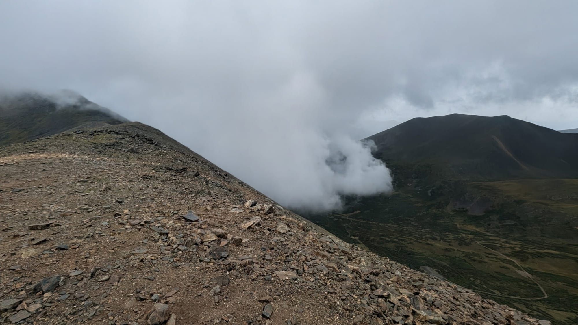
Colorado West is the 493.0 miles both branches of the American Discovery Trail share, between the Utah line at Rabbit Valley and Sheridan on the south edge of Denver, where the northern and southern routes divide. The low ground is about 4,450 feet on the Colorado River at Grand Junction. The high ground is Argentine Pass at 13,207 feet, the highest point on the trail anywhere in the country.
Four segments cover redrock canyon, the largest flat-top mountain in the world, two Continental Divide crossings above 12,600 feet, and a paved creek path into metro Denver. Colorado National Monument, Grand Mesa, Marble, Crested Butte, Lake Ann Pass, Leadville, Camp Hale, Georgetown, and Red Rocks all sit on these miles.
Segment Guides
Rabbit Valley and Colorado National Monument
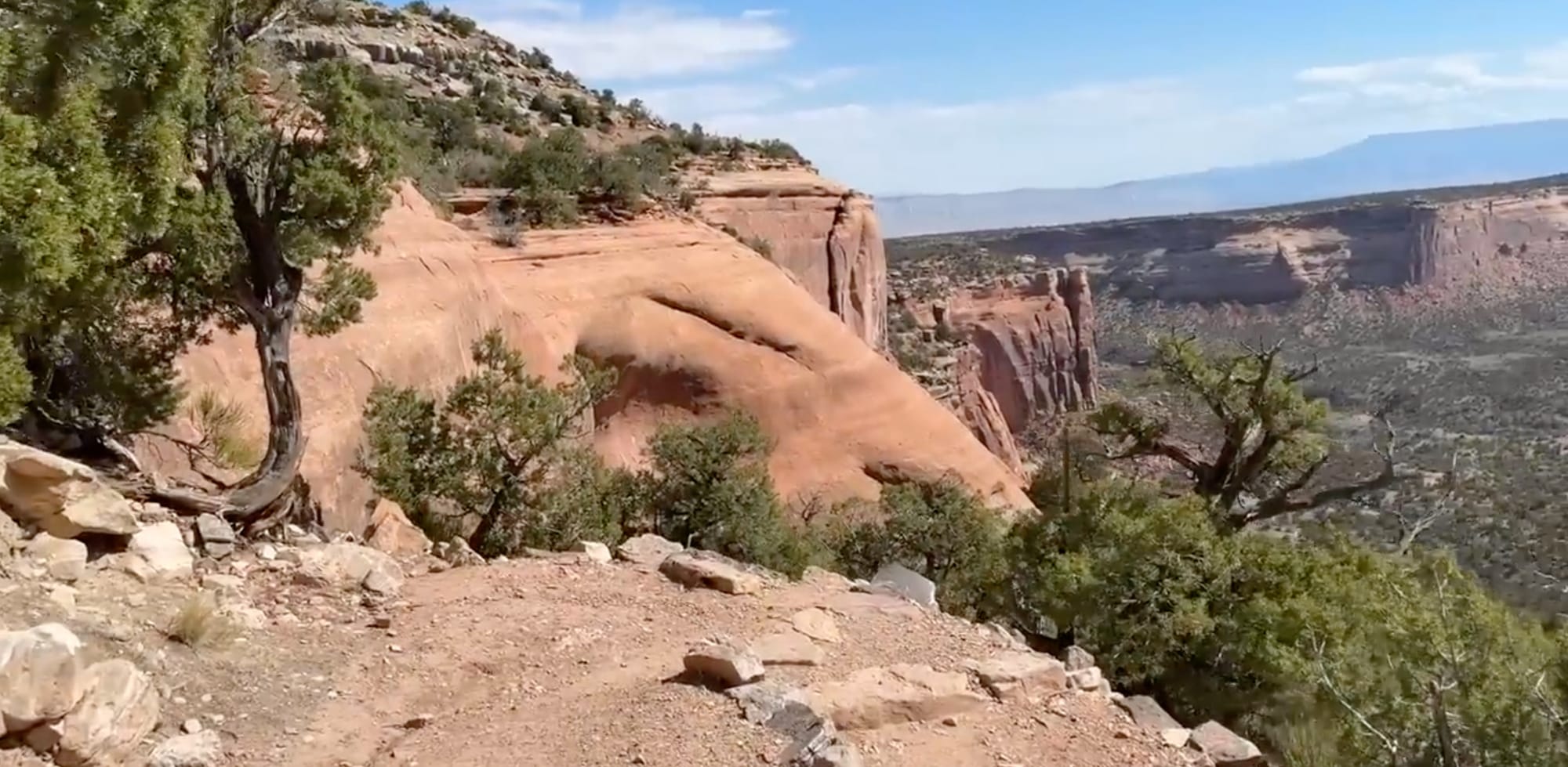
The western end of Segment 1 is a junction of the Kokopelli Trail in Rabbit Valley at 4,817 feet, where Utah Segment 6 ends and Colorado begins. The Kokopelli holds the route for the first several miles through slickrock and juniper, with dispersed campsites and pit toilets at Castle Rocks, Jouflas, and the McDonald Creek trailhead. Fruita has full services. South of Fruita the route is inside Colorado National Monument, on the Monument Canyon Trail beneath Independence Monument, the Coke Ovens, Kissing Couple, and Grand View Spire, and on Rim Rock Drive and the Black Ridge Trail above them. Independence Monument rises 450 feet off the canyon floor; park founder John Otto soloed it in 1911, and climbers still raise a flag on its summit every Fourth of July. The Monument charges a $10 entrance fee for hikers and requires a backcountry permit for camping. James M. Robb Colorado River State Park at Connected Lakes charges $4 and has 13 tent sites by mandatory reservation.

Grand Mesa
Segment 2 covers close to 6,000 feet of relief between Whitewater in the Grand Valley and the top of Grand Mesa, all of it on Lands End Road. Grand Mesa is the largest flat-top mountain in the world, roughly 500 square miles with more than 300 lakes on top. Crag Crest is the marquee 2 miles, an 11,159-foot spine with drop-offs on both sides and a view that reaches the Book Cliffs, the Elk Range, the La Sals in Utah, and the San Juans more than 100 miles south. Snowdrifts can hold on the crest into early July. Grand Mesa Lodge on CO 65 has cabins, a restaurant, and enough shelf stock to count. East of the lodge the route is forest road across the plateau past Trickle Park, Trio, Cherry Lane, Calumet, Chipmunk, and Colby Horse Park reservoirs. The eastern third of the segment is White River National Forest and the West Divide country down to the Crystal River at Redstone. Little Bear Campground closed for reconstruction in June 2025 and is expected to stay closed through summer 2026.
Marble, Crested Butte, and the Elk Mountains
Redstone and Marble bracket the western end of Segment 3. Marble sits at 7,990 feet and gave the country its most famous white stone: the Yule quarry 4 miles up the mountain supplied the facade and columns of the Lincoln Memorial and the 56-ton block of the Tomb of the Unknown Soldier, and Yule marble became Colorado's state rock in 2004. The Marble Mill Site is a 25-acre park of ruined marble buildings in the middle of town, and the community runs the campground. South and east of Marble the route crosses the Elk Mountains on Paradise Basin, Slate River Road, and Gunsight Pass Road. Crested Butte sits at the eastern foot of that crossing with full services and a post office on Elk Avenue. Above town the corridor is Brush Creek Road, Taylor Pass, and the Timberline Trail, with the Friends Hut on the ridge, built in memory of 10 people from Aspen and Crested Butte killed in a 1980 midair collision near East Maroon Pass.
Lake Ann Pass
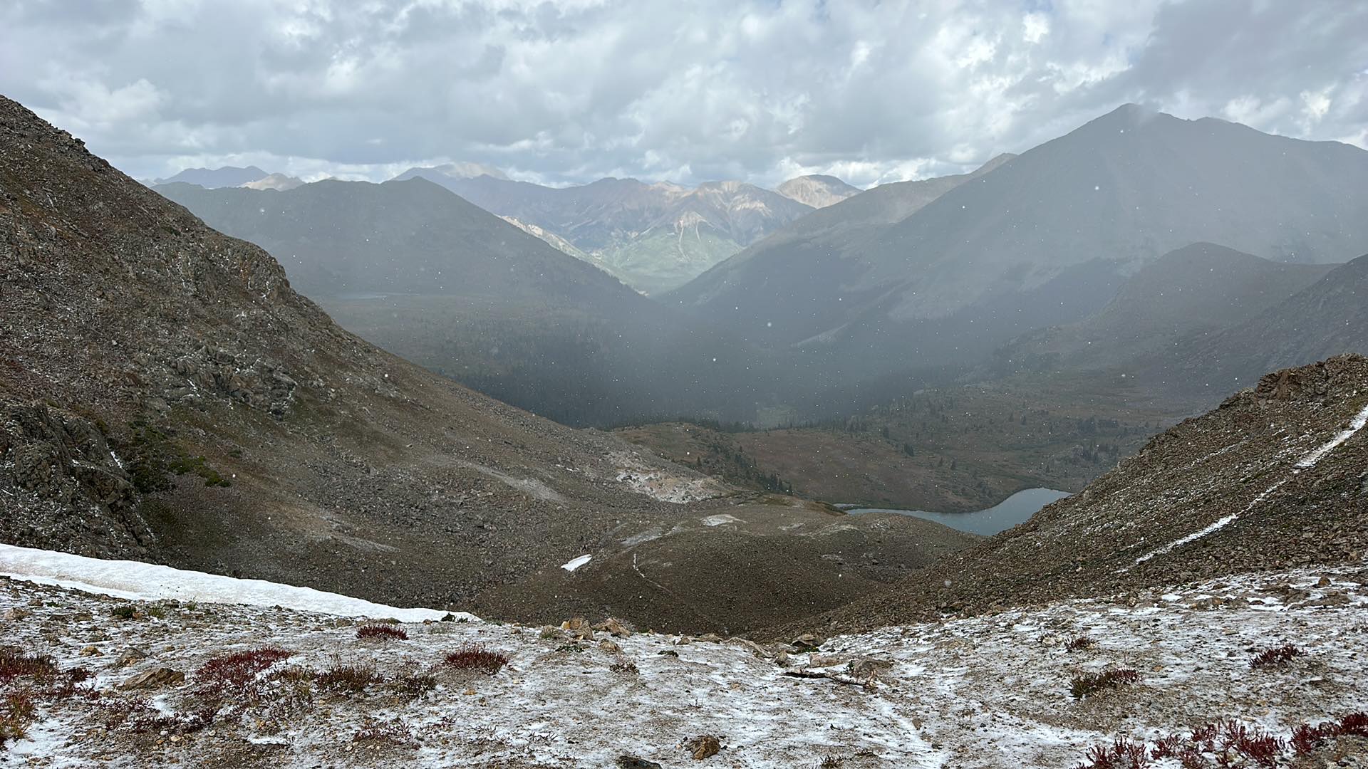
Lake Ann Pass at 12,623 feet is the high point of Segment 3, on the Continental Divide with Granite Mountain to the west and the Three Apostles to the east. Both approaches are steep. The Chaffee County side drops 1,076 feet in 1.2 miles to the ford of South Fork Clear Creek, a 17.4 percent average grade, and the Gunnison side is not much kinder. Springs run near the pass on both sides, confirmed flowing in field reports. The eastern end of the segment is Clear Creek FR 390 at the Winfield mining site, in the Collegiate Peaks Wilderness on the San Isabel side. Wilderness rules apply for camping and fires through this stretch.
The Sawatch, Leadville, and Camp Hale
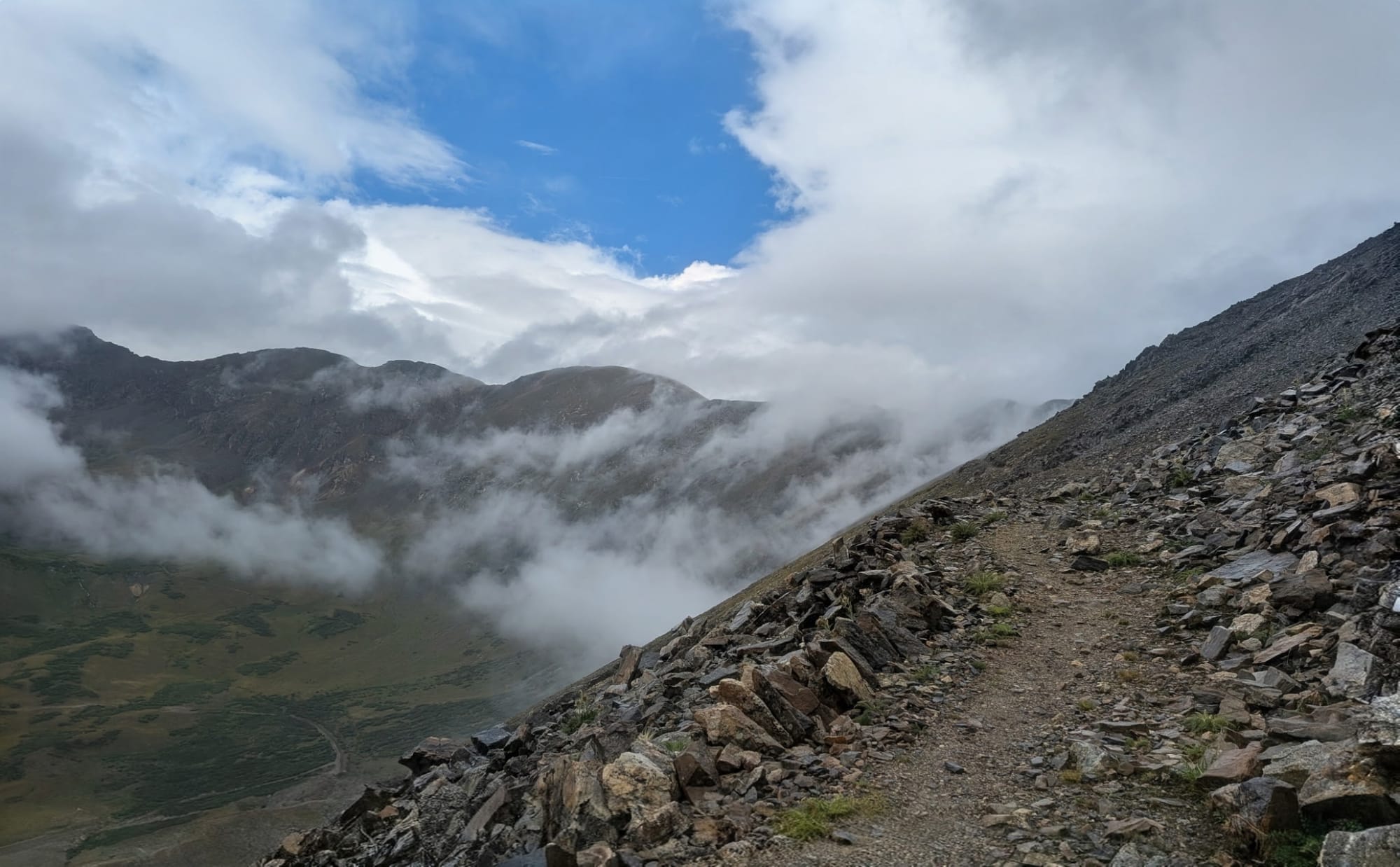
Segment 4 is 217.3 miles and carries the trail's biggest mountains. Twin Lakes has some services 1.5 miles south of the route on an access trail, plus a hostel with a bunkhouse, a small store, and hiker mail drops. North of Twin Lakes the corridor is the Continental Divide Trail and the Colorado Trail under Mount Elbert, at 14,440 feet the highest summit in the Rockies, with the South Elbert trail leaving the route for the top. Leadville is the resupply anchor at 10,152 feet, and a 12.7-mile alternate bypasses it for anyone already carrying enough. The Holy Cross Wilderness and San Isabel National Forest fill the miles north of Leadville. Camp Hale sits at the north end of that stretch, built in 1942 to train the 10th Mountain Division in skiing, climbing, and winter warfare and designated Camp Hale-Continental Divide National Monument in 2022. Copper Mountain, Frisco 4 miles north on Peaks Trail, and Breckenridge 4 miles south on the recreation path are the Summit County options, and free Summit Stage buses connect all three.
Argentine Pass
Argentine Pass sits at 13,207 feet on the Continental Divide southwest of Georgetown, the highest named vehicle-accessible pass in Colorado and the highest point on the American Discovery Trail. Silver was first struck in quantity nearby on McClellan Mountain in 1864, and by 1875 the wagon road over the pass was the highest in the state. The Summit County side is a narrow foot and bike track through Horseshoe Basin; the Georgetown side is a rough four-wheel-drive road. The eastern approach climbs 741 feet in 0.8 miles at a 16.7 percent average grade. Nothing on the route is higher, and the weather window here is the shortest on the crossing.
Clear Creek and the Front Range
Montezuma, Silver Plume, Georgetown, and Idaho Springs hold the eastern slope. Georgetown and Idaho Springs both have full services. East of Idaho Springs the route is Arapaho National Forest and Jefferson County open space: Saxon Mountain, Mount Falcon Park, and the Bear Creek corridor, with Red Rocks Park and Amphitheatre 1.4 miles off-route from Morrison. Morrison has a post office that accepts general delivery with advance notice. The eastern 13 miles are paved and gravel path through Bear Creek Lake Park and Lakewood to the segment's east end at 5,279 feet, the junction of Bear Creek Trail, the Platte River Trail, and the Mary Carter Greenway in Sheridan. Colorado North Segment 1 and Colorado South Segment 1 both start at that junction.
Alternates
The guide carries nine alternates across the four segments. The Riverfront Trail and Monument View option in Segment 1 runs between Fruita and Grand Junction and is 8.5 miles shorter than the mapped route, skipping Colorado National Monument. The Mount Massive alternate in Segment 4 stays on the CDT and Colorado Trail for 12.7 miles instead of dropping into Leadville. A Middle Fork Swan Road bail-out gets off the ridge fast in bad weather and cuts 4.9 miles, at the cost of Whale Peak, Glacier Peak, and the triple point where the ADT, CDT, and Colorado Trail meet. The C4 Peaks alternate follows the Continental Divide for 9.7 miles and tags seven summits, five above 13,000 feet, and it crosses ground flagged as dangerous for cornices. The rest are shorter: a Montezuma shortcut, the Clear Creek Greenway, Mount Pence, Kittredge, and a Twin Lakes option. All are in the turn-by-turn with full waypoints in the GPS data.
Timing and Terrain
Snow sets the window. Lake Ann Pass, Argentine Pass, Crag Crest, and the Divide miles in Segment 4 hold drifts into July in most years and start collecting again in September, which leaves a working season of roughly mid-July through mid-September for the high country. Afternoon thunderstorms build daily over the Divide in summer, and there is a lot of ground on this crossing above treeline with no way off it quickly. The desert end is the opposite problem: Rabbit Valley, Fruita, and the Monument run above 100 degrees in July with no shade and no reliable water in the canyons. Spring and fall are the good months at that end. Nothing on Colorado West is a year-round proposition except the paved miles in the Grand Valley and the Bear Creek path into Denver.
Water, Resupply, and Camping
Fruita, Grand Junction, Crested Butte, Leadville, Frisco, Breckenridge, Georgetown, Idaho Springs, Morrison, and Lakewood cover full resupply. Marble, Redstone, Twin Lakes, Copper Mountain, and Silver Plume are partial. The long gap is Segment 2: 85 miles between Grand Mesa and Redstone with nothing in between, and the Grand Mesa Lodge store is the only shelf stock on the plateau. Water is the reverse of most of the trail out here. The mountain segments are thick with springs, creeks, and lakes; the desert end has almost none, and the Colorado River is the water in the Grand Valley.
Camping is mostly easy and mostly public. Grand Mesa, White River, Gunnison, San Isabel, and Arapaho national forests allow dispersed camping along most of the corridor, and our notes carry specific sites with field dates. The exceptions matter: the Collegiate Peaks and Holy Cross wilderness areas have their own rules on distance from water and trail, Colorado National Monument requires a backcountry permit, and the Front Range from Idaho Springs east is county open space and suburb where dispersed camping is not legal. Peru Creek near Argentine Pass is fordable but carries some of the worst mine drainage in the state and is flagged in the guide as do not drink.
What a Colorado West Crossing Looks Like
493.0 miles, four segments, and about 8,750 feet between the lowest ground and the highest. Segment 1 is slickrock, sandstone towers, and a national monument with an entrance fee. Segment 2 is a mile of climbing onto a plateau with 300 lakes and an 85-mile stretch with no resupply. Segments 3 and 4 hold two Continental Divide passes above 12,600 feet, the training ground of the 10th Mountain Division, the highest point on the trail anywhere in the country, and a Front Range descent that finishes on a paved creek path in a Denver suburb. Both branches of the trail use every one of these miles. 🥾⛰️