
Nebraska on the American Discovery Trail

Nebraska · Northern Route
Nebraska carries the American Discovery Trail's northern route 568.3 miles across the full width of the state, from the Colorado line near Julesburg to the Missouri River at Omaha. Nearly all of it sits in the Platte River valley, the corridor that carried the Oregon, California, and Mormon trails, the Pony Express, the first transcontinental railroad, the Lincoln Highway, and now Interstate 80, all stacked into one shallow trench across the plains.
Eight segments cover the state. The western end holds wagon ruts at Windlass Hill and the 30,000-acre reservoir behind Kingsley Dam. The middle is canal country: more than 130 miles on irrigation service roads with public access along their full length. The eastern third runs the MoPac and Oak Creek rail-trails and the city trail networks of Lincoln and Omaha, corridors the ADT shares with the Great American Rail-Trail, and closes on a cable-stayed footbridge over the Missouri.
↓ Download the PDF segment guidesSegment Guides
Ash Hollow and the Oregon Trail
The western end enters Nebraska on US 138 at the Colorado line, twelve miles of high tableland above the South Platte before Big Springs and the junction with US 30. North of Big Springs the route crosses the Oregon Trail itself, a diagonal scar visible on the USGS topo layer in Gaia GPS, then reaches Windlass Hill at the south edge of Ash Hollow State Historical Park. Emigrant wagons came down that 25-degree slope for about 300 feet with their wheels chained to keep from running over the oxen, and at least five rut scars still cut the hillside. Ash Hollow itself was the payoff: ash timber, spring water, and grass after eighteen dry miles between the South and North Platte. The park's 1,000 acres also hold Ash Hollow Cave, occupied on and off for more than 3,000 years, a rock schoolhouse, and a cemetery on the bluff above Lewellen.
Lake McConaughy and Kingsley Dam
Lake McConaughy is Nebraska's largest reservoir, 30,000 surface acres at capacity with 76 miles of white sand shoreline, and the ADT rides its south shore through a string of lodges, corner stores, and beach campgrounds between Lewellen and Martin Bay. Kingsley Dam closes the east end: 162 feet tall, 3.1 miles long, and the second-largest hydraulic-fill dam in the world when it was finished in 1941. Below it sits Lake Ogallala, 320 acres of cold tailwater that draws bald eagles all winter. More than 340 bird species have been recorded around the two lakes, the longest list for any single location in the state.
Canal Country
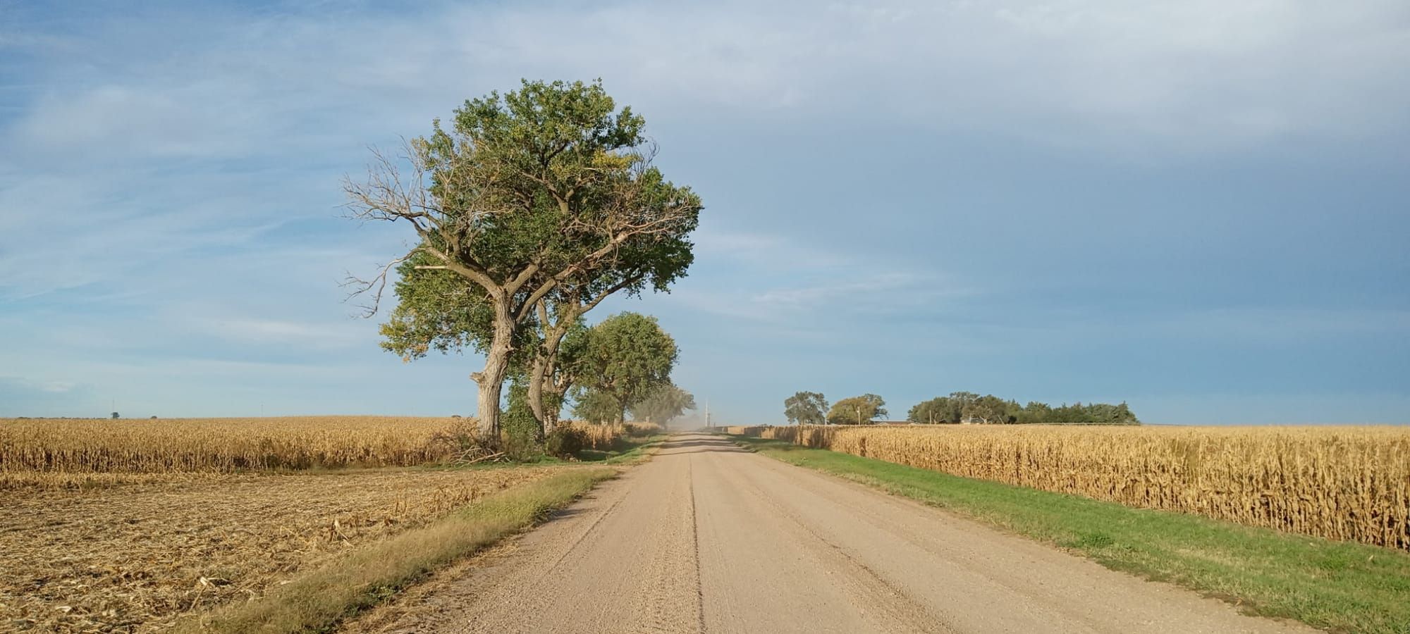
East of the dam the route spends most of two segments on irrigation infrastructure. The Sutherland Canal service road runs a long straight stretch above Ogallala with an 18.5-mile section that has no services on it at all, and past North Platte the Tri-County Supply Canal takes over. That canal runs 75.5 miles along the south side of the Platte valley, forms 26 small lakes on its way, and is open to public recreation along its entire length outside the hydroplant fences. Dispersed camping is legal on the canal banks, which is unusual in a state with almost no public forest, and the segment guides mark the specific stretches. The tradeoff is exposure and monotony: flat gravel service road, irrigation ditch on one side, corn on the other, and no shade for hours at a time.
Fort McPherson and the Great Platte River Road
Between the two canal stretches the route passes the original site of Fort McPherson, built at the mouth of Cottonwood Canyon in 1863 to guard the overland trails and the railroad going in beside them. Custer, Buffalo Bill Cody, and Frank North's Pawnee Scouts all worked out of the post before the army abandoned it in 1880. The 20-acre national cemetery that replaced part of the reservation holds more than 10,000 graves, including remains moved in from 23 abandoned frontier burial grounds, and a Pony Express marker stands on the old trail route that runs through the grounds. Brady, Gothenburg, and Cozad sit north of the canal along US 30 and the Lincoln Highway. Johnson Lake, the largest reservoir on the supply canal, anchors the east end with two campgrounds and the Paul Matson Trail on its west side.
Fort Kearny and the Cranes
Fort Kearny State Historical Park preserves the reconstructed stockade and blacksmith shop of the 1848 post that supplied and policed the Great Platte River Road, and the route runs directly past it. Half a mile east, the Dobytown marker sits on the ghost town that grew up outside the fort's limits to sell the soldiers what the army would not. Between mid-February and early April, something close to a million sandhill cranes stage on the central Platte to fatten up before flying to Canada, Alaska, and Siberia, and the old railroad bridge on the Fort Kearny hike-bike trail is the best over-river roost viewing anywhere on the flyway. Kearney sits 1.3 miles north of the segment junction across the Platte and I-80, with an alternate on the Pioneer's Path Trail for hikers who want to walk in rather than road-walk the highway.
The Dark Island Trail
Aurora, the Hamilton County seat, has a courthouse square, a free campground at Streeter Park, a hardware store, a pharmacy, and a laundromat open around the clock. Northeast of it the route picks up the Dark Island Trail at Marquette, 8.4 miles of crushed limestone and fly ash on the old Republican Valley Railroad grade into Central City. Its centerpiece is a 1,072-foot decked wooden bridge over the Platte, built in the 1880s and rehabbed for foot traffic by volunteers who spent a summer laying deck without pay. The trail takes its name from Lolawakohtito, Dark Island, one of five sacred sites in traditional Pawnee religion, and a sign at the bridge tells the story that attached the name to the place. Hordville, Polk, and Stromsburg follow on county highway, small enough that the post office keeps split hours and the co-op drink machine counts as a resupply. Stromsburg has been the self-declared Swede Capital of Nebraska since Governor Frank Morrison said so at the 1966 Swedish Festival, and its free campground at Buckley Park sits right on the route.
The Oak Creek Trail and the Czech Corridor
Osceola, Shelby, Rising City, and Brainard string east along NE 92 through Polk and Butler counties, Czech and German farm towns with city parks that allow camping and bars that have been in the same family for three generations. At Brainard the route joins the Oak Creek Trail, 13 miles of crushed limestone on a former Union Pacific branch, with a separate natural-surface tread alongside for horses and a bluebird trail paralleling much of it. Loma sits at the halfway point, home to St. Luke's Czech Catholic Shrine, built by immigrant families in 1911, with a restroom just off the trail. The corridor runs oak woodland, native prairie, and open farmland into Valparaiso. The Oak Creek Trail and the MoPac both carry the Great American as well as the ADT, so two sets of trail advocates have an interest in how they hold up.
Lincoln
Lincoln maintains roughly 131 miles of off-road multi-use trail, more than Minneapolis, and the ADT threads a good share of it. The route enters from the northwest through Fallbrook and the Highlands Trail, drops onto the Salt Creek Levee Trail, and runs the Billy Wolff Trail southeast along Antelope Creek past Holmes Lake Park before turning up the 70th Street Trail toward the MoPac. Services are continuous and trailside for most of that distance, which after two hundred miles of county road and canal bank tends to register as a shock rather than a convenience.
The MoPac Trail and the Platte Crossing
The MoPac Trail runs 25 miles east from Lincoln to Wabash on the old Missouri Pacific corridor, abandoned in 1984 after a washout near Elmwood and bought for trail use by the Great Plains Trails Network and the Nebraska Trails Foundation. Crushed limestone, benches every few miles, a lean-to shelter, and trailheads with water at Walton, Eagle, and Elmwood. Twelve Atlas F missile silos went into the farmland in a ring around Lincoln in the early 1960s, two of them beside this corridor near Eagle and Elmwood, and all of them were off alert by 1965. Almost nothing shows above ground now. Northeast of Wabash the Lied Platte River Bridge carries the route 1,714 feet across the Platte, a Rock Island Line span reopened to foot and bicycle traffic in 2002. Springfield, the Sarpy County fairgrounds, and a run of new data centers fill the miles between the river and the Omaha suburbs.
Omaha and the Missouri River
The Omaha metro is covered almost entirely on connected paved trail: Wehrspann Lake, Walnut Grove Park, Zorinsky Lake, the West Papio Trail, and the 144th Street Trail past Boys Town, the village Father Edward Flanagan founded in 1917 and a National Historic Landmark. Standing Bear Lake, the Keystone Trail, and Elmwood Park carry the route into midtown, then Happy Hollow Boulevard, Memorial Park, and Farnam Street reach the riverfront at Heartland of America Park and Lewis and Clark Landing. The eastern terminus of the Nebraska crossing is the Bob Kerrey Pedestrian Bridge, 3,000 feet of cable-stayed S-curve over the Missouri and the first pedestrian bridge built to link two states. The state line runs down the middle of the deck.
Timing and Terrain
Elevation falls steadily from about 3,450 feet at the Colorado line to 951 feet at the Missouri, and the grade almost never announces itself. Windlass Hill is the only real pitch on the whole crossing. Prevailing westerlies make an eastbound hiker's day noticeably easier and a westbound hiker's day noticeably longer, and there is very little shade between the canal country and the Oak Creek Trail. Summer brings heat, humidity in the eastern half, and severe thunderstorms with no cover for miles. Late spring and early fall are the comfortable windows. Mid-March through early April adds the crane migration on the central Platte, which is worth planning around even at the cost of colder nights.
Water, Resupply, and Camping
North Platte, Kearney, Grand Island (eight miles off route from Mormon Island), Aurora, Lincoln, and Omaha are full-service. Between them the towns get small fast: a convenience store, a bar, a post office with split hours, sometimes only a drink machine inside a co-op. The long gaps are on the canals, where an 18.5-mile stretch of the Sutherland and several stretches of the Tri-County have no services at all, and water has to be carried or filtered from the canal. Camping is easier here than in most rail-trail states because the canal banks allow dispersed use and small-town parks routinely permit tenting; Buckley Park in Stromsburg, Streeter Park in Aurora, and Osceola's city park are free. State recreation areas at Lake McConaughy, Lake Ogallala, Johnson Lake, Sandy Channel, Fort Kearny, and Mormon Island fill in the rest. Specific sites, hours, and permissions live in the segment guides.
What a Nebraska Crossing Looks Like
Five hundred sixty-eight miles in the same river valley, and the valley keeps changing what it is. Wagon ruts and a 25-degree hill at one end, a cable-stayed footbridge and a city skyline at the other, and in between a reservoir with sand beaches, 130 miles of irrigation ditch, a wooden bridge named for a Pawnee sacred site, a Swedish town square, a Czech shrine at a rail-trail halfway point, and a million cranes on the river in March. The state that gets written off as flat is doing more work than it gets credit for. 🌾🥾