
Nevada on the American Discovery Trail
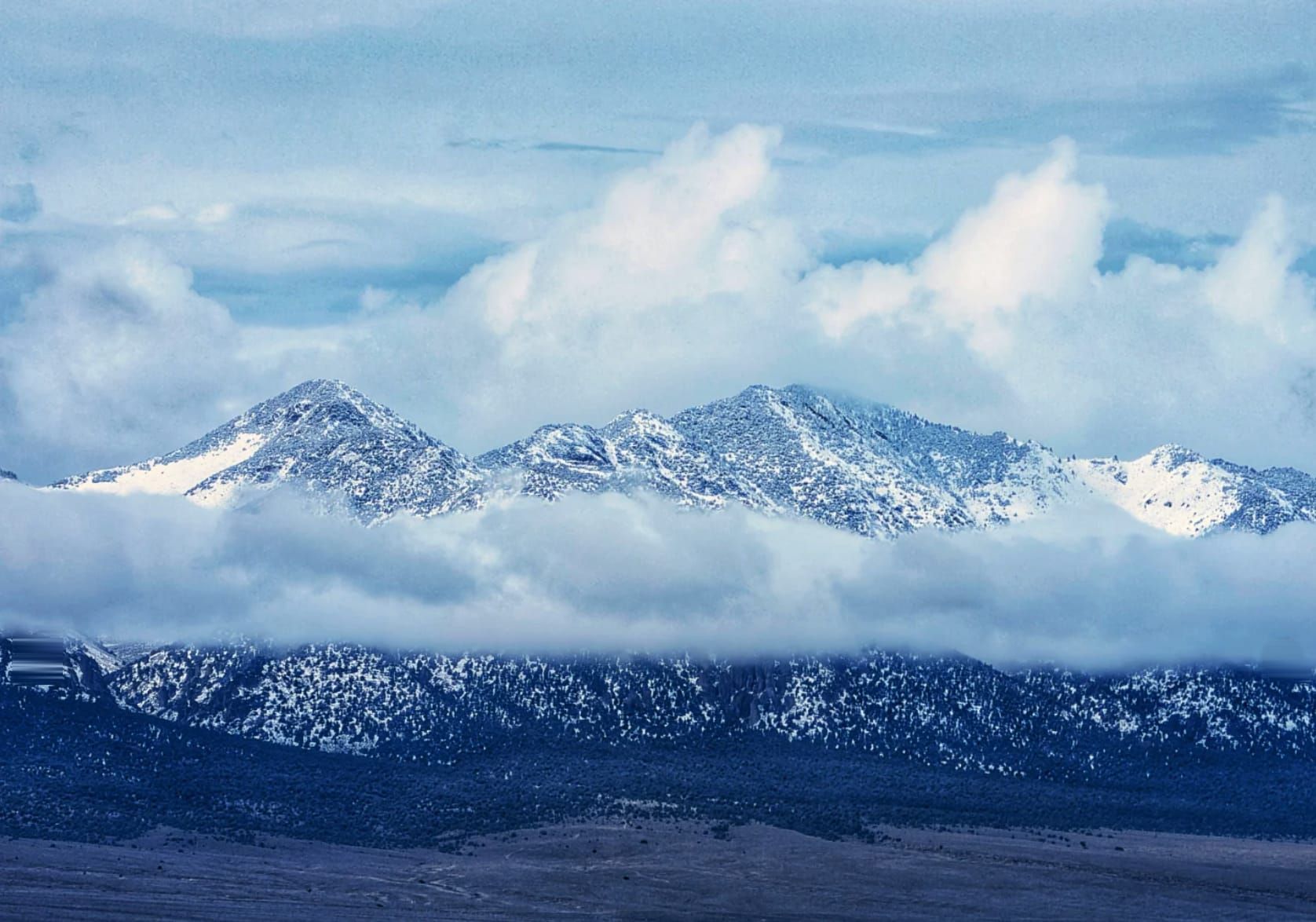
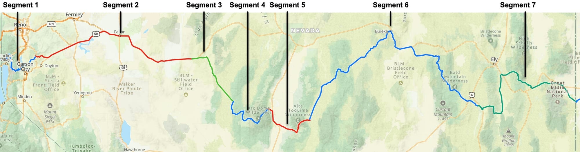
Nevada · The Great Basin
Nevada is 534.8 miles of the American Discovery Trail, between the California line on the Tahoe Rim Trail above Lake Tahoe and the Utah line where NV 487 meets UT 21. Both branches of the trail share every mile. The low ground is 3,919 feet in the basin east of Fallon. The high ground is 11,739 feet on the Mount Jefferson plateau, 7,820 feet above it and 133 trail miles away.
Seven segments cover the Carson Range, the Comstock, the Loneliest Road, the Toiyabe Crest, an alpine plateau John Muir walked in 1878, 165 miles of Monitor Valley and Eureka, a surviving two-track stretch of the Old Lincoln Highway, and the Snake Range at Great Basin National Park. Virginia City, Fallon, Carvers, Eureka, and Baker carry real resupply. Middlegate, Ione, Lund, and Preston are a store and a roof, and sometimes less.
↓ Download the PDF segment guidesSegment Guides
The Carson Range
Segment 1 is 48.4 miles and never drops below 4,900 feet. The California line sits at 9,036 feet on the Tahoe Rim Trail, and the trail holds that elevation across the south-facing slopes of the Mount Rose Wilderness, where most of Lake Tahoe is visible at once. Relay Peak at 10,338 feet is the high ground, and the highest point on the entire 170-mile Tahoe Rim Trail. Bikes are not allowed past the wilderness boundary.
Gray Lake is the dependable water in the western half, spring-fed and reachable by two access trails; nearby Mud Lake earns its name and has gone dry. Ophir Creek runs dependably at the bridge below Tahoe Meadows, and Franktown Creek and McEwen Creek hold water lower down. Between them are a dozen springs and seeps that field reports rate unreliable in most years, and one 12-mile stretch with almost nothing.
Galena Falls and the Mount Rose trailhead draw the heaviest day-use crowds in Nevada. Washoe Lake State Park has a visitor center with water and restrooms, a year-round campground with 49 sites and a shower house, and vault toilets at two lake access points. Carson City is 3.4 miles south of the route at Goni Road, with full services and a bus connection to Reno. Ophir Grade covers about 6 miles of the segment's eastern end, between 7,324 feet and Virginia City at 6,317, winding past Five Mile Reservoir. The Ophir Mining Company built it in 1860 as a toll road to move ore down to the Washoe Valley mills, and the Virginia and Truckee Railroad made it obsolete in 1871.
Virginia City and the Comstock
Virginia City sits on C Street at 6,165 feet and is the junction of Segments 1 and 2. Lodging, restaurants, a post office that takes general delivery, a convenience store, and the county library are all on or within a block of the route. The saloons are the draw and the reason to plan a short day here.
Six Mile Canyon Road holds about 1,500 feet of relief in the 7.4 miles between Mill Street and US 50. A fire station on that stretch has outside faucets that hikers have used since at least 2012, and nothing else on the canyon road carries water.
US 50 and the Loneliest Road
Segment 2 is 99.5 miles, the third longest in Nevada and the flattest ground on the state crossing. Life magazine called Nevada's US 50 the Loneliest Road in America in July 1986 and meant it as an insult; the state adopted the phrase as a slogan within a year and has been signing it that way ever since.
Stagecoach and Silver Springs both put convenience stores, casinos, and a post office on or near the line. Lahontan State Recreation Area covers the reservoir with a marina restroom, drinking water, and a walk-in campground at Blackbird Point. Fallon at 3,986 feet is the biggest resupply between Carson City and Ely, with a supermarket, a big-box store, a sporting goods store, several motels, and a post office a block off the route. Naval Air Station Fallon sits on both sides of the trail east of town; the Navy's strike and air warfare school moved here from Miramar in 1996, and the noise is constant.
Grimes Point Archaeological Area is on the National Register, a field of basalt boulders glazed in desert varnish and covered with pecked petroglyphs, with restrooms, shade shelters, and picnic tables but no water. Sand Springs is a natural seep about 21 miles east of Harmon Junction and 22 miles west of Middlegate, trapped in a rectangular trough, and it is the only reliable source in that 43-mile span. A Pony Express station marker stands nearby, and Sand Mountain rises a mile to the northeast. Fairview at 4,420 feet was a town from 1905 to 1917 with 27 saloons by the count on its historical marker; the bank vault is the only thing left standing, visible from the highway. Middlegate Station at the eastern end has a motel, a restaurant with a full menu, a mini mart, and free camping with fire pits.
Buffalo Canyon and Ione
Segment 3 is 39.1 miles on the Old Lincoln Highway, NV 722, and Buffalo Canyon Road. The Shoe Tree stands on the north side of the road 2.2 miles from Middlegate, hung with cowboy boots, sneakers, and children's shoes for reasons nobody has written down. At the Carroll Summit Road junction the route joins the Pony Express National Historic Trail.
Eastgate Station at 5,126 feet is a large white stone house and a handful of buildings, named for the rock formation above it. Buffalo Creek runs strong through there in spring and carries enough silt to need double filtering; the canyon between Eastgate and the cattle grid is water-filled and inaccessible from the road at the same time. Big Den Creek joins it 1.3 miles upstream and supplies most of that flow. Big Buffalo Well was a dependable trough with a float valve until a 2024 report found it wrecked and dry. Buffalo Summit at 6,844 feet is the Churchill and Lander county line and a proven cache site.
Juniper cover starts about 15 miles from the eastern end and holds most of the way in, which makes camping easy and shade possible. Ione is 0.62 miles east of the segment junction on NV 844, a wild west mining town with no open businesses and a sign at the edge reading "The Town That Refused to Die." The park has a hand pump that has to be switched on and a caretaker who lives in town.
Berlin, Ichthyosaurs, and Grantsville
Segment 4 is 41.7 miles across the Shoshone Mountains and into the Toiyabe Range. Berlin-Ichthyosaur State Park holds the western end at about 6,700 feet. Berlin went up in the 1890s, produced 42,000 troy ounces of gold, and was abandoned by 1911; the state preserves it in what it calls arrested decay, with original buildings standing and some of the original residents in the cemetery. The Fossil House protects the most abundant concentration and the largest known remains of ichthyosaurs anywhere, marine reptiles that swam a warm ocean over central Nevada 225 million years ago. Shonisaurus popularis, named for the range it was found in, is Nevada's state fossil. The fossil beds have been a National Natural Landmark since 1973, and the shelter is open by ranger tour only. The visitor center has a restroom, water, and an apple tree, and a signed drinking water valve at the RV dump station runs treated from roughly May through September and untreated the rest of the year.
Grantsville at 6,861 feet is a second ghost town 4 miles east, several mining buildings still upright, named by Unionists for Ulysses S. Grant. Old mine adits open on the road above it. Grantsville Summit at 7,682 feet has wide flat ground and a view east to Arc Dome. Warner Spring runs cold and clear about a six-minute walk southwest off Trimble Spring Road.
Arc Dome and the Toiyabe Crest
The eastern 18 miles of Segment 4 run through the Arc Dome Wilderness on the Reese River Trail and the Toiyabe Crest Trail, and this is the most technical ground in Nevada. The route fords the Reese River repeatedly. The 5.1 miles between waypoints NV4-23 and NV4-27 turn into the riverbed itself in a heavy snow year or after several days of rain, deep and fast enough to be impassable, and there is no gauge anywhere on the Reese River to check before committing. Hikers who have hit it wrong describe bushwhacking, canyoneering, and rock scrambling on 30 to 40 degree slopes to get through. A large rockslide near the eastern end has wiped out the tread entirely; the options are wading about 100 yards of river or climbing an unstable boulder and scree field.
Toiyabe Crest at 9,249 feet is the segment high point. Below it on the east side, the trail crosses the South Twin River at least a dozen times between the crest and the trailhead, thigh-deep in spring. Arc Dome itself is a side trip on Trail 24020, faint where it leaves the crest. Willows along the creek have been reported loaded with ticks, and beaver dams have submerged the tread in 4 feet of water more than once. Big Sawmill Creek is fairly reliable; Little Sawmill Creek is not.
Big Smoky Valley and Mount Jefferson
Segment 5 is 39.1 miles and holds 6,021 feet of relief between Carvers and the Mount Jefferson plateau. Carvers sits at about 5,640 feet on NV 376 with two motels under one owner, a convenience store with a deli, an RV park laundromat open to anyone, and the Big Smoky Rest Area, where Nevada administrative code allows an 18-hour stay. Round Mountain's post office is 1.7 miles southwest of the line.
Jefferson Canyon Road carries the route through the Toquima Range, and the stream runs in the roadbed for long stretches; a ridge road to the south parallels it when the water is high. There are at least a dozen ankle-deep crossings in the canyon. The historic Jefferson site at 7,461 feet was a silver town of the late 1800s, and the ruins include a two-seat outhouse.
Above 10,000 feet the route enters the Alta Toquima Wilderness, 35,860 acres designated in 1989 and one of the highest wilderness areas in the Great Basin. John Muir walked the heights of Mount Jefferson in 1878 and traced the work of Ice Age glaciers on the landscape. The trail tops out at 11,739 feet on the plateau; Mount Jefferson's South Summit at 11,949 feet is northwest of that, up a boulder field, and it is the highest ground in the Toquima Range. Cairns are the navigation above treeline and they disappear in places. Windy Pass at 10,998 feet has flat ground and lives up to its name. A northeast-facing bowl below the pass holds hard snow late and is dangerous on a cold or cloudy morning before the sun softens it. Between Flowers Camp and Pine Creek Campground there are 18 creek crossings, some shin-deep, some with logs, some running down the trail.
Monitor Valley and Eureka
Segment 6 is 165.9 miles, the longest segment on the Nevada crossing by 65 miles. Monitor Valley Road holds the western 25 miles at about 6,900 feet. Diana's Punchbowl is a hot spring in a deep pit a mile southwest of the road, on ranch land. Potts Ranch pipes warm, clear water into a tub on the line, with hot springs half a mile south; the ground is private, camping is not allowed, and the etiquette is to drain the tub when you are done. The geographic center of Nevada is 16 miles due north in the middle of the valley.
Water through here is a chain of springs, solar wells, and cattle troughs, and the reports on each of them contradict each other by season and by year. Ryegrass Spring is the dependable one, piped into a trough 200 yards north of the road and confirmed full in October 2025. From Ryegrass to Eureka is about 38 miles with nothing certain in between. Solar wells have switches that fill a storage tank slowly enough that they are useless in an emergency. Our route uses a faint two-track across Antelope Road that is 3 miles shorter than the alternative, with two barbed wire gates to open and close.
Eureka at 6,498 feet is a full stop: a grocery and hardware store, a post office, a library, several motels, an RV park, restaurants, and a spigot at the dog park. The Eureka Opera House opened on New Year's Eve in 1880, was restored in 1993, and has one of only three horseshoe balconies in the state; visiting performers have been signing the downstairs walls since a San Francisco company did it in 1897. The Eureka Sentinel Museum occupies the 1879 newspaper building and keeps the complete original press room, posters still on the walls where they were pasted. The town runs about 1,000 people now and had close to 10,000 at the peak of the silver and lead boom.
The Old Lincoln Highway and Hamilton
The eastern 84 miles of Segment 6 sit on the original Lincoln Highway instead of US 50, a two-track on its 1913 to 1926 alignment marked by concrete posts stamped with an "L." An interpretive sign along it explains the old routing. A working gold mine blocks the direct approach, so the route uses a connector two-track.
Hamilton at 8,065 feet is the best ghost town on the Nevada crossing, a silver boomtown of the late 1860s and 1870s with relics still standing, including a building with an archway that was the Wells Fargo bank. The structures are private property. Shellback Ridge at 8,263 feet is the high ground on the eastern half. Rosebud Spring, Tom Plain Spring, and a pair of open-top water tanks with ladders are the water, and every one of them has been reported both full and bone dry depending on the year. Tom Plain Spring is the most consistent.
Ellison Creek runs alongside the road through the White Pine Range at the eastern end of the segment, with the Bald Mountain Wilderness on the north side, protected Native American ruins near the road, and a dry cave big enough to wait out a storm. Cattle use the creek heavily at the lower end, so collect upstream. The Ellison Ranger Station is a mile north of the turn and has open ground and a porch. Preston at 5,636 feet has a general store and truck stop with showers, a restaurant, a motel, and an RV park.
Cave Valley, Cave Lake, and Ely
Segment 7 is 101.1 miles. Lund is 1.83 miles south of the line with a store and a post office. The route crosses a pass near 8,545 feet past a chain of springs named for an old sawmill; Lone Pine Spring and Hole in the Bank Spring are the two that have run when the others were mud, and a 2026 report describes clearing the Hole in the Bank pipe by hand to get 3 liters a minute out of it. Established campsites with fire rings are thick along the ridge road.
Cave Valley Road runs north at about 6,800 feet with Willow Creek at its southern end, flowing multiple gallons a second from a pipe under the road. Ward Charcoal Ovens State Historic Park sits a few miles off the line, six beehive kilns 30 feet tall built by Italian masons in the 1870s to make charcoal for the Ward smelters. Comins Lake at 6,557 feet is the northern anchor, with a restroom at the boat launch, ducks, fish, and a marsh; camping and fires are prohibited there. Ely is 6 miles north on US 50 with everything, including a supermarket, travel centers, and motels.
Cave Lake State Park covers Steptoe Creek and Grasshopper Canyon with two campgrounds, flush toilets, and showers. Steptoe Creek and Cave Creek both run reliably and have USGS gauging. Dispersed camping is not allowed inside the state park and is allowed in the Humboldt-Toiyabe National Forest above it. Cooper Canyon Road tops out at 8,678 feet, the high point of the segment, with Cooper Summit at 9,380 feet to the west. Expect no cell service from Cave Lake until the US 50 crossing 35 miles on. The creeks on the east side of the pass have been reported dry along their whole length, which puts the next water 25 miles out.
Osceola, Baker, and the Snake Range
Osceola is Nevada State Historical Marker 98 and the longest-lived placer gold camp in the state. Lode gold turned up in 1872 in a belt reported at 12 miles by 7 miles, and placers in Dry Gulch followed in 1877. A 24-pound nugget came out of that gulch, the largest ever recovered from a Nevada placer. Water was the constraint, so the Osceola Ditch was cut 18 miles from the slopes of Wheeler Peak, in what is now Great Basin National Park, to feed hydraulic monitors working gravel beds 10 to 200 feet thick. The town held around 1,500 people. Scattered ruins and the marker are what is left. The Osceola Cemetery sits high in the Snake Range with a handful of marked graves, most of them dated before 1900 and many of them children.
Weaver Creek and Strawberry Creek are reliable on the eastern side; Sage Creek and Dry Gulch are not. The route crosses about a mile of private land near the cemetery where camping is not permitted. The Great Basin National Park visitor center is on the line near Baker with water, restrooms, an outlet, and WiFi. Baker at about 5,345 feet has a post office, two motels, a general store, restaurants, and pay showers, and it is where Nevada's services end. Garrison, across the line, has a post office and a water pump; Milford is 91 waterless miles past that. The park itself is a side trip worth building a day around: Wheeler Peak at 13,063 feet, Lehman Caves, bristlecone pine groves among the oldest living things on earth, and an International Dark Sky designation. Congress created it in October 1986, three months after that Life magazine article. The state line is at 5,291 feet, and the clock changes there from Pacific to Mountain.
Alternates
The guide carries four alternates across the seven segments. In Segment 1, a 1.5-mile Tahoe Rim Trail alternate near Relay Peak uses the older and less exposed line, and the 16.2-mile detour between NV1-32 and NV1-48 routes around the Marlette and Hobart construction. In Segment 2, the Pioneer Way alternate is 0.1 miles longer than the US 50 line and carries far less traffic. In Segment 4, the 30.5-mile Arc Dome Bypass replaces the Toiyabe Crest. All four are in the turn-by-turn with full waypoints in the GPS data.
Water and Caching
The 43 miles between Harmon Junction and Middlegate hang on one seep at Sand Springs. Ryegrass Spring to Eureka is 38 miles. The east side of Cooper Canyon can run 25 miles dry. Caching stops being optional in this state. Long stretches of Segments 6 and 7 depend on solar wells and cattle troughs that field reports have found full one year and empty the next, sometimes shot through with bullet holes. Our guide carries coordinates and dated field notes for proven cache sites in every segment, including four placed and confirmed in October 2025 that were still in position when last checked. Hikers who use a cache are asked to say so, because the next person is reading the same note.
Ophir Creek, Franktown Creek, Buffalo Creek, the Reese River, the South Twin, Ellison Creek, Steptoe Creek, and Weaver Creek all run dependably, and 40 and 50-mile basins that hold nothing separate them.
Timing and Terrain
The basins on US 50, through Monitor Valley, and across Cave Valley run past 100 degrees in July and August with no shade and no water, which makes spring and fall the working months down low. The high country runs the opposite calendar. Mount Jefferson and the Alta Toquima plateau hold snow into June and start collecting again in September, the Reese River fords in Arc Dome are at their worst exactly when the desert is at its best, and the Carson Range and the Egan Range both carry late snow on north-facing slopes. Most hikers accept a compromise on one end of the state. Rain sets its own limits: the Jefferson Canyon roadbed becomes the creek, the Monitor Valley two-tracks and mud flats turn impassable, and the Reese River becomes uncrossable for days.
Resupply and Camping
Virginia City, Fallon, Carvers, Eureka, and Baker are the towns that can restock a hiker properly, and Ely is 6 miles off the line with the best selection on the eastern half. Carson City is 3.4 miles south of Segment 1. Post offices at Virginia City, Silver Springs, Fallon, Round Mountain, Eureka, Lund, Ely, and Baker all accept general delivery with notice, though hold periods run from 14 to 30 days depending on the office, and Baker takes USPS only. Middlegate, Ione, Lund, and Preston are stops, not resupplies.
Camping is easy nearly everywhere. BLM ground across the Sierra Front, Tonopah, Mount Lewis, and Bristlecone field offices, plus the Humboldt-Toiyabe National Forest, allow dispersed camping along most of the corridor, and our notes carry specific sites with field dates and wind exposure. Cave Lake State Park requires a paid designated site, Comins Lake prohibits camping outright, the Potts Ranch and Osceola parcels are private, the Arc Dome Bypass crosses reservation land where camping is not allowed, and Berlin-Ichthyosaur and Washoe Lake charge a fee. Nevada allows an 18-hour stay at a roadside rest area, which makes the Big Smoky and Eureka rest areas legal options.
What a Nevada Crossing Looks Like
534.8 miles, seven segments, and 7,820 feet between the lowest ground and the highest. Segment 1 is 48 miles of Tahoe Rim Trail over the highest point on that trail. Segment 2 is 99 miles of the Loneliest Road with one seep in the middle of it. Segment 3 is a canyon, a shoe tree, and a summit on a county line. Segment 4 crosses two ghost towns and a wilderness where the trail becomes the river. Segment 5 tops out on an 11,739-foot plateau that John Muir studied in 1878. Segment 6 is 165 miles of Monitor Valley, a restored opera house, and an original stretch of the Lincoln Highway. Segment 7 holds a placer camp, a bristlecone range, and a time zone change. Both branches of the trail use every one of these miles. 🥾⛰️