
Two Miles-Per-Page Project: COMPLETE!
We FINALLY finished increasing the resolution of our collection of 3,317 pages of American Discovery Trail maps to 2-miles-per-page!

Maryland Sections 2, 5 & 6
Whether you subscribe to the old Turkish proverb, "The baker's child goes hungry," or the mid-16th century saying, "The shoemaker's son always goes barefoot," both describe the conclusion of one of our year-long projects.
This week, we FINALLY finished increasing the resolution of our collection of 3,317 pages of American Discovery Trail maps to 2-miles-per-page! And the last three sections completed (of the 111 total) are among those closest to The Hiking America headquarters in Silver Spring, Maryland. 🙄
Why Two Miles Per Page?
The method to our madness.
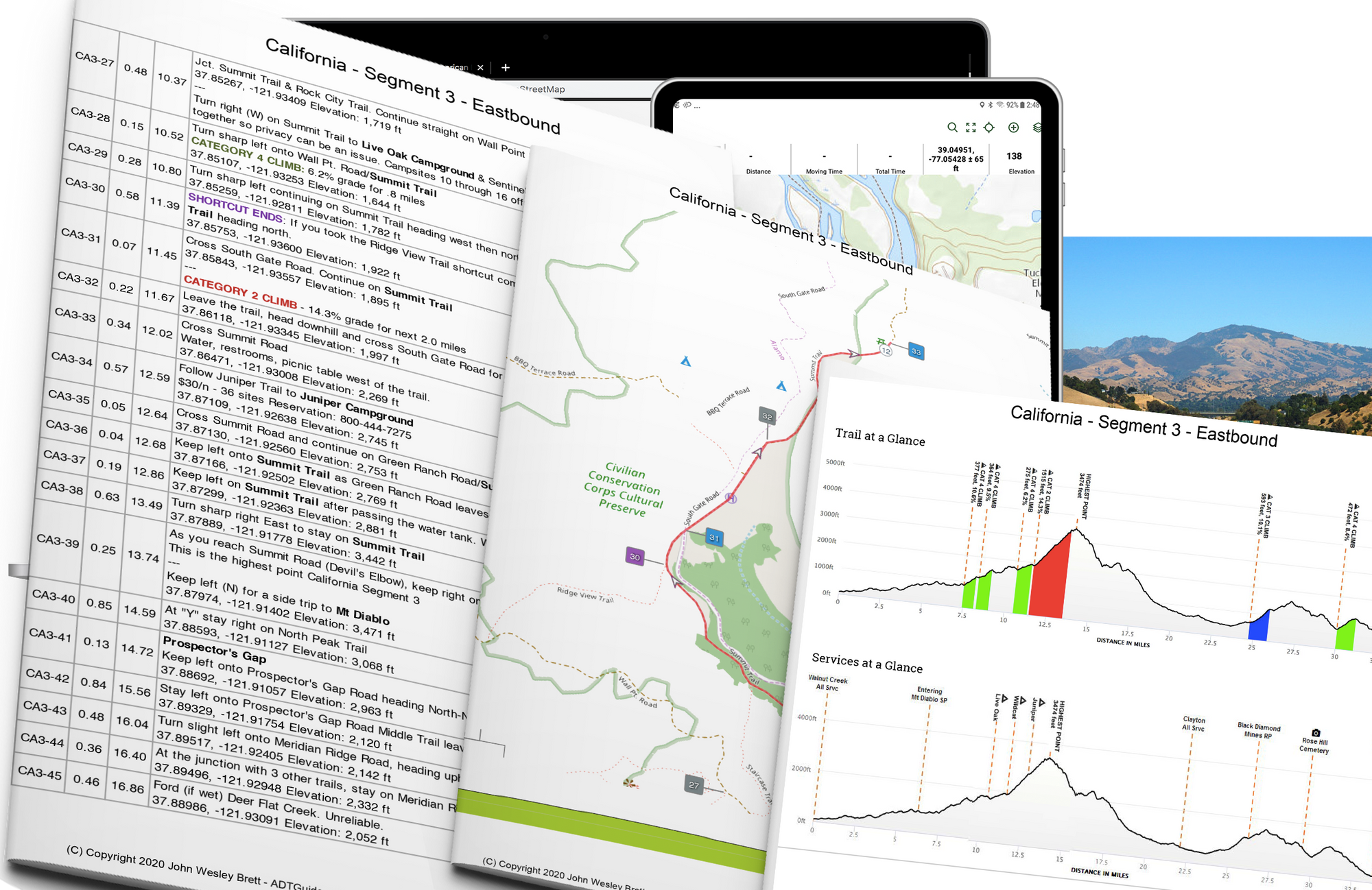
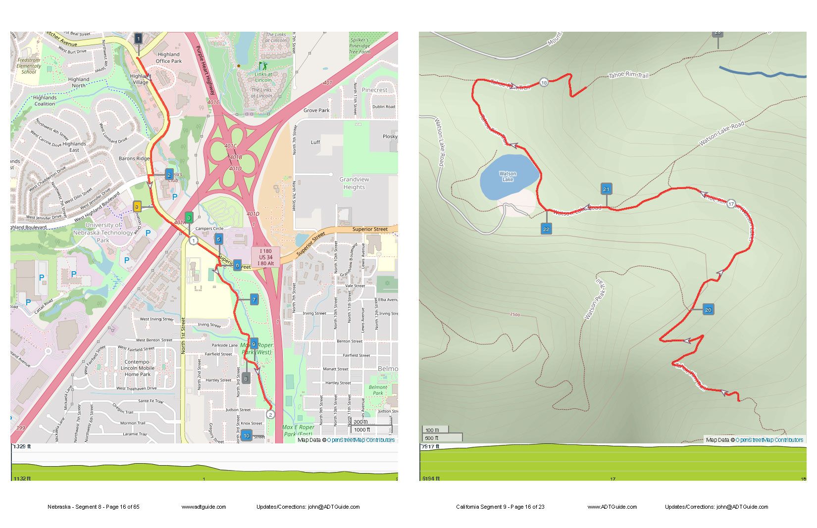
The most common topographic map resolution since the beginning of time since 1947 has been a 7.5-minute or 1:24,000-scale, or just over 2.5 inches/mile. So on a standard 8.5 x 11-inch piece of paper, you could show a 5-mile trail if the trail were straight and stretched diagonally from one corner to the other. Add more twists and turns, as trails do, and more mileage fits on the page.
So with the turning of each page, you are left with the task of adding up the miles and calculating the time needed to complete them.
Hang on — We're almost there...
The American Discovery Trail is different from other long-distance routes such as the Appalachian Trail, Pacific Coast Trail, and Continental Divide Trail in that way more than half of its 6,800+ miles are on roads between trails.
So early on, we decided our set of ADT maps would include BOTH road 🛣️ and topographical ⛰️ maps. So, "At A Glance," you could tell if asphalt or dirt was in your future.
And keeping with the "At a Glance" theme, we decided each page would show, generally, the same amount of mileage. We settled on 2-miles-per-page because — 🥾 the average hiking speed is two mph. 🥾 S0, "At A Glance," you know each page represents one hour of walking! Brilliant, no?
That may be stretching it, but hopefully helpful.
With tech advances since 1947, carrying our 4,100 digital pages of Turn-By-Turn Directions and maps actually weighs less than a printed guidebook.
Hiking America Updates
Nebraska 8 - Lincoln to Omaha (Iowa State Line)
Beginning June 20 through July 1, a portion of the MoPac Trail between O Street and Sycamore Drive will have temporary daily closures for a bridge repair project.
The trail will be closed from 8 a.m. to 3 p.m. Monday through Friday.
Each afternoon and weekend, the bridge will reopen.
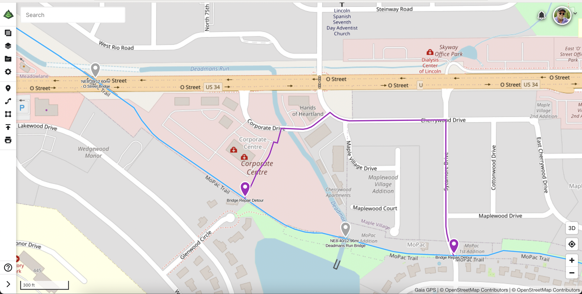
Detour included on Hiking America Maps and Hiking America on Gaia GPS.
Hiker Notes Added
Delaware - Segment 1 - Bridgeville (This segment is free to everyone!)
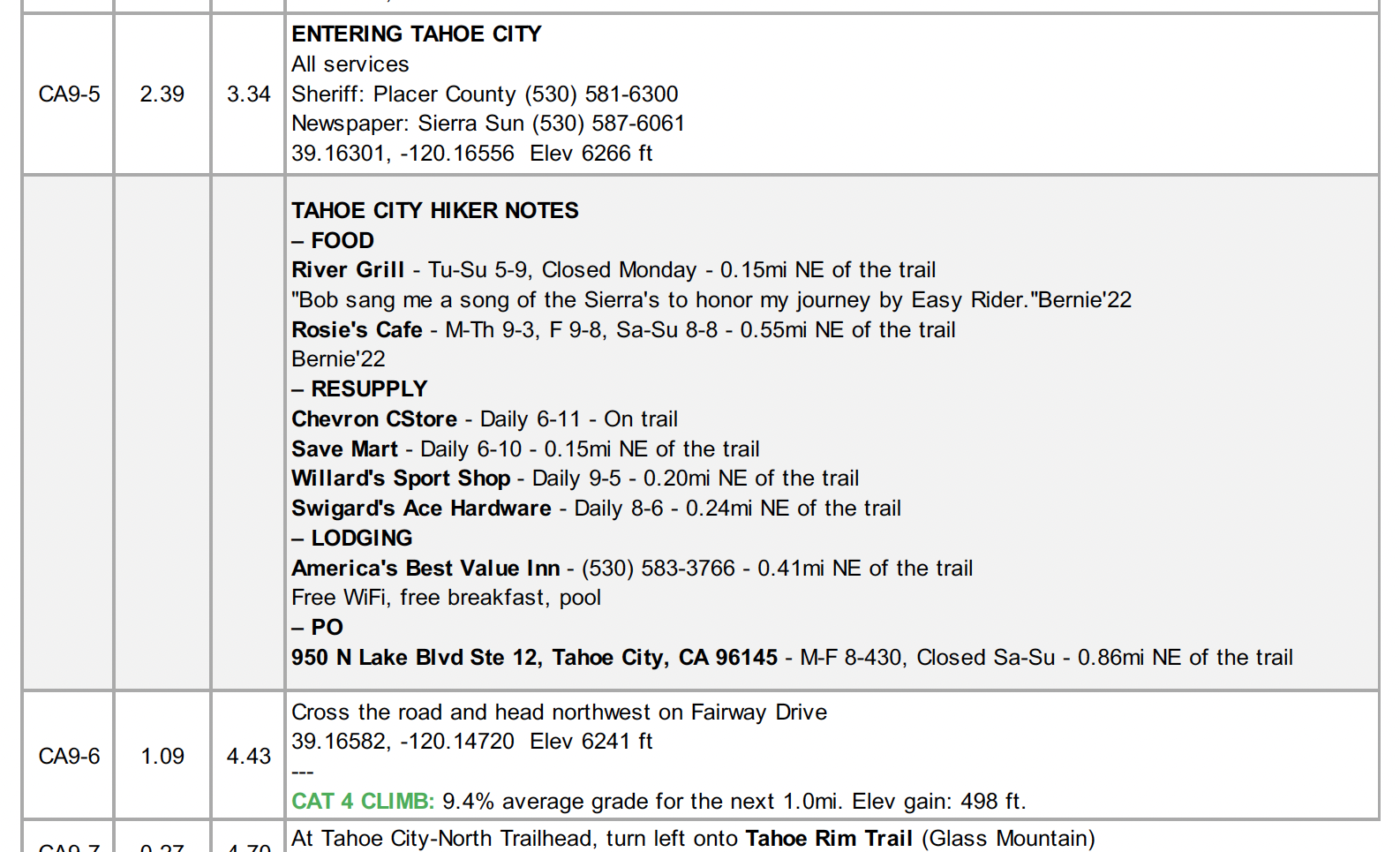
California - Segment 9 - Tahoe City
On-Trail Updates
Along the ADT - Missouri: Woman rides cross-country on horseback to raise awareness for mustang adoption https://t.co/5PbOEI8W7L
— The ADT Guide (@adtguide) June 12, 2022
Along the ADT: Maryland - The Patuxent River has stood in the way of joining up the WB&A Trail for decades, but on Friday local officials and advocates gathered to break ground on the bridge that will close the gap. https://t.co/tXFXS2QBL6
— The ADT Guide (@adtguide) June 12, 2022
Hike Your Hike – John.