The Great American Rail-Trail for Hikers: Why This Isn't Just a Bike Trail
Most coverage of the Great American Rail-Trail centers on cycling. But walk it and you're on a different trail — one where the gaps matter less, the route choices open up, and the hardest state to ride becomes some of the best country to hike. Here's what the Great American looks like on foot.

If you've been looking into the Great American Rail-Trail with the idea of walking it, you've probably noticed something. Almost everything written about it is about bikes. The photos are cyclists. The mileage talk is cycling mileage. The economic studies count riders. Spend enough time reading, and you start to wonder whether you're even in the right place.
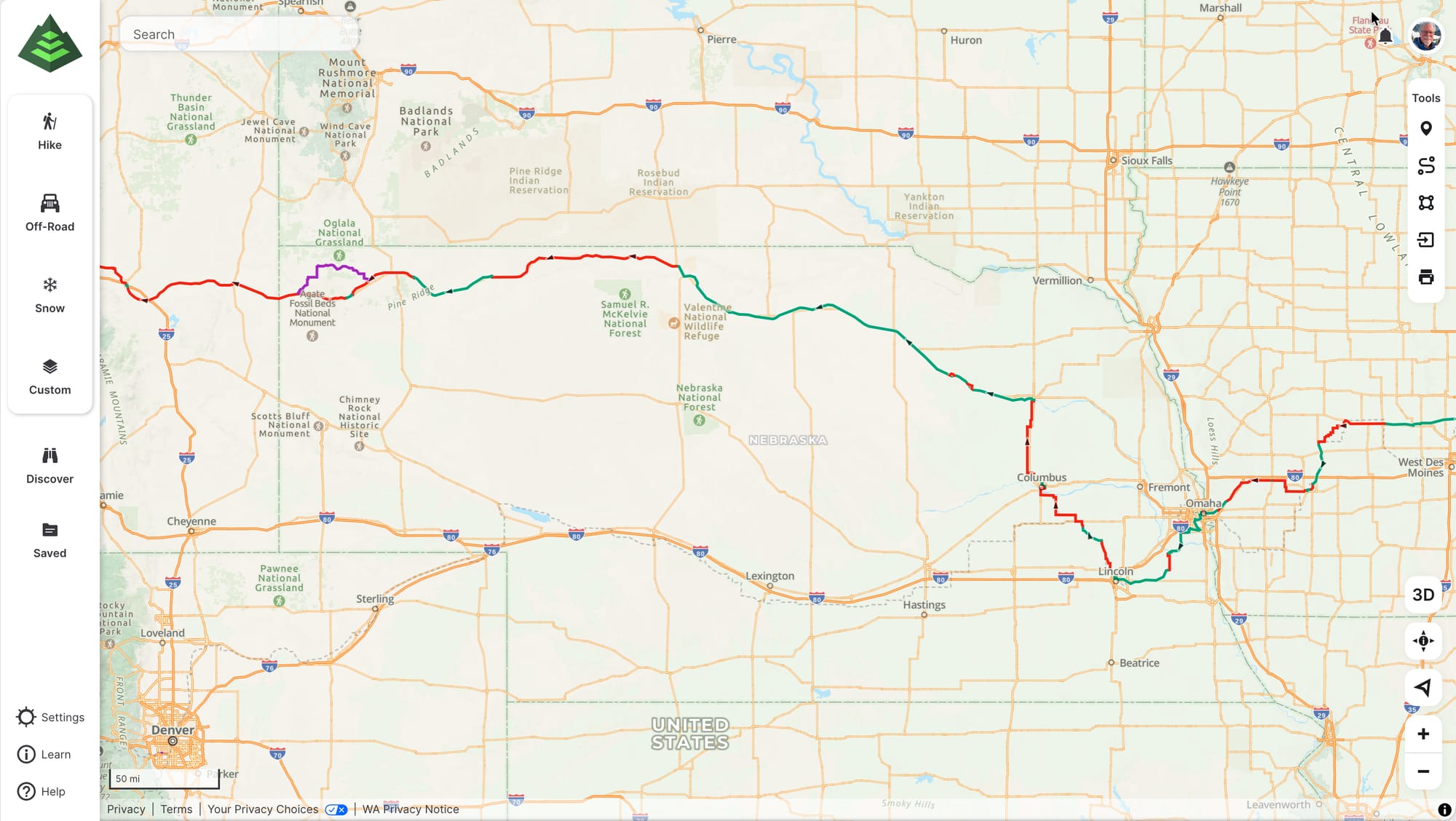
You are. The Great American Rail-Trail is a developing, roughly 3,700-mile multiuse pathway running cross-country between Washington, D.C., and Washington State across 12 states — and "multiuse" means hikers belong on it as much as anyone. But here's what I've figured out so far: it's a different trail on foot than it is on two wheels. The surface, the gaps, the route choices — you read all of it differently than a cyclist does. Once that clicks, the Great American stops feeling like you're borrowing someone else's trail and starts feeling like yours.
It's a bike trail in the brochures, a hiking trail under your feet
The Rails-to-Trails Conservancy created the Great American and promotes it as a multiuse corridor. Most of the external coverage you'll find, however, frames it around cycling, because cycling is where a lot of the momentum and the visible mileage live. None of that closes the door on you. It just means the public story about this trail isn't really written for a hiker yet.
So you have to do a little translating. When a planning resource tells you a section is "incomplete" or "not yet rideable," that's a cyclist's verdict — it usually means there's no continuous paved or hard surface. On foot, that same section often walks just fine. The trail you experience and the trail in the brochure aren't quite the same thing, and most of the difference works in a hiker's favor.
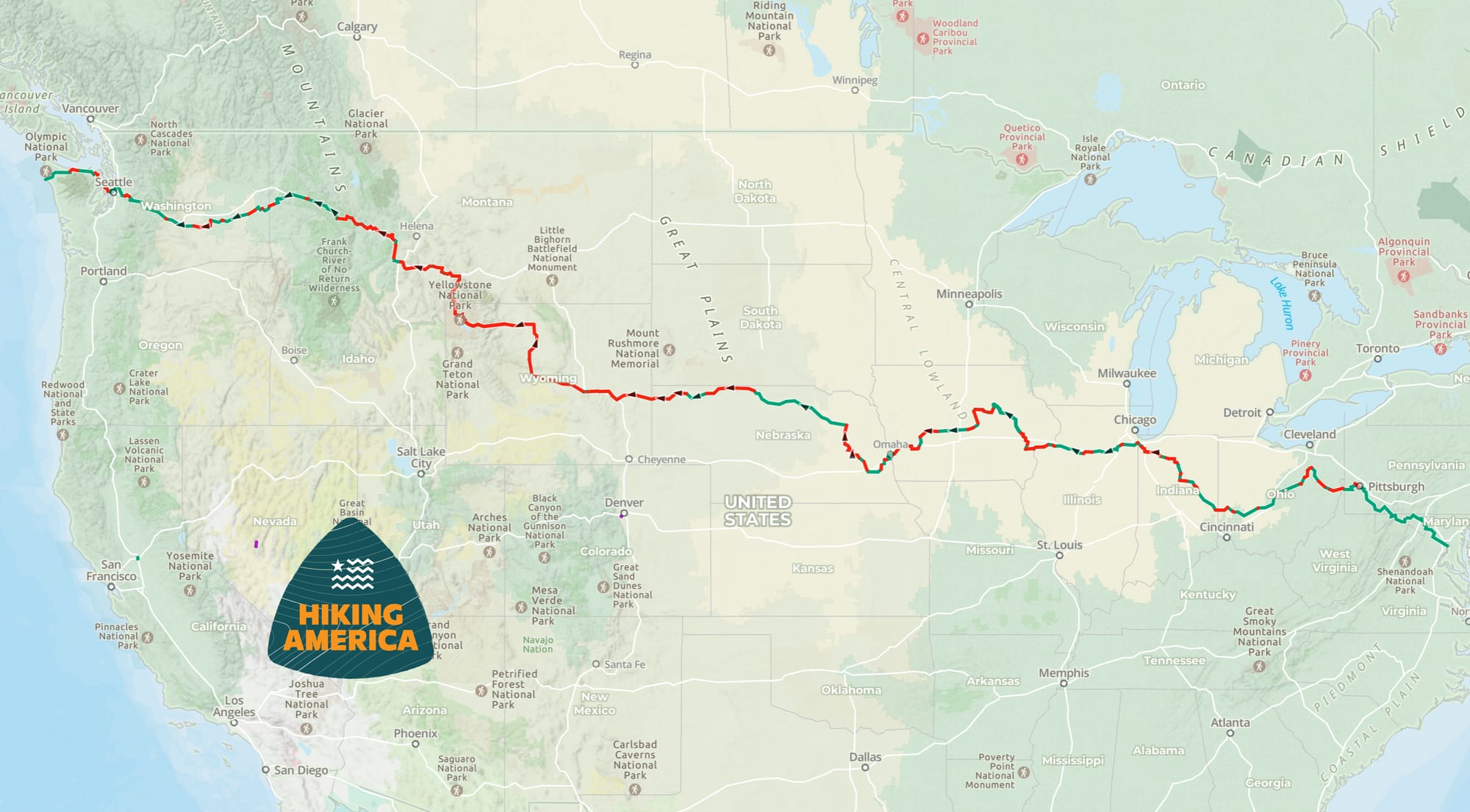
The Great American is about 56% complete — and the gaps change everything
As of late 2025, around 2,086 miles of the route are built and maintained — close to 56% of the whole thing. The rest is gap: stretches that haven't been developed into finished trail yet.
For a cyclist, a gap is a problem to solve. No rideable surface means routing onto road shoulders, stitching together detours, or waiting for construction that may be years out. For a hiker, a gap is mostly just the next stretch of the walk. You're already moving at three miles an hour on whatever's under your feet — connector roads, two-tracks, shoulders, the unbuilt corridor itself. The gaps that define the cyclist's experience barely bend a hiker's.
That's also where having solid navigation matters most, because the gaps are exactly where signage thins out. Our Great American Rail-Trail GPS tracks are free to anyone — the full route, gaps included, as downloadable GPX files. Pull them into the navigation app of your choice, and you can see the whole line before you ever decide to walk it.
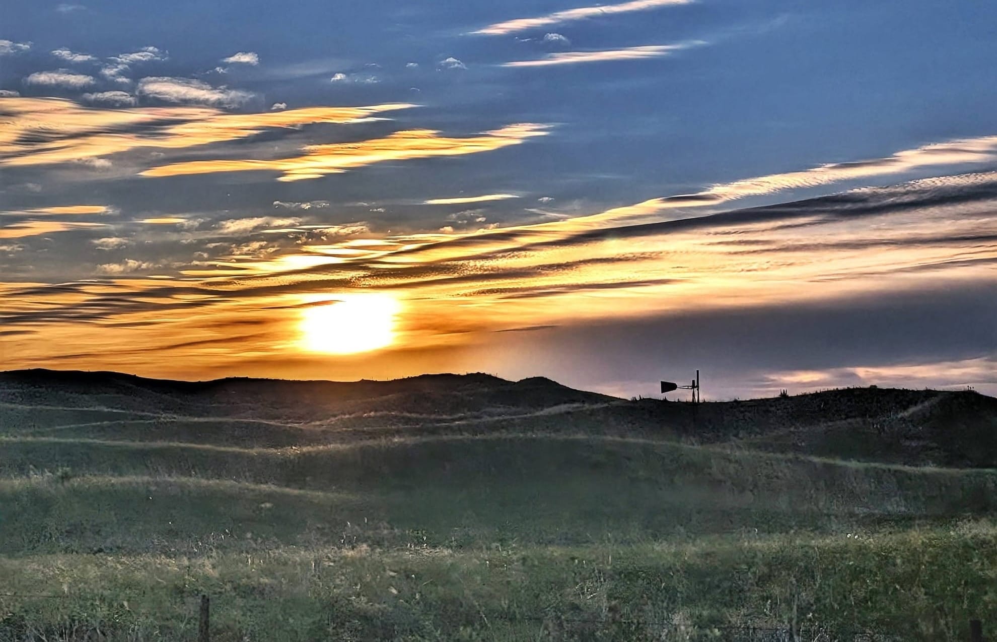
Wyoming is where the bike route and the hiker route stop being the same trail
If you want one place that proves the point, it's Wyoming. By the Conservancy's own assessment, Wyoming has more gap miles to develop than any state on the route — roughly 500 miles, with only a handful currently built. The terrain is the reason: the grades and the country don't lend themselves to long, ridable multiuse paths, and there simply isn't an existing corridor to follow. The Conservancy has gone so far as to study possible routes through Yellowstone National Park, because that's the kind of problem Wyoming presents.
On a bike, that's the hardest knot on the entire trail. On foot, it's an opening. Where there's no rail-trail to follow, a hiker has one of the great long trails in the country running through the same ground: the Continental Divide Trail.
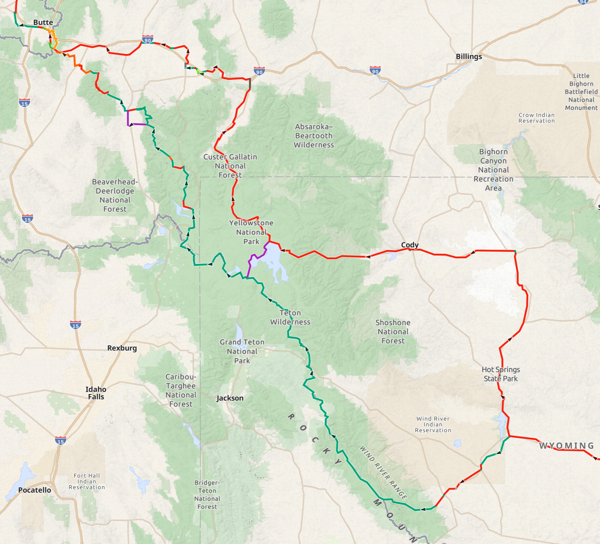
That's the approach Bernie Krausse is working out for his own Great American hike — leaving the developed route around Shoshone, Wyoming, and making his way north past Yellowstone toward Butte, Montana, following the general line of the Continental Divide Trail and incorporating much of it. The exact route is still being refined, and probably will be right up until his boots are on it. But the principle holds regardless: a surfaced multiuse path can't go through that country. A hiker can. That's a route decision only a person on foot gets to make, in the one state where the bike route has the least to offer.
What you gain when you stop thinking like a cyclist
Once you let go of needing a continuous ridable surface, the trail opens up. You're free to take the higher, wilder line through the parts of the country that are hardest to build trail across. National parks, national scenic trails, ground a paved path will never reach — those become options instead of obstacles.
I'll be honest about the trade. That freedom comes with more route-finding and more self-reliance in the undeveloped stretches. It isn't harder for the sake of being harder. It's just a different set of decisions, made by you, in real time.
For a lot of hikers, that's the appeal, not the drawback.
Why we built this for the person on foot
Hiking America's Great American Rail-Trail tracks are free to anyone — the entire route, gaps and all, as downloadable GPX files. That part doesn't cost a thing.
Subscribers get more: those same tracks already loaded in Gaia GPS and kept current as the route is refined, plus the services waypoints layer — where to eat, sleep, and resupply, chosen for what's actually walkable from where the trail puts you. That services data is being built and verified in real time through Bernie Krausse's 2026 hike — the first known end-to-end thru-hike of the Great American Rail-Trail — as he documents conditions on foot, mile by mile, heading west.
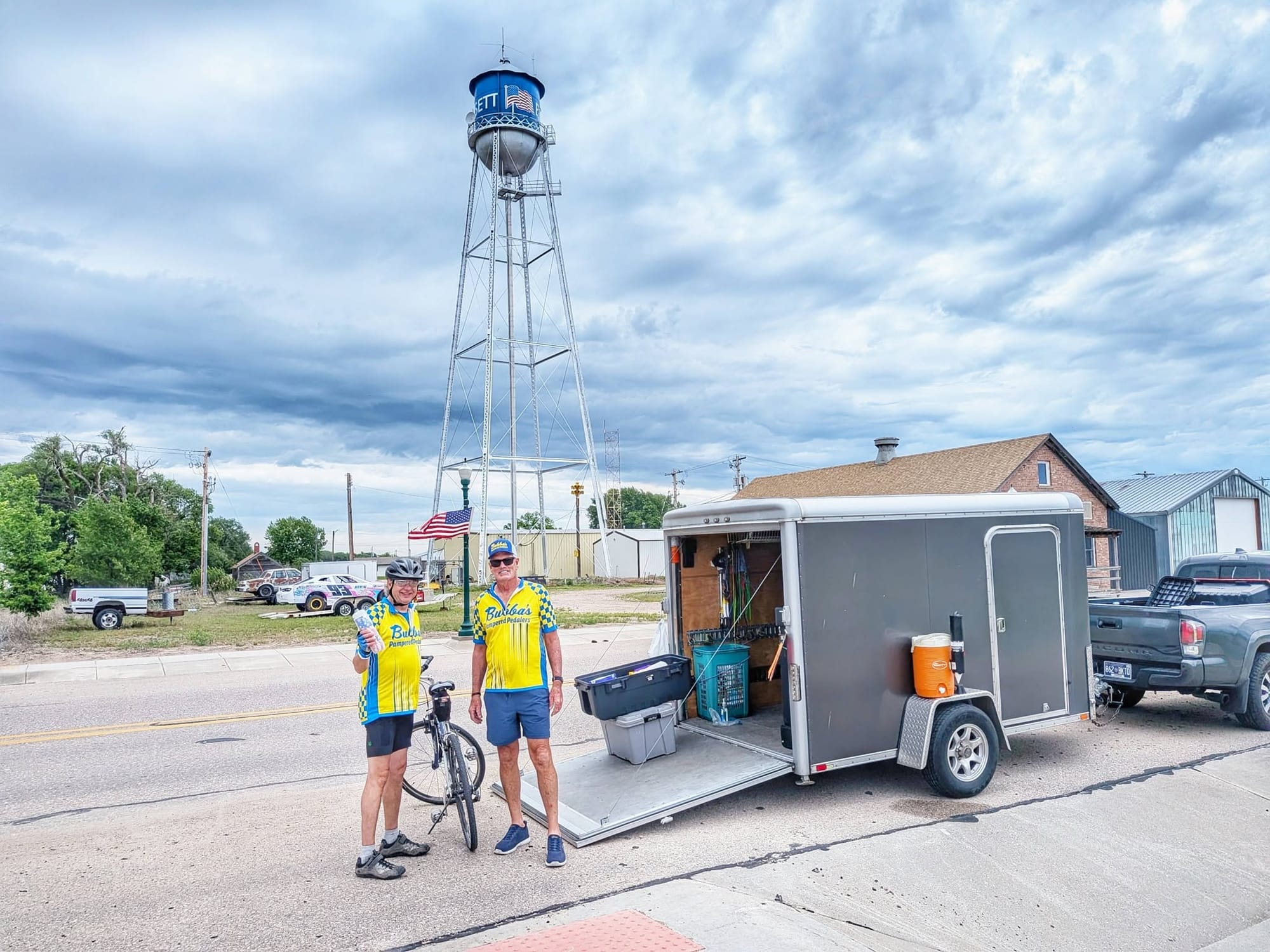
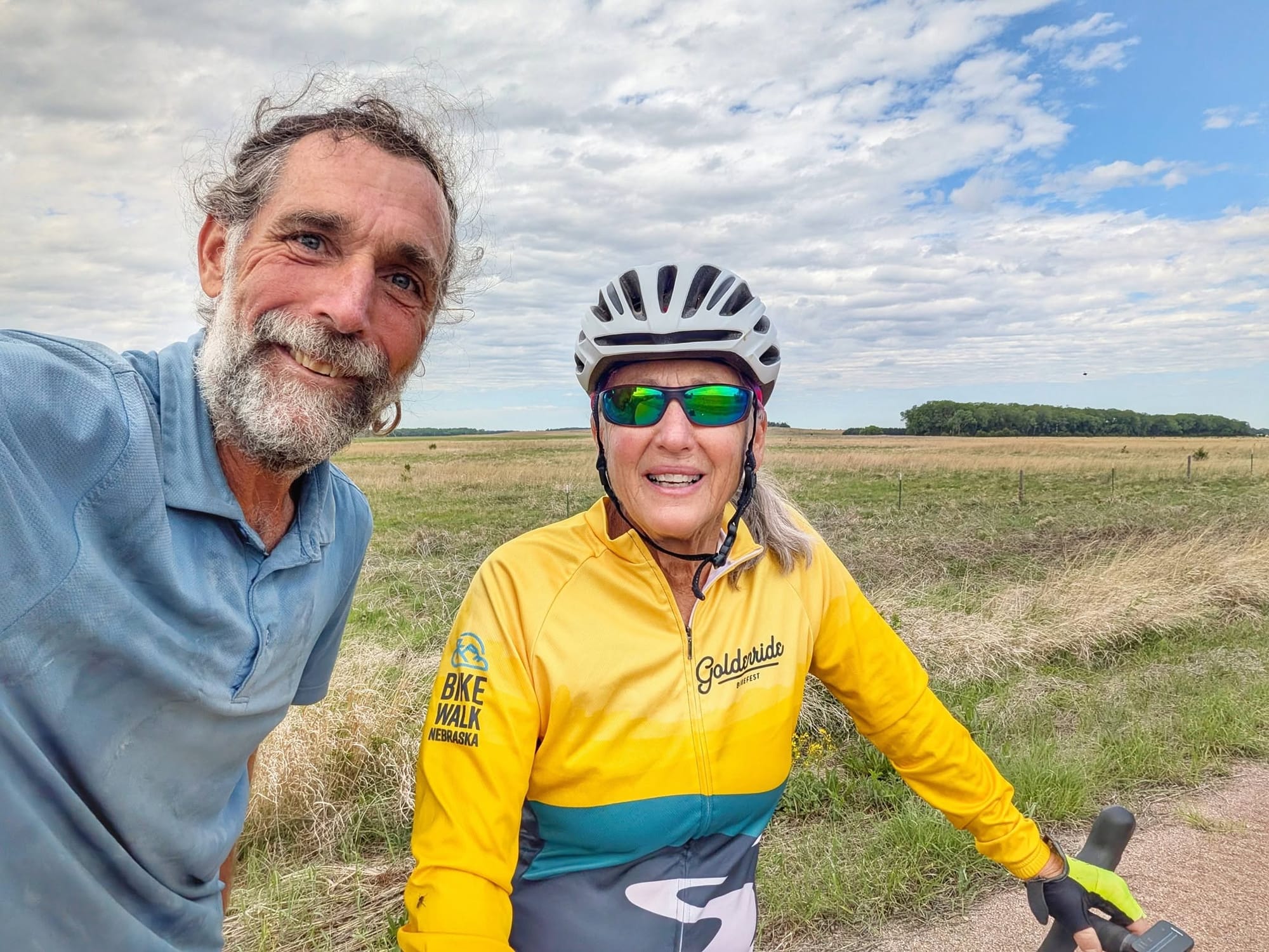
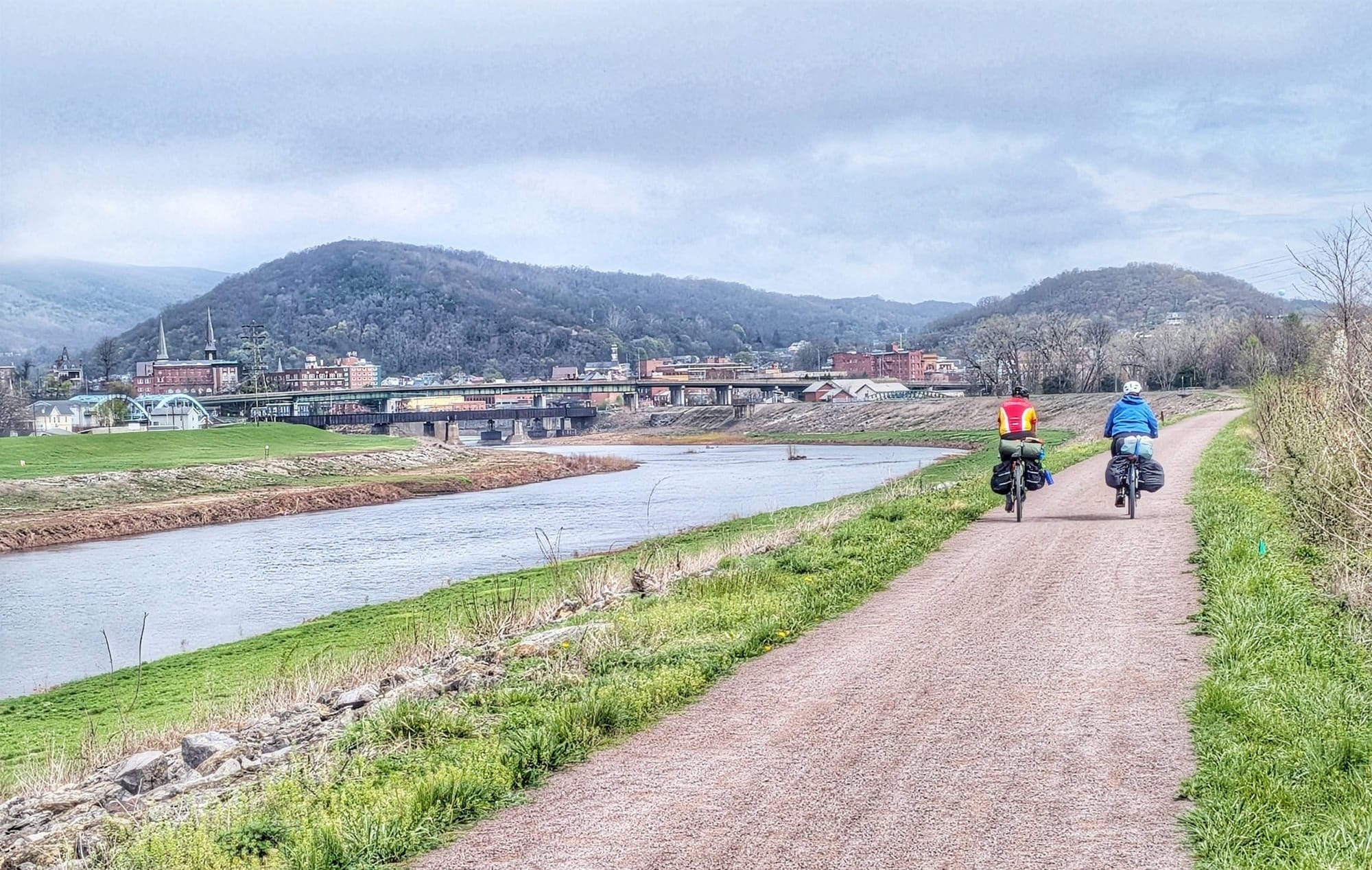
Bernie Krausse meeting cyclists on the Great American Rail-Trail - Photos Bernie Krausse
The Great American isn't going to stop being marketed to cyclists, and it shouldn't — it's their trail too. But if you've been hanging back because every photo is a bike and every mile count is a bike count, you don't have to wait for permission. On foot, it's a different trail. And in the places that are hardest to ride, it's often the best place to walk.
Start with the free tracks
Hiking America's full Great American Rail-Trail GPS tracks are free — download the GPX files and see the whole route, gaps included, before you commit to anything.
Then join Hiking America
When you're ready for more, a Hiking America subscription gets you those tracks already loaded in Gaia GPS and kept up to date, plus the services waypoints layer — where to eat, sleep, and resupply along the way.
Over 8,900 waypoints!
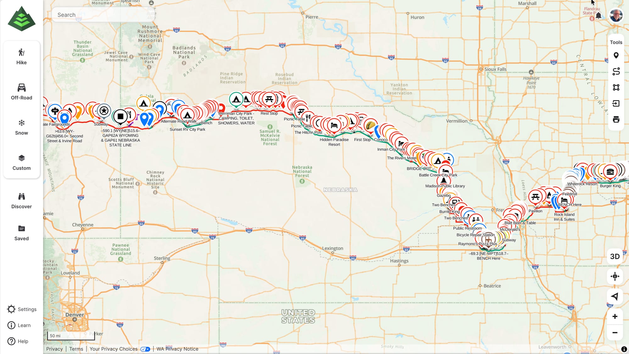
That layer is growing every week as Bernie verifies it from the trail. 🥾