
What's New on the ADT in Kansas: A City Surprise and Two Detours
Rhiis and Sara are walking the American Discovery Trail through eastern Kansas right now and sending back what they find. This week: two new detours around construction, 72 fresh waypoints, and a Kansas City walk that surprised them.


Most thru-hikers brace for the cities.
Pavement, traffic, the long grind of getting through a metro area and back to something green. So when Rhiis and Sara walked the Kansas City stretch of the American Discovery Trail this week, they were ready for the usual slog.
They got the opposite.
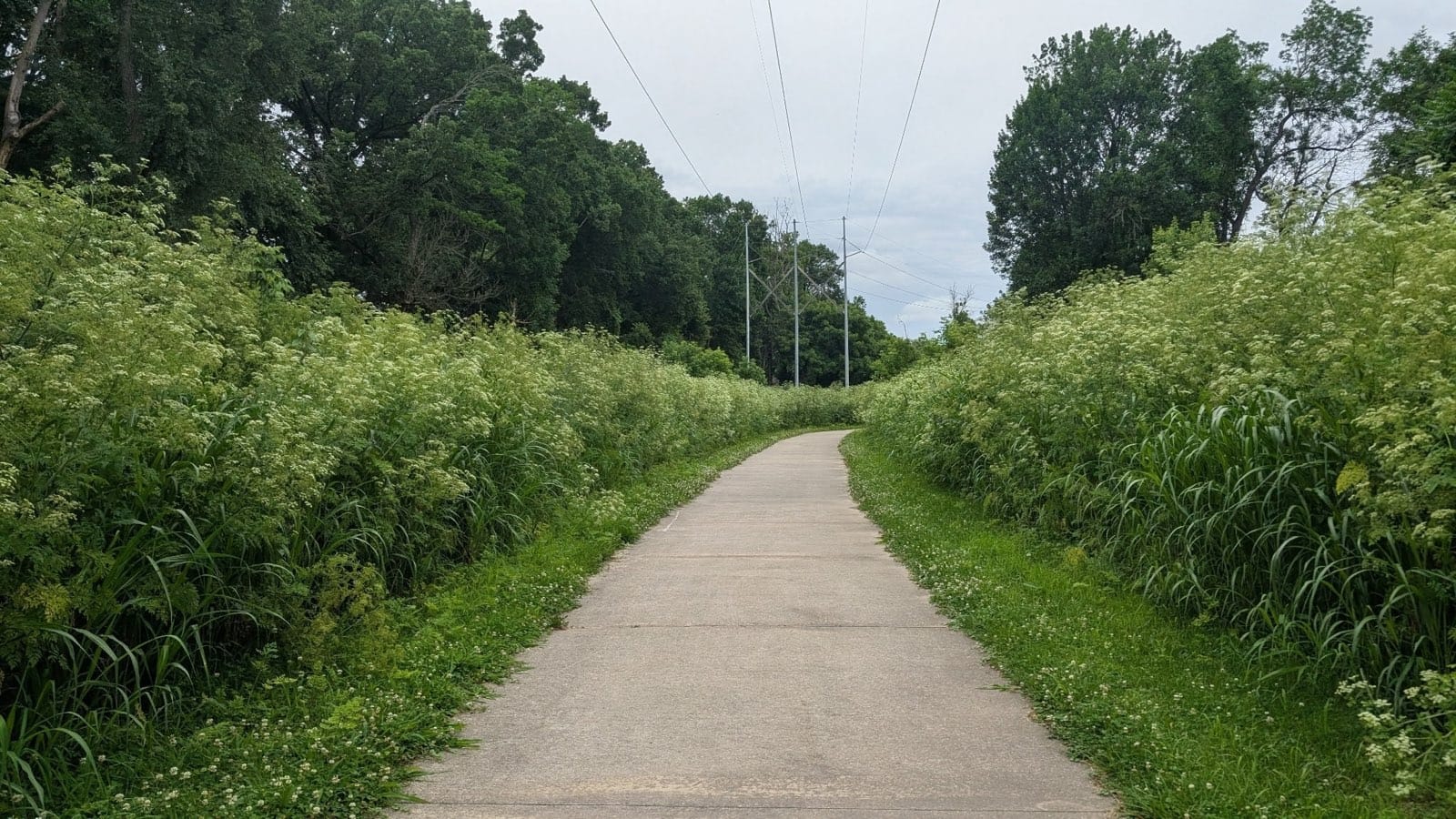
The trail keeps you surrounded by green almost the whole way through. There's a little road walking, but the roads are quiet, and the scenery holds up. And then you're moving through a major metropolitan area, all that growth around you, and you only hear the city — you rarely see it. Services stay close when you need them, but the noise and concrete mostly stay out of view. Rhiis and Sara put it plainly: one of the best big-city thru-hikes they've walked anywhere on the ADT.
That's worth sitting with because it runs counter to what most people assume about crossing a continent on foot: that the cities are something to survive. This one isn't.
Two new detours west of the metro
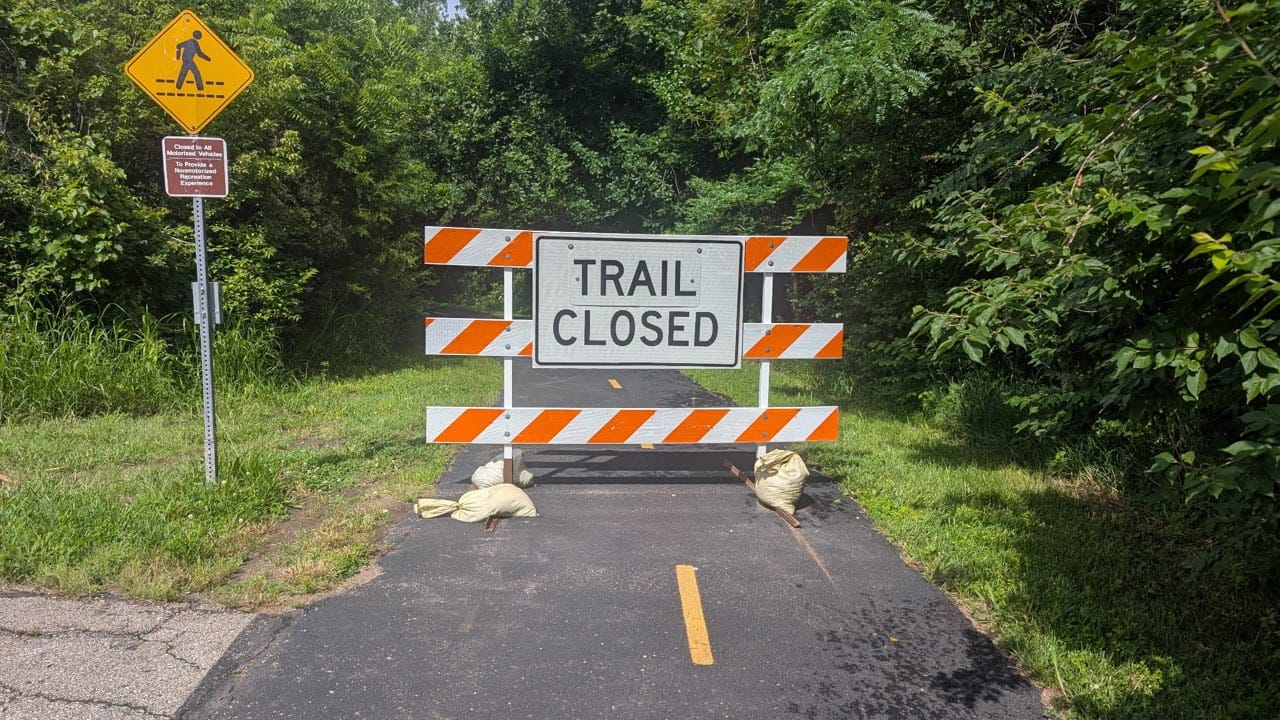
Heading west out of Kansas City, two spots have changed since our last data push.
The first is on the Gary L. Haller Trail, west of Olathe, where a section is closed for road construction. We've mapped a detour around it, drawn from Rhiis and Sara hitting the closure firsthand. That one's expected to stay closed through the end of the year.
The second sits a little farther west, in Eudora, where bridge construction over Captain Creek has blocked the original line. There's a detour around that one too, already in the data.
Neither adds much mileage. But they will stop you cold without the detour.
Rhiis & Sara
Westbound - Southern Route
Began: February 21, 2025 - Cape Henlopen, DE
Paused: November 5, 2025 - Julesburg, CO
Restarted: March 10, 2026 - Illinois/Indiana Line - Southern Route
Support Links: ImHikingAmerica, TrailJournals, YouTube, Venmo
72 new waypoints this week
Beyond the two detours, Rhiis and Sara added 72 new waypoints to the Missouri and Kansas data over the past week — including a handful of camp options, AND yet another NEW TRAIL ANGEL!
A few months ago, Rhiis and Sara sent me a bottle of Tito's and challenged me to enjoy a shot every time they score a new Trail Angel to the trail.
So, cheers to Trail Angel Amanda! Welcome!

All of this comes from two people walking the trail right now, writing down what they find so the hikers behind them don't have to guess. That's how the Kansas data got better this week, and it'll keep getting better as they move west.
If you're a Hiking America member, all of it is already in your Gaia GPS Hiking America folder — the detours, the waypoints, everything. Nothing to download again.
It's just there the next time you open the map. 🥾
Hike Your Hike - John.


Hiking America Custom Hang Tag
Recognized by trail angels, hostels, and fellow hikers nationwide!
Get your Custom Hiking America Hiker Tag!
Only $19 for a Limited Time!
Always Free to Hiking America Members.