
Know the Climb Before You Feel It: The Elevation Gain Calculator
Distance tells you how far. Elevation tells you how hard. The second tool in Hiking America's Trail Tools reads the climbing off any GPX track — total gain, total loss, and the profile of the whole route.


A flat twelve-mile day and a twelve-mile day with four thousand feet of climbing are not the same day. The mileage looks identical on paper. Your legs know better by noon.
The GPX Distance Finder answered how far. This one answers how hard.
Today, Hiking America is adding the Elevation Gain Calculator to the Trail Tools library. Free, browser-based, no account. Your GPX file never leaves your device.
Free, no account, runs in your browser.
Open the Elevation Gain Calculator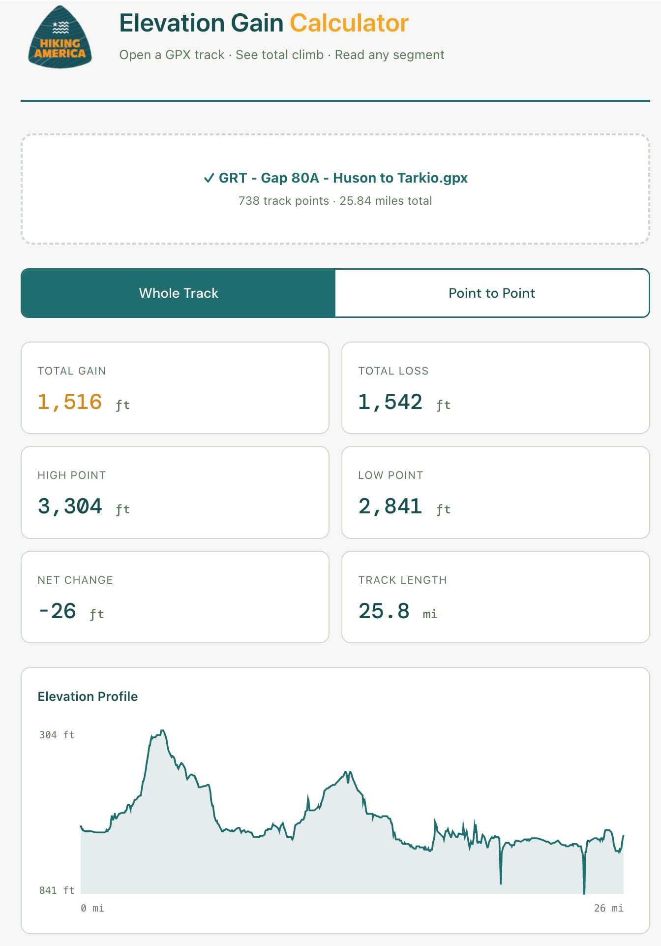
What It Does
Open a GPX track, and it reads the elevation data in the file, then hands you the numbers that decide how a day feels: total gain, total loss, high point, low point, net change, and the full length of the track. It draws an elevation profile of the whole route, so you can see where the climbing actually lives instead of guessing from a line on a map.
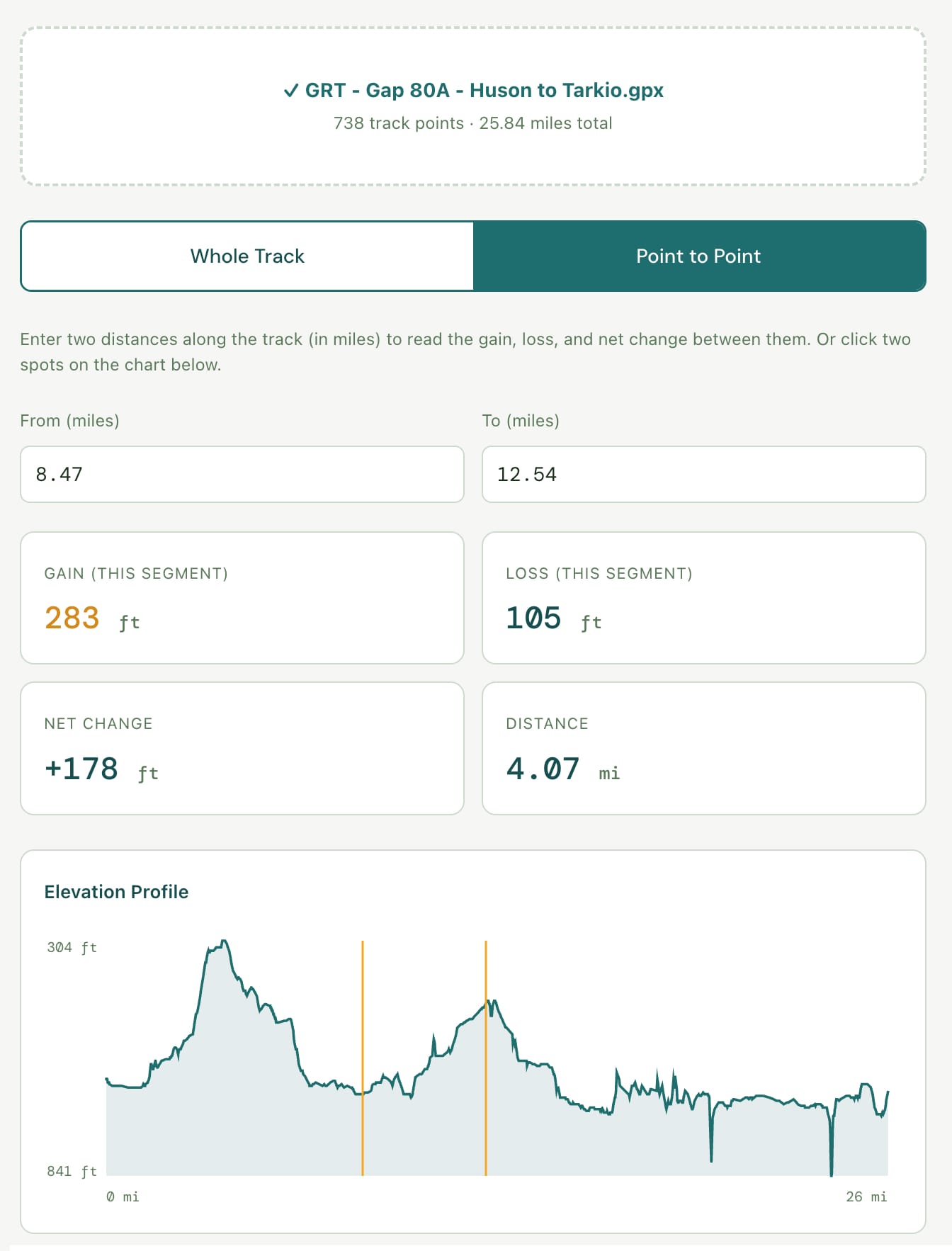
Then it goes one step further. Switch to point-to-point mode — or click two spots on the profile — and it reads the gain and loss for just that stretch. The climb to one pass. What a single planned day is going to cost you. The three miles before a water source where the trail decides to go straight up.
Run it as many times as you need. Everything happens in your browser, and the file stays on your device. Nothing is sent to any server.
Why I Built It
Building navigation data for the American Discovery Trail and the Great American Rail-Trail means reading a lot of elevation off a lot of tracks. Reading total climb off a raw GPX file by hand is tedious, and doing it segment by segment is worse.
I was already doing this math for the routes I map. Now the tool does it, for my tracks and for yours.
A note on the numbers, because it matters: elevation recorded by consumer GPS is noisier than horizontal position, and different tools filter that noise differently, so their totals rarely match to the foot. Treat what you get here as a solid planning estimate, not a surveyed measurement — the same caution applies to every elevation tool, ours included.
When a GPX Has No Elevation Data
Some tracks record only latitude and longitude — no elevation at all. When that happens, the tool tells you so instead of inventing a number. Re-export your track from Gaia GPS, CalTopo, or your GPS device with elevation included, then open it again. Most mapping tools include it by default or offer it as an export option.
What's Coming Next
Two tools down. Still on the board: a hiking pace and completion calculator, a resupply interval planner, a pack weight tracker. Each one free, browser-based, and built around a question long-distance hikers actually ask while planning.
If there's a calculation you keep doing by hand while planning a long route, I want to know about it. — john@hikingamerica.com
Try It Now
The Elevation Gain Calculator is live. So is the whole Trail Tools section, where new tools land as they're built.
Both are free. No login, no strings.
If you're planning the American Discovery Trail or the Great American Rail-Trail, the trail-specific navigation resources are at hikingamerica.com.
Hike Your Hike — John. 🥾